Underground sight

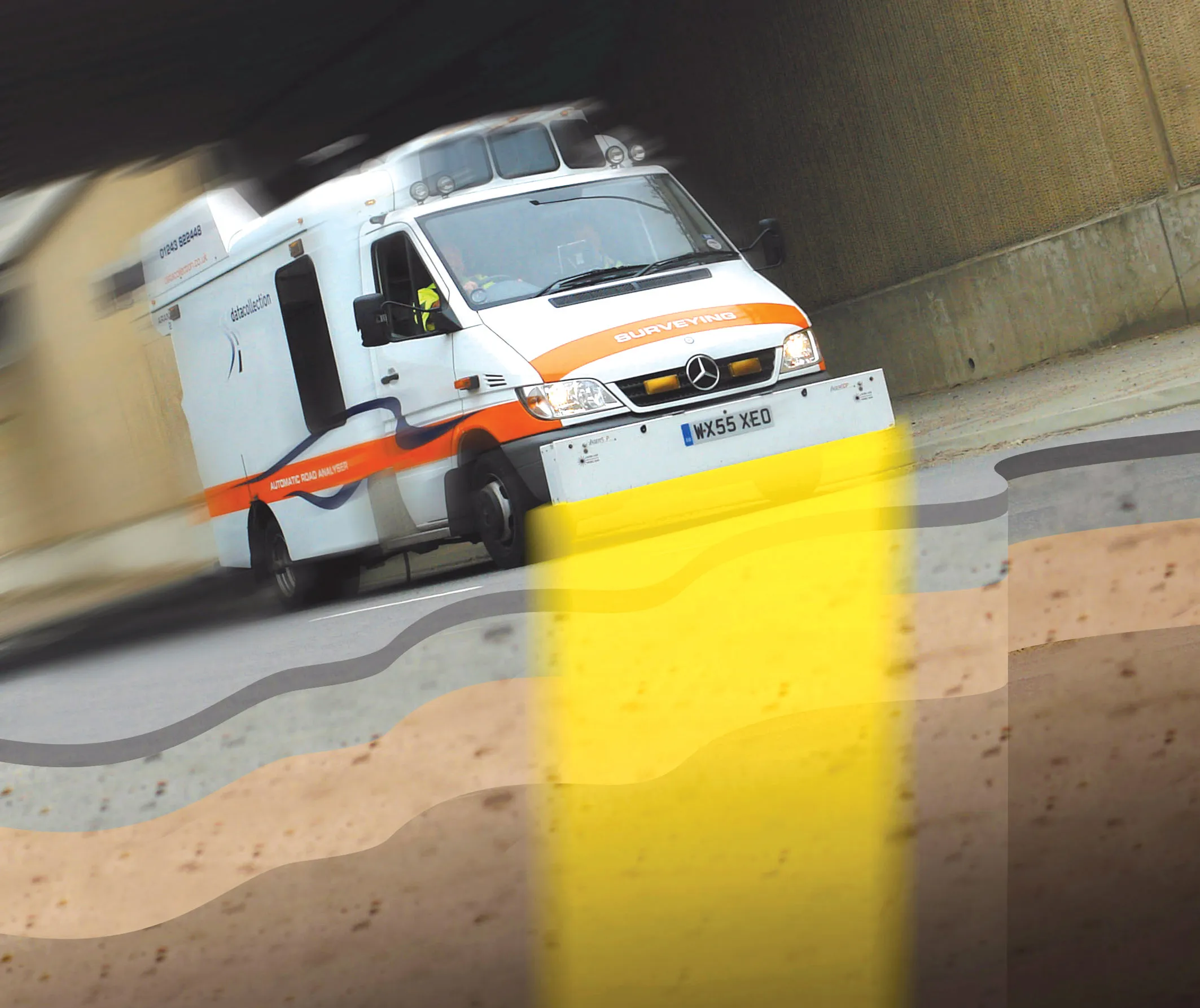
Innovative mobile radar technology that can detect subsurface problems is now being launched by surveying specialist Data Collection Limited. The system uses a specially designed vehicle to carry out surveys at normal traffic speeds. Ground-penetrating radar is used to generate a cross-sectional profile of the subsurface. This information can be used to assess road condition, helping with planning repairs and re-surfacing.
September 3, 2012 Read time: 2 mins
Travelling at highway speeds, this sophisticated survey package offers fast highway scanning

Innovative mobile radar technology that can detect subsurface problems is now being launched by surveying specialist Data Collection Limited. The system uses a specially designed vehicle to carry out surveys at normal traffic speeds. Ground-penetrating radar is used to generate a cross-sectional profile of the subsurface. This information can be used to assess road condition, helping with planning repairs and re-surfacing.

The ground penetrating radar (GPR) is fitted to a new electronic survey vehicle called ARAN2, which is also equipped with surface scanning systems and advanced technology to detect cracks down to 2mm in size. Unlike most conventional vehicles this allows surface and subsurface data to be collected at the same time.

The radar emits pulses of radio frequency energy into the road surface. With the transition of the pulses from one material to another, part of the energy echoes back to the surface and returning signals are processed to generate subsurface profiles. This equipment does away with the need for core sampling and means that survey data can be collected while travelling at normal traffic speeds. This GPR information maps layers to an accuracy of 5-10mm, and gives highway engineers a picture of road make-up and condition. On bridges, GPR is particularly useful for determining the location and thickness of concrete and asphalt layers, as well as reinforcing steel.

Related Content

  • Mersey Bridge advance study
    May 1, 2012
    Research is underway on the Mersey Estuary in the UK, mapping tidal flows. The data will be used by the designers of the new Mersey Gateway Bridge, currently being designed. This profiling work is being carried out close to Runcorn and Widnes and is mapping the strength and direction of currents in the Mersey Estuary. Part of the development of the Mersey Gateway Project, the surveying work has been carried out by specialist contractor ABPmer using Acoustic Doppler Profiling equipment. The work measured the
  • Smart intelligent compaction system from Dynapac
    April 10, 2024
    The system is now offered as an option on the new rigid frame CX 8C and CX 9C models, which have drum widths of 1.5m and 1.7m and weights of 8tonnes and 9tonnes respectively.
  • Tough competition in concrete paving market
    February 13, 2012
    One thing is clear in the concrete slipforming sector. This comparatively niche market for equipment is rapidly becoming a good deal more competitive as key manufacturers jostle for position.
  • Global pressures driving bitumen developments
    June 19, 2015
    A raft of global pressures is driving developments in the materials and equipment we use for the handling, storage and treatment of bitumen. The goal is to achieve better performance and longer life for less financial outlay, and at the same time overcome the challenges of inconsistent and varying bitumen supplies. Kristina Smith reports.