Underground sight

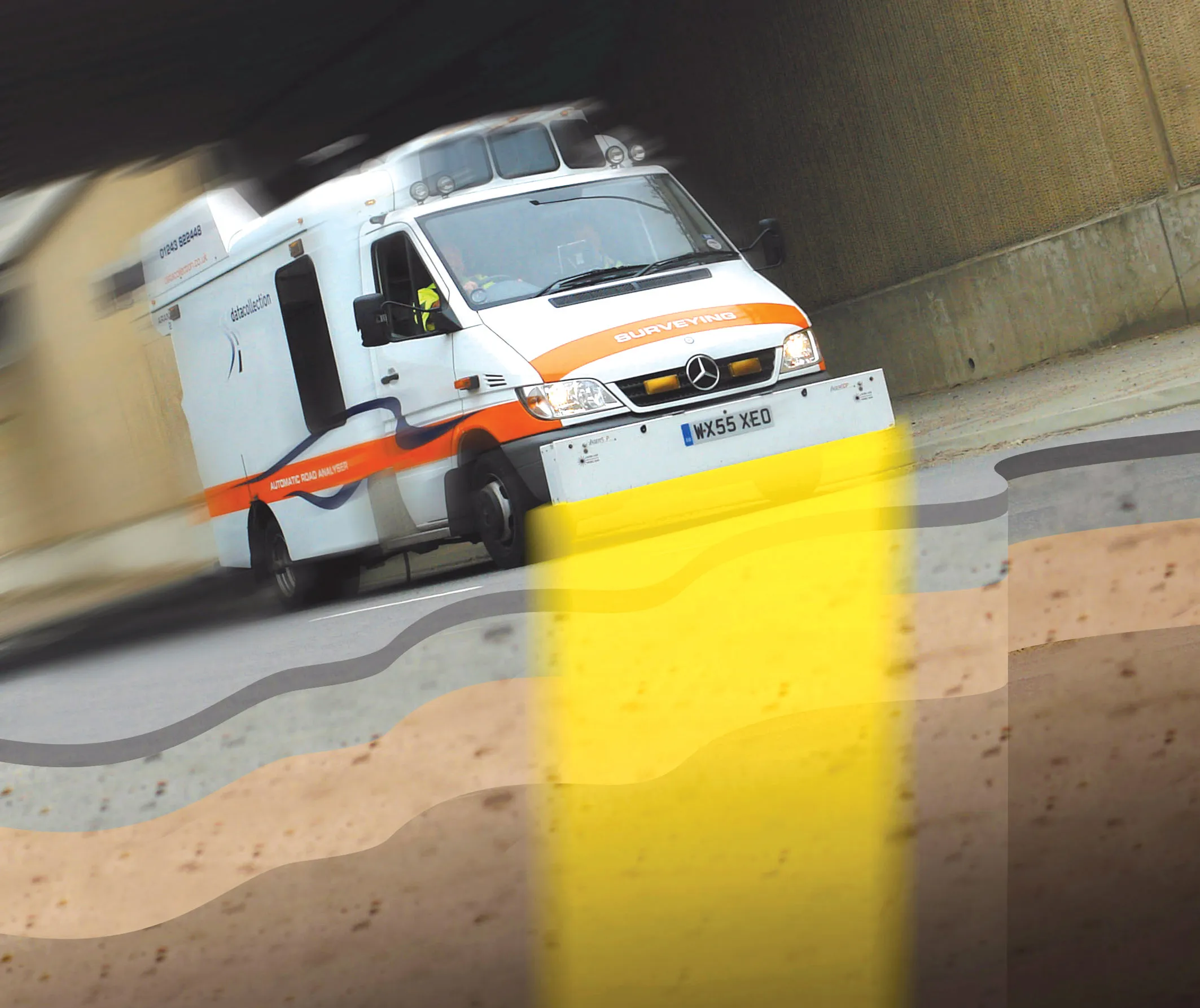
Innovative mobile radar technology that can detect subsurface problems is now being launched by surveying specialist Data Collection Limited. The system uses a specially designed vehicle to carry out surveys at normal traffic speeds. Ground-penetrating radar is used to generate a cross-sectional profile of the subsurface. This information can be used to assess road condition, helping with planning repairs and re-surfacing.
September 3, 2012 Read time: 2 mins
Travelling at highway speeds, this sophisticated survey package offers fast highway scanning

Innovative mobile radar technology that can detect subsurface problems is now being launched by surveying specialist Data Collection Limited. The system uses a specially designed vehicle to carry out surveys at normal traffic speeds. Ground-penetrating radar is used to generate a cross-sectional profile of the subsurface. This information can be used to assess road condition, helping with planning repairs and re-surfacing.

The ground penetrating radar (GPR) is fitted to a new electronic survey vehicle called ARAN2, which is also equipped with surface scanning systems and advanced technology to detect cracks down to 2mm in size. Unlike most conventional vehicles this allows surface and subsurface data to be collected at the same time.

The radar emits pulses of radio frequency energy into the road surface. With the transition of the pulses from one material to another, part of the energy echoes back to the surface and returning signals are processed to generate subsurface profiles. This equipment does away with the need for core sampling and means that survey data can be collected while travelling at normal traffic speeds. This GPR information maps layers to an accuracy of 5-10mm, and gives highway engineers a picture of road make-up and condition. On bridges, GPR is particularly useful for determining the location and thickness of concrete and asphalt layers, as well as reinforcing steel.

Related Content

  • Building Egypt's world class Desert Highway
    February 9, 2012
    A huge highway upgrade project will transform the Cairo-Alexandria road link into a world-class connection as Mike Woof reports
  • Building Egypt's world class Desert Highway
    May 3, 2012
    A huge highway upgrade project will transform the Cairo-Alexandria road link into a world-class connection as Mike Woof reports. The work to upgrade the Desert Highway connecting Egypt's sprawling capital Cairo with its major port Alexandria, is one of the country's largest infrastructure projects for many years. This 220km highway link is being widened and improved to cope with the hugely increased traffic volumes resulting partly from Egypt's fast growing vehicle population. The Egyptian economy is strong
  • Building Egypt's world class Desert Highway
    April 13, 2012
    A huge highway upgrade project will transform the Cairo-Alexandria road link into a world-class connection as Mike Woof reports. The work to upgrade the Desert Highway connecting Egypt's sprawling capital Cairo with its major port Alexandria, is one of the country's largest infrastructure projects for many years. This 220km highway link is being widened and improved to cope with the hugely increased traffic volumes resulting partly from Egypt's fast growing vehicle population. The Egyptian economy is strong
  • Help is on hand from Roadtec’s Guardian Telematics
    August 17, 2015
    Telematics is giving contractors a greater oversight of the location and performance of their machinery In simple terms, telematics is any integrated use of telecommunications and ICT (information and communications technology). It concerns the sending, receiving and storing of information via telecommunication devices. Typically, this is in conjunction with machine or device control and includes use of global positioning systems, or GPS.