Underground sight

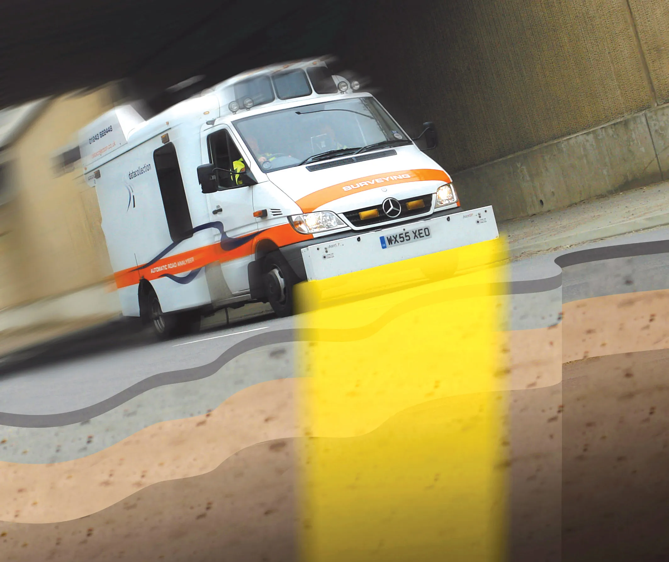
Innovative mobile radar technology that can detect subsurface problems is now being launched by surveying specialist Data Collection Limited. The system uses a specially designed vehicle to carry out surveys at normal traffic speeds. Ground-penetrating radar is used to generate a cross-sectional profile of the subsurface. This information can be used to assess road condition, helping with planning repairs and re-surfacing.
September 3, 2012 Read time: 2 mins
Travelling at highway speeds, this sophisticated survey package offers fast highway scanning

Innovative mobile radar technology that can detect subsurface problems is now being launched by surveying specialist Data Collection Limited. The system uses a specially designed vehicle to carry out surveys at normal traffic speeds. Ground-penetrating radar is used to generate a cross-sectional profile of the subsurface. This information can be used to assess road condition, helping with planning repairs and re-surfacing.

The ground penetrating radar (GPR) is fitted to a new electronic survey vehicle called ARAN2, which is also equipped with surface scanning systems and advanced technology to detect cracks down to 2mm in size. Unlike most conventional vehicles this allows surface and subsurface data to be collected at the same time.

The radar emits pulses of radio frequency energy into the road surface. With the transition of the pulses from one material to another, part of the energy echoes back to the surface and returning signals are processed to generate subsurface profiles. This equipment does away with the need for core sampling and means that survey data can be collected while travelling at normal traffic speeds. This GPR information maps layers to an accuracy of 5-10mm, and gives highway engineers a picture of road make-up and condition. On bridges, GPR is particularly useful for determining the location and thickness of concrete and asphalt layers, as well as reinforcing steel.

Related Content

  • Scanning geotextiles in-situ to monitor condition
    April 1, 2016
    A new solution from Schreiner Services allows RFID transponders integrated into Provlies geotextile products to be scanned and identified. The novel geotextile material can be used to repair into cracked roads, where it delays future damage due to its elasticity. Every 100m an RFID transponder records data relating to traffic count or road condition. Schreiner Services has developed a mobile solution for the Provlies geotextile that enables the readout of the recorded data at speeds of up to 60km/h.
  • New non-destructive testing technologies for roads and bridges
    July 11, 2018
    Two new technologies for non-destructive testing offer key benefits, one suiting road surfaces, the other suiting concrete structures - Kristina Smith reports Dynatest has developed a new way to measure and record the state of pavements, using a machine that travels at the same speed as traffic. The Rapid Pavement Tester (Raptor) has been seven years in the making and offers road owners the chance to have comprehensive surveys without the need to disrupt traffic. “People have been wanting to do this for
  • Fugro to use its ARAN system in Dutch surveying deal
    May 9, 2019
    Fugro, a geo-data specialist, is using the latest version of its Automatic Road Analyser (ARAN) in a new five-year pavement survey contract for Dutch highways. The contract, with an option to extend to 10 years, was awarded by the Dutch infrastructure agency Rijkswaterstaat. It includes the collection of surface condition and road measurement data from 8,600km of principal highways each year. The company’s Automatic Road Analyser - ARAN - which is adapted to meet European specifications and includes i
  • The Road Ahead
    August 5, 2020
    According to recent figures, there are over 560,000 potholes that pose a risk of damage to vehicles in the UK alone, and the situation is similar in countries across the globe.