Underground sight

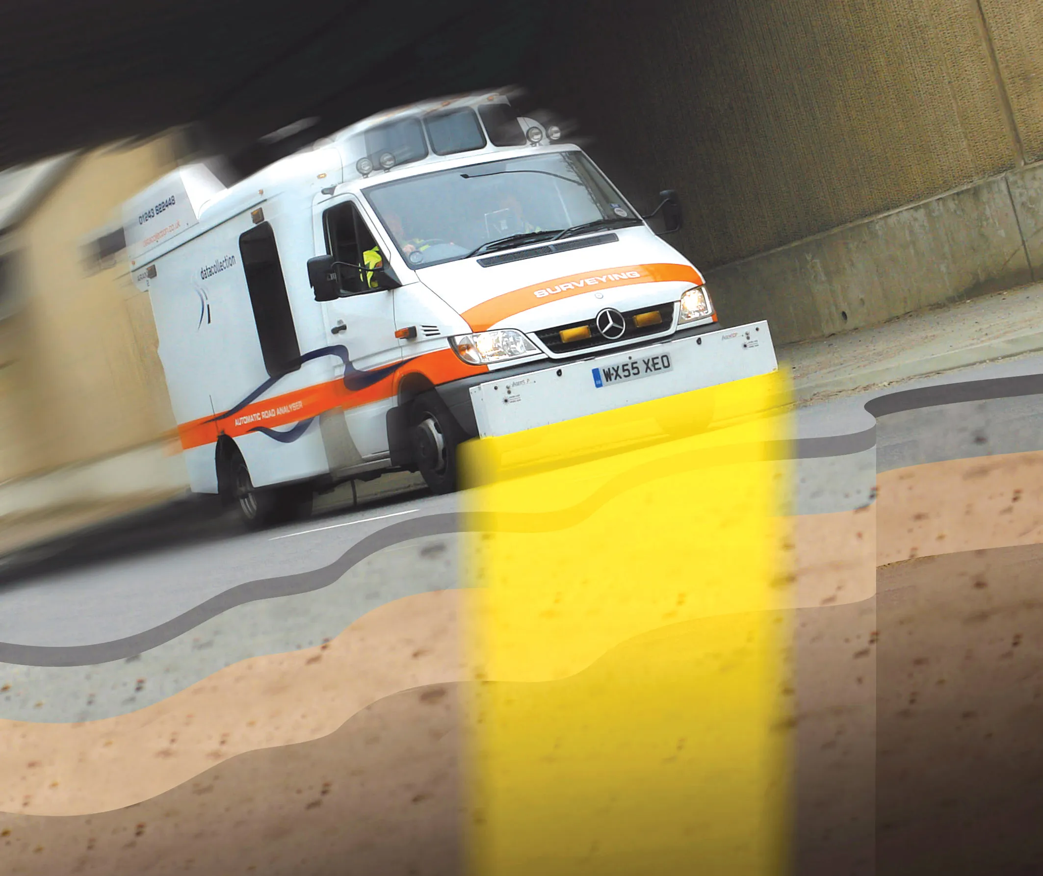
Innovative mobile radar technology that can detect subsurface problems is now being launched by surveying specialist Data Collection Limited. The system uses a specially designed vehicle to carry out surveys at normal traffic speeds. Ground-penetrating radar is used to generate a cross-sectional profile of the subsurface. This information can be used to assess road condition, helping with planning repairs and re-surfacing.
September 3, 2012 Read time: 2 mins
Travelling at highway speeds, this sophisticated survey package offers fast highway scanning

Innovative mobile radar technology that can detect subsurface problems is now being launched by surveying specialist Data Collection Limited. The system uses a specially designed vehicle to carry out surveys at normal traffic speeds. Ground-penetrating radar is used to generate a cross-sectional profile of the subsurface. This information can be used to assess road condition, helping with planning repairs and re-surfacing.

The ground penetrating radar (GPR) is fitted to a new electronic survey vehicle called ARAN2, which is also equipped with surface scanning systems and advanced technology to detect cracks down to 2mm in size. Unlike most conventional vehicles this allows surface and subsurface data to be collected at the same time.

The radar emits pulses of radio frequency energy into the road surface. With the transition of the pulses from one material to another, part of the energy echoes back to the surface and returning signals are processed to generate subsurface profiles. This equipment does away with the need for core sampling and means that survey data can be collected while travelling at normal traffic speeds. This GPR information maps layers to an accuracy of 5-10mm, and gives highway engineers a picture of road make-up and condition. On bridges, GPR is particularly useful for determining the location and thickness of concrete and asphalt layers, as well as reinforcing steel.

Related Content

  • Banking on the Banksman Auto Braking system by Vision Techniques
    January 8, 2019
    UK contractor Eurovia Surfacing and Sims Milling, based near London, are trialling an automatic braking system that could save the lives of workers and pedestrians. The Banksman Auto Braking radar system is designed to remove the risk of accidents while a vehicle is reversing, with 100% accuracy at detecting objects. The system - provided by Vision Techniques – emits low-energy microwaves from a unit mounted at the rear of the vehicle. If an obstruction or hazard is detected then the system will automatica
  • Rapid adoption of GPS machine control
    April 5, 2012
    The high sophistication of GPS machine control systems has resulted in a fast pace of technological advancement. The three major players in the machine control sector, Leica Geosystems, Topcon and Trimble have all made major gains in recent years. The sophistication of the latest systems can combine satellite position data from the GPS and GLONASS networks with information from total stations to provide precise, high speed machine operation. Further more the firms have also prepared themselves for the intro
  • Major Necaxa-Tihuatlan Highway project for Mexico
    October 1, 2014
    A new highway in Mexico is connecting Necaxa with Tihuatlan and the project features challenging terrain - Mauro Nogarin reports In Mexico a landmark highway project is now close to completion, having set a number of records for Latin America.
  • New generation highways condition data collection
    February 21, 2012
    Fugro Aperio is launching its SCANNER survey service, which it says offers competitive, efficient and dynamic highways data collection to assist road agencies and local authorities in reporting to National Indicators.