Underground identification

Improved detection of buried objects can be achieved with the latest RD7000+ utility cable and pipe locator range from Radiodetection.
February 9, 2012 Read time: 1 min
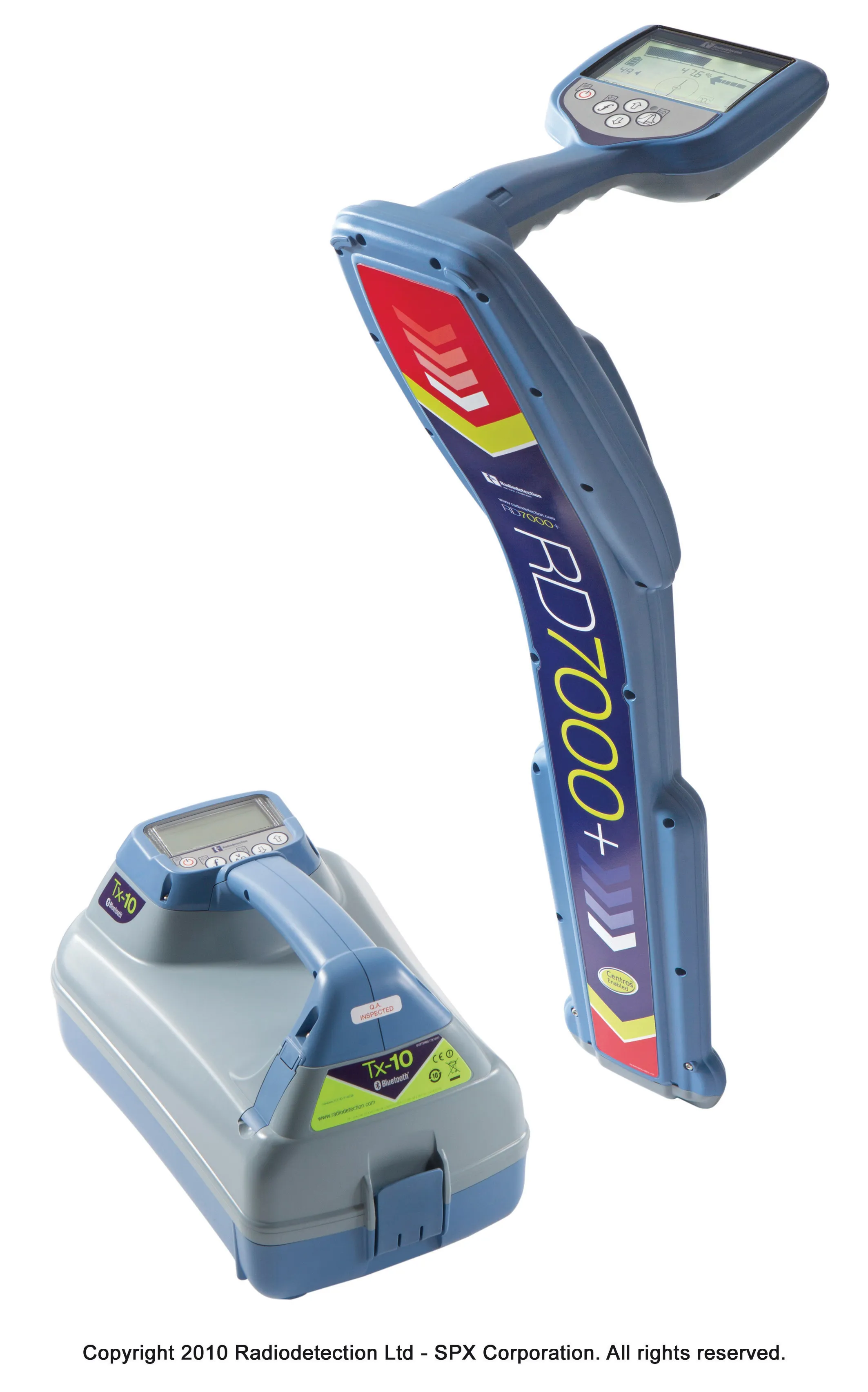
Improved detection of buried objects can be achieved using the latest tool from Radiodetection
Improved detection of buried objects can be achieved with the latest RD7000+ utility cable and pipe locator range from 2537 Radiodetection. The units feature compass and dynamic overload protection and are said to be ergonomic in design and user-friendly. The dynamic overload protection system improves location performance in electrically noisy areas while the compass package determines the orientation of a target cable or pipe, simplifying route determination and helps to improve depth measurement accuracy. The RD7000+ range comprises four locators, with the RD7000SL+ featuring standard active frequencies and rugged design, suiting it particularly to use in the construction industry. All the RD7000+ units are Centros and this measurement engine is based on over 30 years of development, combining new and innovative algorithms with established software on a high-performance processor core. The units also feature Radiodetection's eCAL package, which allows users to validate the original factory calibration of their RD7000+ locator.

For more information on companies in this article

Related Content

  • The use of concrete cutting tools and tips for users
    October 8, 2015
    Despite the proven importance of identifying metal targets and electrical lines before cutting into concrete, every day there are stories about mishaps that happen when the necessary reconnaissance is not done. In this article, a few firms that provide concrete scanning services weigh in on the critical importance of locating embedded and or buried obstructions by scanning for these features using ground penetrating radar (GPR). Also offered are tips for selecting the best GPR equipment and best practices f
  • Rapid adoption of GPS machine control
    February 10, 2012
    The high sophistication of GPS machine control systems has resulted in a fast pace of technological advancement. The three major players in the machine control sector, Leica Geosystems, Topcon and Trimble have all made major gains in recent years. The sophistication of the latest systems can combine satellite position data from the GPS and GLONASS networks with information from total stations to provide precise, high speed machine operation. Further more the firms have also prepared themselves for the intro
  • Automatic control
    February 7, 2012
    Leica Geosystems says that sophisticated PowerDigger 2D guidance system for excavators offers automatic slope control. The system expands on its PowerSnap technology and is said to make excavating easier and more productive. The system uses a standard panel whether fitted to a dozer, excavator or grader, which is also said to save money on training and equipment, as well as reducing down time. Leica PowerDigger 2D system allows multiple elevations and slopes to be constructed at any orientation, witho
  • Efficient concrete inspection from GSSI
    June 17, 2016
    A new portable tool from GSSI offers fast and accurate analysis of concrete structures. The firm’s latest handheld ground penetrating radar (GPR) can be used for concrete inspection Industry. The StructureScan Mini series is a handheld, all-in-one GPR system for locating rebar, conduits, post-tension cables and voids. The unit can also be used to determine concrete slab thickness in real time. The firm offers the product in two models, the standard StructureScan Mini and the high resolution StructureSca