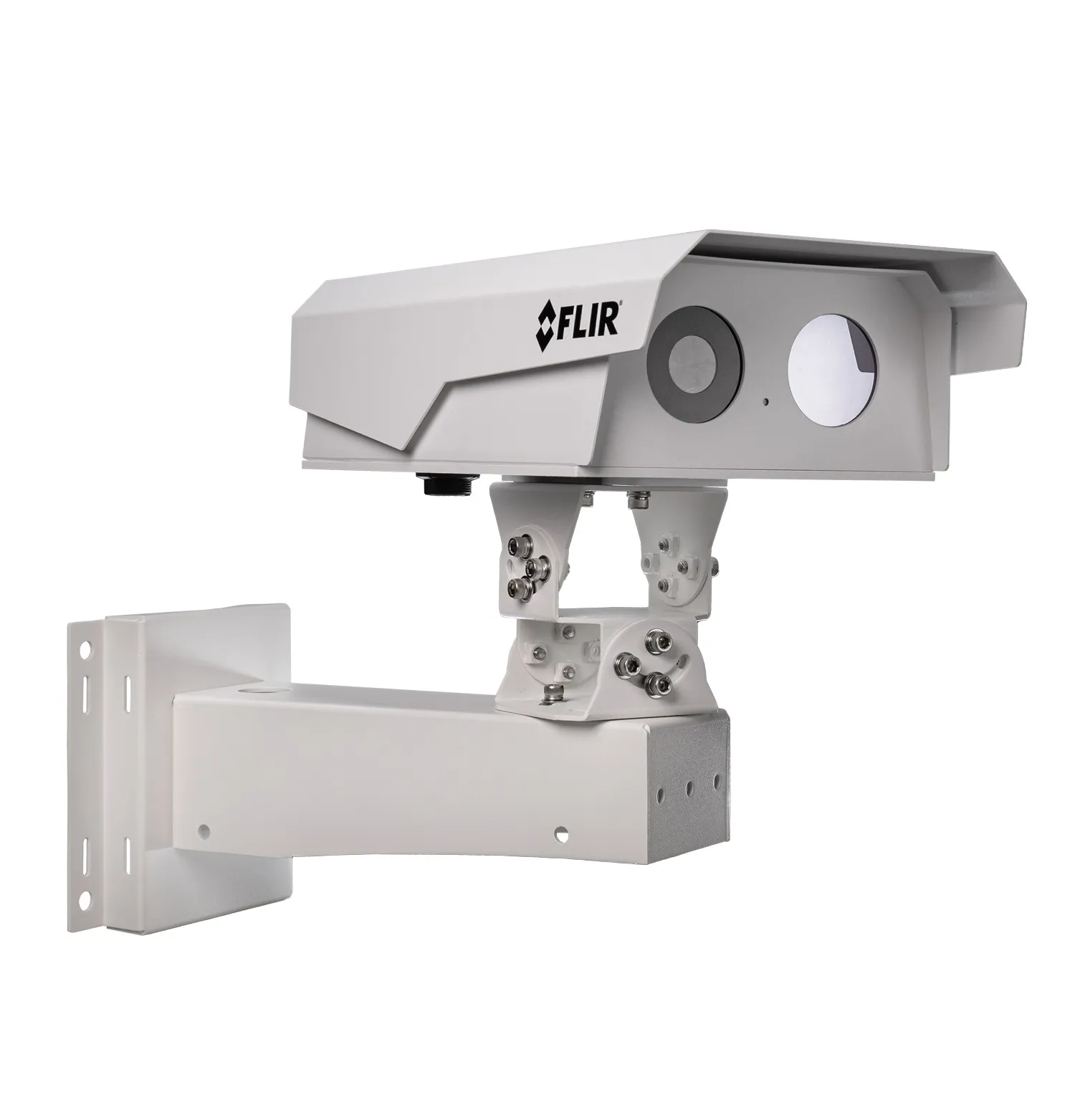
Flir has launched the closed circuit TrafiBot Dual AI multispectral camera system specifically to improve safety in tunnels and on bridges.
Flir, part of Teledyne Technologies, noted that it is in tunnels and on bridge that where drivers are most at risk for hitting unseen objects or being trapped by fast-growing vehicle fires.
The TrafiBot Dual AI offers a fast thermal core, the most reliable 14-bit early fire detection for road tunnels and robust artificial intelligence (AI) for the highest detection performance. Flir says that it has the most dependable traffic data collection along interurban roadways, without sacrificing imaging resolution or data loss due to bandwidth restrictions.
TrafiBot Dual AI uses three Flir proprietary AI models simultaneously, developed and trained from millions of Flir-captured images collected across the world. One model identifies and classifies fallen objects while the other two classify vehicles on thermal and on the visual stream, including unusual objects such as e-scooters and vulnerable road users like pedestrians and bicyclists.
Combined with the Flir’s 3D world tracker, TrafiBot Dual AI features a greater capacity to detect incidents within a scene. As vehicles enter its field of view, the camera anticipates vehicle speed and trajectory, even if tracked objects become occluded or obscured by other vehicles, objects or road infrastructure. TrafiBot Dual AI can also detect sudden lane changes and wrong-way drivers. This is all critical data for traffic managers to better manage safety incidents while reducing false alarms.
TrafiBot Dual AI analyses the 14-bit thermal information directly on the camera. This gives the camera algorithm 64-times more information which guarantees unparalleled fire detection, speed and reliability while dramatically reducing the potential for false alarms.
“Today traffic management teams require more immediate, accurate traffic data to alert first responders, save lives, and get vehicles moving again,” said Stefaan Pinck, vice president for business development at Flir. “TrafiBot Dual AI provides that capability through a combination of proprietary AI models 3D world tracker and its early fire detection capabilities.”
TrafiBot Dual AI has a three-axis rotational design that provides greater installation flexibility for mounting on unique roadway infrastructure including the sloped walls of tunnels and within tight spaces. The three-axis camera swivel, pans, tilts and rolls sideways. This eliminates the need for custom adapter plates that take a lot of time to install. The tilt sensor inside also calibrates the camera automatically, further reducing installation time and any ensuing traffic disruption.
TrafiBot Dual AI is housed within an IP 66/67-rated non-corrosive, marine grade, stainless-steel casing built to withstand all types of weather, including salt air and humidity, along with high-pressure water blasts from road-and-tunnel cleaning operations. The 4K camera features an optical zoom of 6mm to 22mm with a detection range of up to 300m. Flir says that this provides greater coverage per camera compared to predecessor Flir intelligent traffic cameras.
The camera is designed to integrate with Flir Cascade, a recently launched software that collects and organises data from TrafiBot Dual AI. It also provides intelligent incident filtering to ensure only the relevant incidents are shown to the traffic operator. If an incident is detected, a short 4K-resolution colour and/or a thermal video clip of the scene is flagged up for the traffic management team for immediate review.
Flir says that TrafiBot Dual AI can also further integrate with video management systems to provide live footage.
Meanwhile, Teledyne has launched a website dedicated to the Teledyne Vision Solutions group to focus on imaging technology. The website includes comprehensive product and support information from Teledyne DALSA, e2v CMOS image sensors, Flir IIS, Lumenera and Photometrics and Princeton Instruments. To be included in the near future will be Teledyne Judson Technologies, Acton Optics and Adimec.