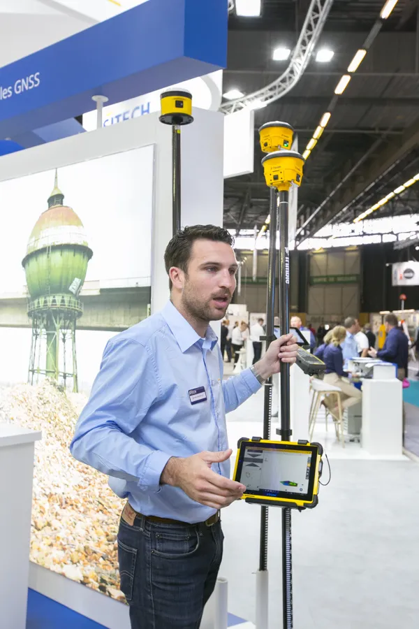
“It has updated boards inside and gives a GPS position,” said Martin Wagener, worldwide product implementation manager.
An important feature is its new sensor and Wagener said, “It has an internal angle sensor called eBubble.”
This detects if the mast is at an angle when taking measurements and automatically corrects the reading to take account of the degree of tilt, boosting accuracy.
The unit benefits from the new SiteWorks software package, with a new 3D view and a touch sensitive screen.
According to Wagener: “We also have a new controller called the TSC7 with all the capabilities of a full PC, with internal GPS and a camera.”
Trimble says that a version with a larger screen is also offered that is a more rugged table for onsite use. Both units run on the popular Windows 10 software.