Trimble’s new drone package offers versatility

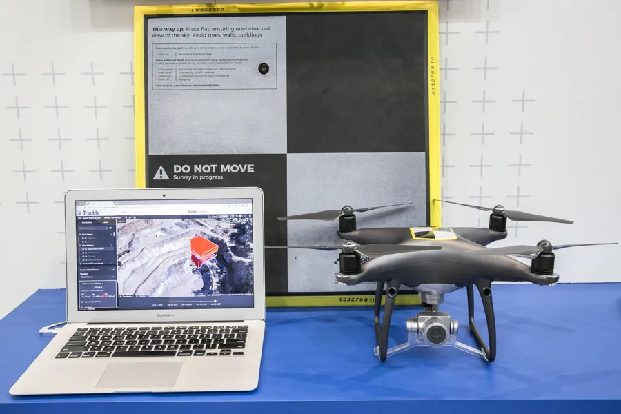
Trimble is now offering a sophisticated new drone package called Trimble Stratus, through the firm’s partnership with drone-mapping and analytics company Propeller Aero. According to Martin Wagener, worldwide product implementation manager for the firm, the system allows the user to employ any type of commercial quality drone. The important part of the package is the Aeropoint, a small flat plate developed by Propellor. This is placed on the ground and acts as a point of reference for all of the drone’s ge
April 26, 2018 Read time: 2 mins
Trimble’s new drone offering can deliver accuracy and versatility
2122 Trimble is now offering a sophisticated new drone package called Trimble Stratus, through the firm’s partnership with drone-mapping and analytics company 8779 Propeller Aero. According to Martin Wagener, worldwide product implementation manager for the firm, the system allows the user to employ any type of commercial quality drone.


The important part of the package is the Aeropoint AeroPoint, a small flat plate ground control point developed by Propeller Aero that makes drone data survey-grade and works with any GPS enabled device. This is placed on the ground and acts as a point of reference for all of the drone’s geolocated images and measurements. The plate features integral GPS and wireless connectivity.
 
The package allows a user to get a comprehensive overview of a project or working area. “You upload all of the pics onto the online Trimble Stratus package and it stitches all the images together to form a digital terrain model. A few hours later you get full pointcloud models from Trimble,” said Wagener.
 
Wagener explained that it requires minimal training to operate, with the complex image data handling task offered as a service by Trimble Trimble Stratus, or its SiTech SITECH dealer network, for the customer.

For more information on companies in this article

Related Content

  • Latest GIS and software tools improve operations
    February 24, 2012
    Innovative GIS and software solutions are coming to market from the three key market players - Mike Woof reports Competition is strong in the field for GIS and surveying systems as well as the associated software. The three major players in the sector, Leica Geosystems, Topcon and Trimble, all invest heavily in research and development and continue to roll out new solutions for construction customers that will boost the efficiency of surveying as well as overall project implementation.
  • Asset management and BIM solutions offer cost efficiency
    May 22, 2018
    New technology will help deliver projects more efficiently – Mike Woof writes. An array of new software and hardware tools are coming to market that can boost working efficiency for construction projects. Technology company thinkWhere is helping to improve collaboration and communication on Scotland’s largest road infrastructure project. Providing online access to multiple layers of live project maps and geographical data, the firm’s groundMapper software offers a web-based viewer that is allowing the co
  • Trimble’s technology advances for machine fleets
    January 26, 2018
    Trimble is gearing up to boost construction efficiency with a new level of machine technology – Mike Woof writes The introduction of the latest version of Trimble’s VisionLink package will help allow contractors to reduce operating costs while boosting working efficiency, according to the firm. Trimble’s VisionLink system was developed in partnership with Caterpillar and includes tools for production monitoring. This now offers customers greater capabilities, due in many respects to its increased versat