The Trimble Quantm alignment planning system, on show at CONEXPO/CON-AGG 2014, allows road designers to cut planning time and deliver projects with little environmental and social impact at a reduced cost. The system analyses millions of alignment alternatives and returns a range of options to the planning team for consideration. When new data becomes available the Quantm system can quickly recalculate more alignment options.
The 2122 Trimble Quantm alignment planning system, on show at Conexpo/CON-AGG 2014, allows road designers to cut planning time and deliver projects with little environmental and social impact at a reduced cost. The system analyses millions of alignment alternatives and returns a range of options to the planning team for consideration. When new data becomes available the Quantm system can quickly recalculate more alignment options.
Also on show at the Las Vegas, US exhibition, Trimble’s design-build-operate (DBO) solutions range features intuitive software and field solution brands such as SketchUp Pro, Tekla Structures, Vico Office, WinEst, Modelogix, and Prolog. These solutions help architects, engineers and construction site managers improve productivity, increase efficiencies, and maximise profitability of construction projects.
Three other Trimble systems and solutions were due to be on show at Conexpo-CON/AGG 2014.
The2123 Manitowoc Falcon, Trimble and Manitowoc’s new collision avoidance system for cranes, uses precise positioning technology, wireless communications and comprehensive software capabilities to improve the way cranes and information are managed on a construction site. Using precision GNSS with collision avoidance technology, the system provides real- time, centimetre-level positioning for multiple cranes working onsite. The solution enhances crane operator awareness - boosting safety and productivity in the construction lifting industry.
TrimFleet, for ready-mix and aggregate fleets, allows users to monitor driver behaviour and safety, identify drivers and individual service statuses, route drivers to and from job sites, monitor fuel usage and efficiency, communicate effectively and safely, and evaluate vehicle diagnostics remotely. Furthermore, users can generate reports and review business performance analytics.
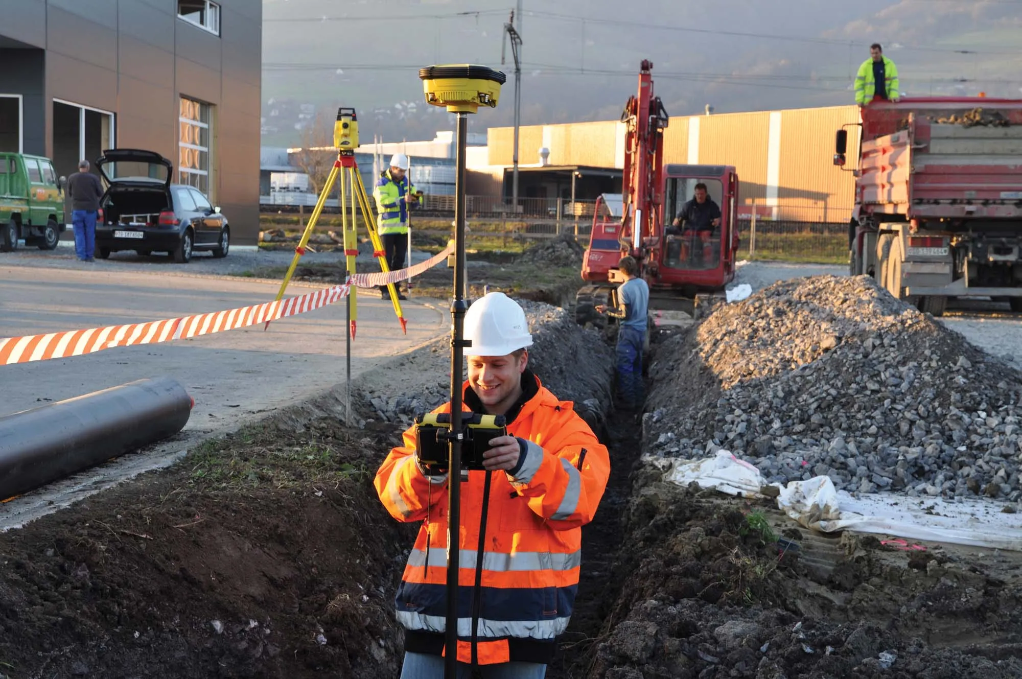
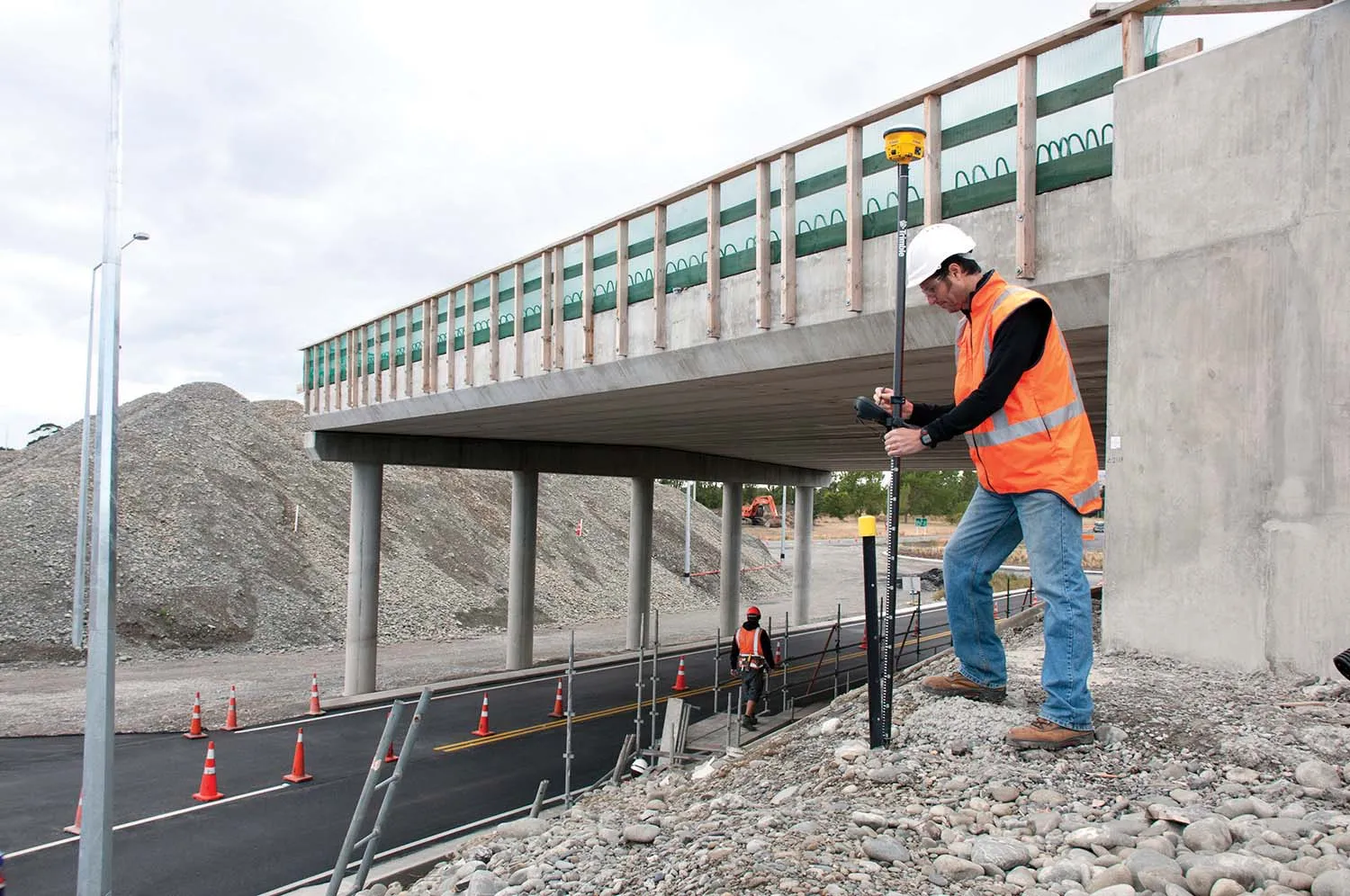
Finally, Trimble Positioning Services for Construction allows users to obtain accurate positioning for construction projects, including site surveys, machine control, site stakeout, site layout, and fine grading. Services include Trimble VRS Now and OmniSTAR. Using Trimble VRS Now contractors save time, money and resources by having access to real-time kinematic (RTK) corrections utilising a network of permanent (fixed) continuously operating reference stations. The OmniSTAR delivers real-time and highly reliable correction services 24 hours a day 365 days a year.
Also on show at the Las Vegas, US exhibition, Trimble’s design-build-operate (DBO) solutions range features intuitive software and field solution brands such as SketchUp Pro, Tekla Structures, Vico Office, WinEst, Modelogix, and Prolog. These solutions help architects, engineers and construction site managers improve productivity, increase efficiencies, and maximise profitability of construction projects.
Three other Trimble systems and solutions were due to be on show at Conexpo-CON/AGG 2014.
The
TrimFleet, for ready-mix and aggregate fleets, allows users to monitor driver behaviour and safety, identify drivers and individual service statuses, route drivers to and from job sites, monitor fuel usage and efficiency, communicate effectively and safely, and evaluate vehicle diagnostics remotely. Furthermore, users can generate reports and review business performance analytics.
Finally, Trimble Positioning Services for Construction allows users to obtain accurate positioning for construction projects, including site surveys, machine control, site stakeout, site layout, and fine grading. Services include Trimble VRS Now and OmniSTAR. Using Trimble VRS Now contractors save time, money and resources by having access to real-time kinematic (RTK) corrections utilising a network of permanent (fixed) continuously operating reference stations. The OmniSTAR delivers real-time and highly reliable correction services 24 hours a day 365 days a year.