
Trimble offers advanced dozer machine control solution

Trimble is now introducing its Earthworks for Dozers package, following on from the Earthworks for Excavators system unveiled last year. The Earthworks Grade Control System for Dozers uses the same inertial motion sensors (IMUs) as the excavator package and mounts its dual GNSS receivers on top of the cab to eliminate masts and cables conventionally located on the blade. The dual GNSS receivers suit steep slope work and complex designs with tight tolerances. The new configuration keeps valuable receivers
February 28, 2018 Read time: 2 mins
Trimble’s latest Earthworks package will boost accuracy for dozing

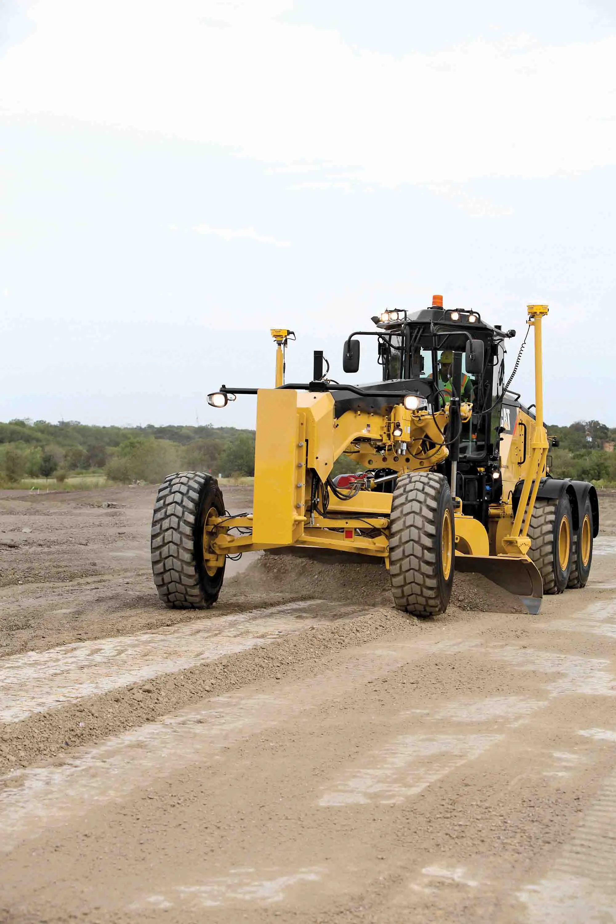
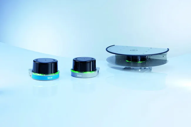
2122 Trimble is now introducing its Earthworks for Dozers package, following on from the Earthworks for Excavators system unveiled last year. The Earthworks Grade Control System for Dozers uses the same inertial motion sensors (IMUs) as the excavator package and mounts its dual GNSS receivers on top of the cab to eliminate masts and cables conventionally located on the blade. The dual GNSS receivers suit steep slope work and complex designs with tight tolerances. The new configuration keeps valuable receivers safer and also saves contractors time by reducing the time needed to remove and reinstall them each day. Putting the receivers on the cab means that safety is improved too, as there is no need to clamber over the blade to retrieve the units. Mounting the units on the top of the cab means that the system has to be calibrated with the distance to the blade tip. However the system is more accurate and provides more data than previous generation packages. Martin Wagener of the firm said, “It measures so fast we can monitor the whole machine. Before, the old system just measured the blade. But this takes 100 measurements/second and not just slope like the old sensor. We really know exactly where the blade is.”

The system is said to be highly rugged and durable and the IMU units are waterproof, with special salt-protection packages also available for use where seawater spray would otherwise cause corrosion isuses.

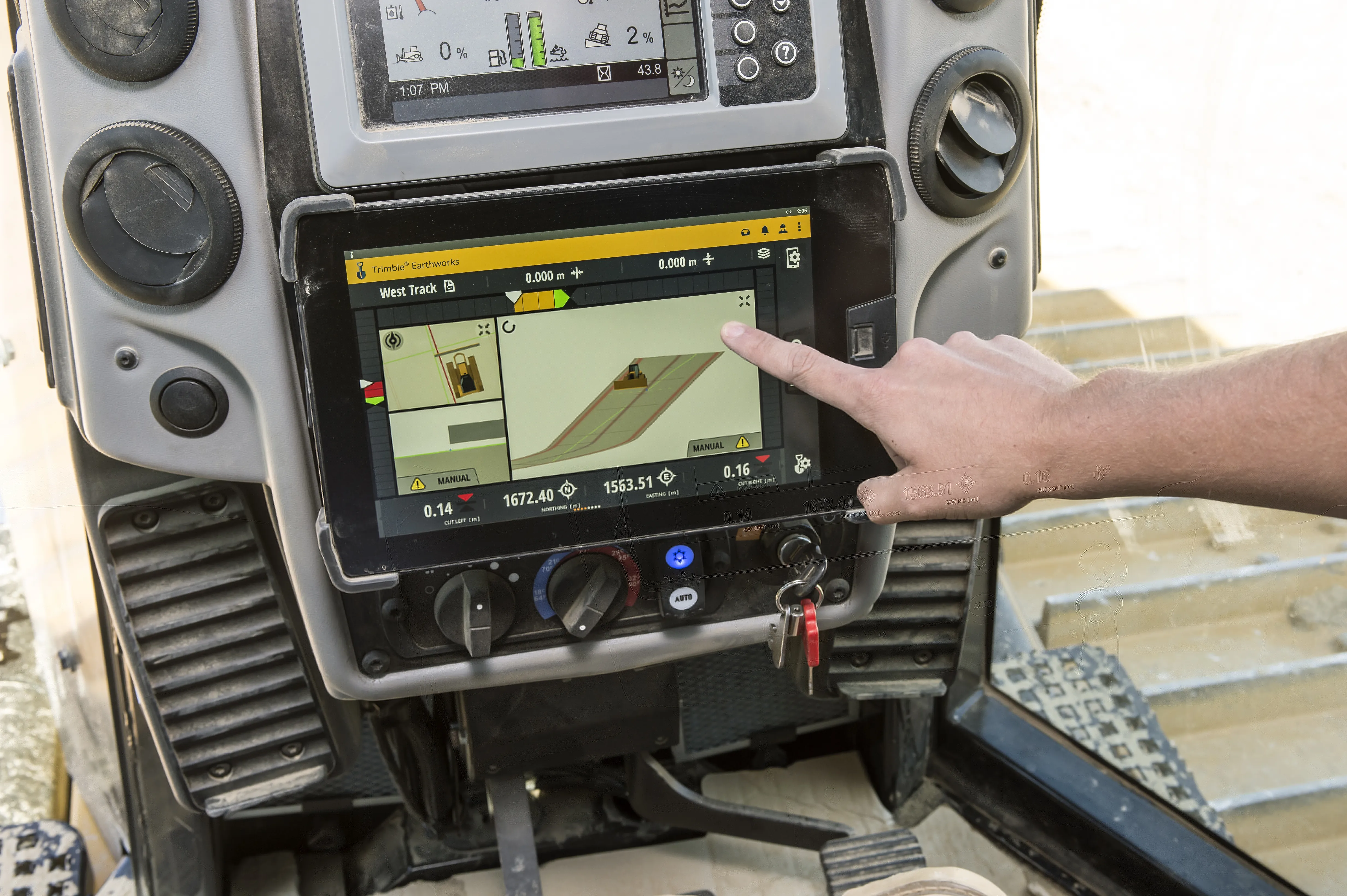
The Trimble Earthworks grade control application is built on the Android operating system and runs on a Trimble TD520 touch-screen display. The package has graphics and self-discovery features that are said to make the software intuitive and easy to learn. Earthworks also allows data files to be transferred to or from the office wirelessly and automatically so that the operator is always using the latest design. The software runs on an Android operating system and is said to be state-of-the-art, along with the hardware. According to Trimble, the package allows operators of all skill levels the ability to work faster and more productively than before.

For more information on companies in this article

Related Content

  • New developments in asphalt compaction
    June 14, 2019
    New developments in asphalt compaction offer performance gains for contractors, with future innovations being unveiled – Mike Woof writes Advanced asphalt compactors are offering huge gains in performance over previous generation machines. Better working quality and finish is claimed for the latest machines, while future developments will offer sophisticated solutions. The new ARX 91 articulated tandem roller from Ammann is designed as a high productivity compactor that can be used on both thin and t
  • New developments in bulldozers and graders
    February 7, 2017
    A number of new bulldozer and grader developments are now coming to market - Mike Woof reports Bulldozers and graders are often overlooked as earthmovers, with the focus all too often concentrating on excavators, wheeled loaders and ADTs. However, key manufacturers are rolling out new graders and bulldozers too, which are also benefiting from the latest low emissions engine technology as well as advanced telematics systems and improved cabs with better all-round visibility. Caterpillar’s 26tonne 14M3
  • Smart constructioon with GIS, GPS design technology
    May 2, 2012
    A UK highway project has benefited from the latest software, GIS and GPS technology, Mike Woof reports. Sophisticated software, GIS and GPS technology has played an important role in a large highway upgrade project in the UK and helping to increase efficiency and drive down construction costs.
  • SICK’s LMS 1000 and RMS 1000 sensors deliver the goods
    January 7, 2019
    SICK says that it’s recently launched LMS1000 and MRS1000 infrared LiDAR sensors deliver more accurate and reliable distance sensing and measurement, especially in difficult conditions. The robust, compact sensors weigh just 1.2kg and come with rotatable connectors for easy mounting on gantries. Heavy rain, mist, dust or snow can lead to false signals, explained Neil Sandhu, SICK’s national product manager for imaging, measurement, ranging and systems. The addition of SICK’s triple-echo HDDM+ - High Defini