Topcon offers compact digital imaging solution

Topcon claims that its new IP-S3 system offers a compact and lightweight 3D imaging solution. This high density system is said to be five times faster than previous generation tools, while weighing in at just 18kg. Scanning at 700,000 points/second, the system is said to offer data-rich results with its 30MP panoramic imagery and offers a mobile mapping powerhouse, according to the firm. The company says that this high-density and high-resolution camera comes in a unit that is much smaller than its predeces
February 2, 2015 Read time: 1 min
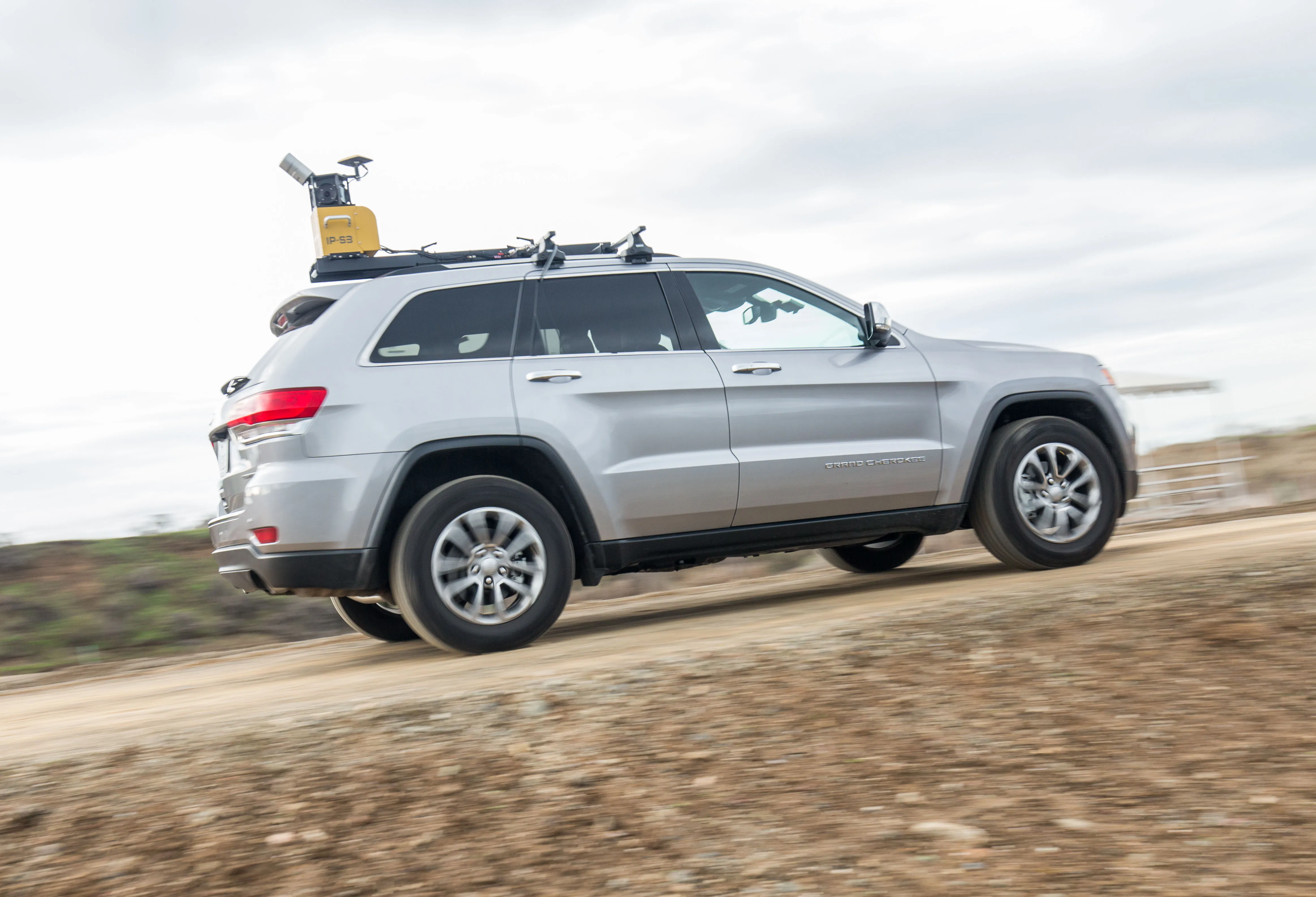
Topcon’s IP-S3 offers a smaller, lighter digital imaging solution
342 Topcon claims that its new IP-S3 system offers a compact and lightweight 3D imaging solution. This high density system is said to be five times faster than previous generation tools, while weighing in at just 18kg. Scanning at 700,000 points/second, the system is said to offer data-rich results with its 30MP panoramic imagery and offers a mobile mapping powerhouse, according to the firm. The company says that this high-density and high-resolution camera comes in a unit that is much smaller than its predecessors. The system is used with the Topcon Mobile Master Office software to carry out post-processing functions in a single application. And the company says that the Mobile Master Office software provides a comprehensive workflow in a single package, which can turn raw sensor data collected by the IP-S3 system into rich and precise point clouds and images.

For more information on companies in this article

Related Content

  • Topcon offers compact digital imaging solution
    January 6, 2017
    Topcon claims that its new IP-S3 system offers a compact and lightweight 3D imaging solution. This high density system is said to be five times faster than previous generation tools, while weighing in at just 18kg. Scanning at 700,000 points/second, the system is said to offer data-rich results with its 30MP panoramic imagery and offers a mobile mapping powerhouse, according to the firm. The company says that this high-density and high-resolution camera comes in a unit that is much smaller than its predeces
  • Laser scanning focuses on asset management
    January 9, 2015
    Laser scanners and improved data collection and analysis software are making light of asset management surveying. David Arminas reports The age of the laser scanner is upon us, taking over from traditional manual methods of surveying, data collection and processing. These new technical developments are making it much easier to process and use the data captured and are providing highways engineers with powerful tools to record, map and visualise their assets. This is good news for highways authorities
  • Positioning tools continue to improve
    July 16, 2012
    Topcon says that its new IP-S2 package combines GNNS positioning capabilities with inertial sensors, while the firm also has a solution for customers wanting to mix and match receiver components. The IP-S2 is a vehicle-mounted, mobile 3D tool that offers precision mapping and surveying capabilities. The package collects data using 3D laser scanners, LIDAR, and/or cameras, and this is then integrated, time-stamped and geo-referenced. The customer can use this assembled data to combine LIDAR point cloud and d
  • Latest GIS and software tools improve operations
    February 24, 2012
    Innovative GIS and software solutions are coming to market from the three key market players - Mike Woof reports Competition is strong in the field for GIS and surveying systems as well as the associated software. The three major players in the sector, Leica Geosystems, Topcon and Trimble, all invest heavily in research and development and continue to roll out new solutions for construction customers that will boost the efficiency of surveying as well as overall project implementation.