Topcon and Bentley join forces to model reality

Topcon Positioning and Bentley Systems are introducing the product of their joint development project at CONEXPO-CON/AGG 2017, a reality modelling software solution.
March 8, 2017 Read time: 2 mins
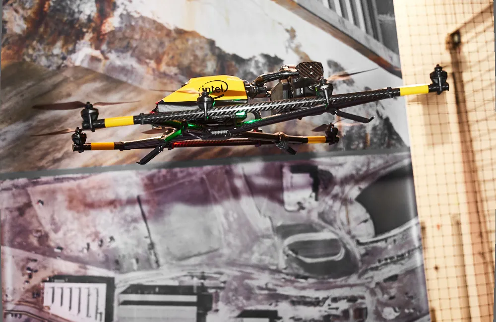
Topcon and Bentley have jointly developed a modelling system for use with drones

342 Topcon Positioning and 4019 Bentley Systems are introducing the product of their joint development project at CONEXPO-CON/AGG 2017, a reality modelling software solution. The Topcon ContextCapture package is powered by Bentley Systems and will be offered with Topcon unmanned aerial systems (UAS). The system has been designed for use in mapping, construction and surveying.

It allows users to quickly turn simple photographs or point cloud data into true-to-life, highly detailed 3D models for use throughout a project lifecycle.

The package includes Topcon ContextCapture Standard and Topcon ContextCapture Advanced products. Charles Rihner, vice president of the Topcon GeoPositioning Solutions Group said, “The standard package will be bundled with Falcon 8 and Sirius Basic/Pro and allows operators to process data from these UAS into textured 3D reality meshes, point clouds and orthophotos. ContextCapture Advanced allows users to process data from any UAS. It also includes ContextCapture Editor, which enables operators to take advantage of all project data by integrating reality meshes and point clouds, into infrastructure workflows. The result is access to a wide variety of reality modelling tools to help increase productivity.”

The ContextCapture Advanced integration includes CAD, inspection, GIS, civil engineering, and survey workflows on desktop and mobile devices, in multiple formats. This technology allows users to start from a reality-captured survey context and update digital engineering models throughout the construction process, finally delivering the as-built infrastructure in real time.

For more information on companies in this article

Related Content

  • LiDAR surveying is making inroads into asset management
    December 18, 2017
    In the coming age of the autonomous vehicle, fast and accurate LiDAR surveying will be increasingly important, explains Valdis Vanags. The game-changing introduction of autonomous vehicles relies not only on intelligent traffic systems but well maintained roads to help computer-guided systems navigate using road markings. Laser scanning technology, too, is a game changer when it comes to planning and executing many civil engineering projects, including transport network upgrades and smart city initiatives.
  • Hexagon and Nemetschek form partnership
    September 19, 2024
    Hexagon and Nemetschek have formed a key partnership.
  • Software alliance improves productivity
    June 12, 2012
    In the fast moving world of construction software, major innovations are happening on a continuous basis. All the leading players are making notable contributions to the sector. A new strategic alliance just announced between the management and data handling software giant Pitney Bowes, and design and construction software producer Autodesk, will help create an end to end range of products and tools for rapidly evolving BIM strategies in the industry. In particular in should help develop an integrated suite
  • Topcon beefs up eXchange AutoCAD 3D civil engineering software
    March 10, 2015
    Topcon’s latest eXchange software add-on for AutoCAD Civil 3D civil engineering design software converts data into files compatible with Topcon 3D construction solutions as well as the MAGNET software system. The add-on even converts complex road designs with defined corridors into Topcon standard file formats, such as MJF (MAGNET Field job) for land surveying and construction layout, and TP3 (3D Topcon Project File) for machine control systems. After installation, users are offered the ability to log in to