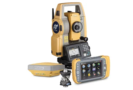
Spectra Precision is widening its line of optical survey solutions. There are two additional FOCUS 30 Total Stations now in the range, the new LockNGo and StepDrive models. The LockNGo instrument uses a passive tracking technique that constantly tracks the instrument to the range pole and this is said to improve efficiency by enabling the instrument to constantly lock onto the prism.