Surveying accurately

Spectra Precision says that its EPOCH 35 system benefits from the latest GPS and GLONASS technology to provide accurate cadastral, topographic, control and stakeout survey applications. Said to be reliable and cost-effective, the EPOCH 35 GNSS system includes a base, rover, field software, data collector, and radio. The rover features integrated Bluetooth capability, an internal radio modem and battery. For North America, the system operates with the proven TDS Survey Pro field software while for other mark
July 18, 2012 Read time: 1 min
Riegl's sophisticated V-Line range includes interfaces for GPS, networking and mobile operation together with high precision time stamping
2373 Spectra Precision says that its EPOCH 35 system benefits from the latest GPS and GLONASS technology to provide accurate cadastral, topographic, control and stakeout survey applications. Said to be reliable and cost-effective, the EPOCH 35 GNSS system includes a base, rover, field software, data collector, and radio. The rover features integrated Bluetooth capability, an internal radio modem and battery. For North America, the system operates with the proven TDS Survey Pro field software while for other markets, the system runs the Spectra Precision Field Surveyor package. For RTK surveying, the base system can include a choice of radio modems with either a long or short range data link from the base to the rover. In addition, Network RTK is also supported by simply connecting to an external data-capable cellular modem. Back at the office, surveyors can use the Spectra Precision Office Software for post-processing and quality control.

For more information on companies in this article

Related Content

  • New surveying tool from Sokkia
    July 6, 2016
    Sokkia is introducing a new field controller for use with construction and surveying applications, the SHC5000. The unit runs the firm’s MAGNET Field, Site and Layout software and is designed as a versatile and fast handheld computer for GNSS receivers and total stations. It is also said to offer the largest screen size in the Sokkia line. The display’s capacitive touch interface comes with finger, glove, small tip stylus and water capable options. Operators can also change the screen from portrait to l
  • Topcon unveils Hybrid Robotic System
    January 21, 2014
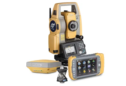
    Topcon Positioning Group has unveiled its Hybrid Robotic System, featuring the new DS series robotic total station and the recently announced MAGNET v2.0 software suite, a Topcon enterprise solution for the geomatics industry. Other Topcon components in the cutting-edge HRS include the economical HiPer SR GNSS receiver and Tesla large-screen tablet controller. The new system combines GNSS positioning and robotic measurements with an automated data workflow to provide added versatility and efficiency for
  • Construction software boosts operating efficiency
    March 5, 2012
    Intelligent data handling and management technologies are helping boost operating efficiency - Mike Woof reports The construction software sector and GIS market are seeing a rapid development of new products and technologies that will help boost efficiency, with factors such as data management and platform integration being key focus areas.
  • Positioning tools from Topcon
    November 15, 2012
    Topcon is offering an array of new tools that can improve surveying and machine control capabilities for contractors. Light and compact, the B110 dual-frequency positioning receiver board features the new Vanguard ASIC system and can support 226 universal channels for GPS, GLONASS and Galileo tracking and scalable positioning. The B110 board’s small size, low power consumption and versatile communication interfaces make it easy to integrate into any precise positioning application. It features a high perfor