The stability and integrity of structures such as bridges, culverts and walls can be compromised by bridge scour where fast-flowing water removes material from around the footings of bridge abutments and piers.
There are three main types of scour*. Local scour is caused by the faster water flow that occurs around piers and abutments. Constriction scour is created by water accelerating through a narrow opening. Meanwhile, degradation scour can lower a riverbed over a longer period, both upstream and downstream of a structure.
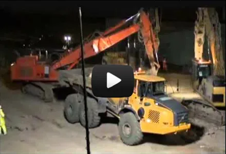
The effects of bridge scour can be disastrous. For example, during a flood in 1987, the Glanrhyd Bridge in Carmarthenshire, Wales, partially collapsed, causing a train to plunge into the River Towy, killing the driver and three of the passengers. In 2009, failure of the Malahide Viaduct in Dublin, Ireland, was caused by foundation scour. Two commuter trains packed with hundreds of passengers were just seconds away from disaster when a 20m section of the viaduct collapsed after they passed over it. Nobody was killed, but travel chaos ensued.
Today, highways and rail authorities conduct regular inspections in order to asses scour risk. “The most important objective is the early detection of increased risk,” says Jim Brown, the south-east unit bridge manager for Transport Scotland. “Once we have established which structures are more vulnerable during flooding, we are able to implement different levels of mitigation.
“Much research has been undertaken in an attempt to be able to monitor scour, but this is obviously problematic because potential scour takes place at times when it is not possible to see the riverbed and certainly not possible to deploy divers,” says Brown, who spent 42 years as a civil engineer with the UK’s national Network Rail, 13 of which he headed the geotechnical discipline in Scotland. “For this reason, continuous monitoring of water level is not the perfect solution, but may be the best and most practicable.”
Water level is already used as a risk factor by the inspection teams where the 1 in 200 flood level – a 0.5 per cent chance of a water level being equalled or exceeded in any one year - is shown on structures by a fixed marker. However, Transport Scotland has to monitor 700 structures which are over or adjacent to water and site inspections are costly, both financially and in resources. The inspection system could, therefore, be more efficient if it could be informed by remotely available water level data. This is especially the case if the data enables faster, more efficient implementation of mitigation.
If a structure is determined to be high risk, a hydrological assessment is undertaken. This may prompt a requirement for strengthening of the structure itself, as well as measures to protect or fill potential scour zones and/or to alter water flow and disrupt vortices. In extreme cases, when a potentially vulnerable structure is exposed to high water, it may be necessary to close highways or rail lines until the level of risk can be lowered.
A trial was conducted at a Transport Scotland bridge over Vales Burn, near Hawick, and the monitoring equipment was provided by OTT HydroMet**, a weather and hydrology monitoring company based in Sheffield, England. The trial was to determine whether access to remote water level measurements could improve the protection of critical transport infrastructure.
“The system was set to deliver alarms at preset water levels, which enhanced the timing and efficiency of site inspections,” says Wendy Strain, business development manager at OTT HydroMet.
Vales Burn trial
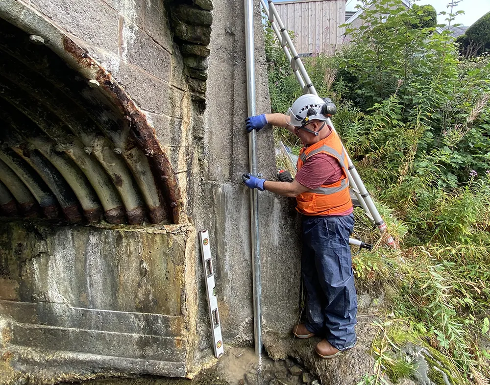
In light of the potential for live water level data to inform the bridge inspection process, OTT HydroMet was invited to propose a monitoring system that could be evaluated at a culvert on the Vales Burn. “Our solution comprised an OTT ecoLog 1000 water level logger in a stilling well with cellular data connection to Hydromet Cloud. A web-enabled platform was used for processing, displaying and storing hydrometeorological data,” says Strain. “Data was set to be transmitted routinely every six hours, but two alarm levels were set to prompt SMS [text] alerts, when necessary.”
![Data was set to be transmitted routinely every six hours, but two alarm levels were set to prompt SMS [text] alerts (image courtesy OTT HydroMet/Transport Scotland)](/sites/wh/files/inline-images/Bridge%20-%20river%20level%20monitoring%20-%20PIC%202%20copy.jpg)
The monitoring system was installed in September 2021, explains Transport Scotland’s Brown. “The trial has been a great success. We use the Scottish Environmental Protection Agency (SEPA) flood alert warnings to monitor flooding and it has been our experience that the highest water levels generally occur about one or two days after a storm. So, one of the main objectives of the trial was to determine the best time to despatch inspection staff.”
The monitors did issue alerts during the trial, but these were when levels met the lower alarm level and in these cases, further interventions were not required. “With the benefit of water level data, we will therefore be able to optimise the deployment of the inspection teams and mitigate risk,” says Brown.
The deployment of remote water level monitors/alarms that can be accessed via PCs or a mobile App offers highway and rail authorities an opportunity to optimise their scour assessment activities. They can prioritise countermeasures, improve transport resilience and protect safety.
“This project has shown that a network of water level monitors could inform bridge engineers of potentially affected structures,” says Brown. “I understand that the HydroMet Cloud platform is able to connect with an almost infinite number of water level monitors, so we may be able to roll this out on a larger scale in the future.”
*See Alberta’s peaceful partnership, a World Highways exclusive report (April 2020) concerning scour upon a bridge construction project in the town of Peace River in the western Canadian province of Alberta.
**From precipitation as well as surface and ground water to marine monitoring applications, OTT HydroMet Group’s measurement and communication technologies provide a complete picture of the water cycle. OTT and Hydrolab have been longstanding members of the OTT HydroMet Group. Adcon Telemetry was acquired in 2011. Sutron and Lufft joined the group in 2015 and Kipp & Zonen joined in 2017. Meanwhile, Aquatic Informatics joined the Danaher Water Quality platform in 2020, which means that the company now offer sensors and data handling technology and software for every application.