Remote surveying and scanning

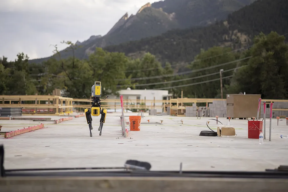
Remote surveying and scanning can be achieved using the autonomous robotic system available from Trimble. The package combines the Spot robot autonomous rover unit with the Trimble X7 3D laser scanner and Trimble FieldLink software.
January 18, 2022 Read time: 2 mins
Autonomous surveying and scanning is possible using the new package from Trimble

This solution has been jointly developed between Trimble and Boston Dynamics and allows autonomous operation on construction sites. The system takes advantage of the robot's ability to navigate challenging, dynamic and potentially unsafe environments. Trimble's 3D data capture technology can deliver a continuous flow of information between the field and the office for documentation of jobsite progress.

The innovative package allows users to make important decisions, rather than waiting for the information to be relayed to project staff. The integration is focused on the automated capture of field construction data through the use of Trimble 3D capture technology and the Spot robot. The autonomous workflow for the X7 laser scanner uses fully integrated Spot robot controls in FieldLink software to create a predefined path of waypoints for Spot to follow and collect laser scans.

Laser scans collected using the X7 scanner and the Spot robot can be tied to a jobsite project coordinate system, as well as individual scan stations. The data is collected, and then made into a composite point cloud in real-time on the Trimble tablet controller before leaving the site. While performing autonomous operations, Spot's docking station enables in-field charging of batteries on both the robot and the X7 3D laser scanner, and also provides the continuous transfer of data through a Gigabit Ethernet connection to the office.

For more information on companies in this article

Related Content

  • Trimble Sketch out major 3D deal
    April 30, 2012
    Trimble has announced a ‘definitive agreement’ to acquire SketchUp, one of the most popular 3D modelling tools in the world, from Google. The major deal is expected to close in the second quarter of 2012, subject to customary closing conditions and expiration of the waiting period under the Hart-Scott-Rodino Antitrust Improvements Act. SketchUp is currently used by millions of users annually—ranging from architects to engineering and construction firms to building and design professionals—for designing, mo
  • Hamm’s Dr Stefan Klumpp explains future of autonomous compaction
    December 20, 2016
    Autonomous vehicles that can move around without human intervention are not yet a part of everyday life, but they are almost within reach.
  • Machine control developments from Leica Geosystems, Topcon, Trimble and Wirtgen in the slipforming sector
    July 1, 2013
    Machine control technologies were pioneered in the concrete paving sector with systems having been used for over 10 years. Leica Geosystems was the first of the machine control technology suppliers to offer these systems on concrete slipforming machines and has developed a strong position in this segment. However the company met resistance from some quarters in the construction market and specialist Karl Soar said that some contractors were very reluctant to give up using conventional stringlines. He said,
  • A new road maintenance approach developed jointly can improve efficiency
    April 11, 2013
    Innovative road maintenance solutions in Austria. A sophisticated system for managing maintenance tasks has been developed in Austria to meet the specific needs of a highway concession package. Bonaventura Straßenerhaltungs-GmbH is a 100%-owned business of the French company Egis Road Operation S.A., and was founded to provide the road maintenance services of the first Austrian PPP infrastructure project "Ypsilon"(PPP-Ostregion, Paket 1) granted by ASFINAG. The concessionaire won a 30-year contract in 2006