Remote surveying and scanning

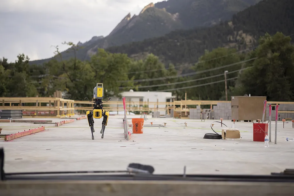
Remote surveying and scanning can be achieved using the autonomous robotic system available from Trimble. The package combines the Spot robot autonomous rover unit with the Trimble X7 3D laser scanner and Trimble FieldLink software.
January 18, 2022 Read time: 2 mins
Autonomous surveying and scanning is possible using the new package from Trimble

This solution has been jointly developed between Trimble and Boston Dynamics and allows autonomous operation on construction sites. The system takes advantage of the robot's ability to navigate challenging, dynamic and potentially unsafe environments. Trimble's 3D data capture technology can deliver a continuous flow of information between the field and the office for documentation of jobsite progress.

The innovative package allows users to make important decisions, rather than waiting for the information to be relayed to project staff. The integration is focused on the automated capture of field construction data through the use of Trimble 3D capture technology and the Spot robot. The autonomous workflow for the X7 laser scanner uses fully integrated Spot robot controls in FieldLink software to create a predefined path of waypoints for Spot to follow and collect laser scans.

Laser scans collected using the X7 scanner and the Spot robot can be tied to a jobsite project coordinate system, as well as individual scan stations. The data is collected, and then made into a composite point cloud in real-time on the Trimble tablet controller before leaving the site. While performing autonomous operations, Spot's docking station enables in-field charging of batteries on both the robot and the X7 3D laser scanner, and also provides the continuous transfer of data through a Gigabit Ethernet connection to the office.

For more information on companies in this article

Related Content

  • Topcon announces increased integration with Autodesk scanning software
    June 2, 2016
    Topcon Positioning Group has announced increased integration in the Autodesk and Topcon reality data workflow that it says is designed to increase project efficiency. Raw scan data from the Topcon GLS-2000 laser scanner can now be taken directly into Autodesk ReCap 360 and ReCap 360 Pro with no intermediate software conversion steps necessary. Topcon said that this integration is designed to streamline point cloud analysis to quickly identify conflicts, measure variations and make adjustments at vari
  • Software innovations benefit construction planning
    February 9, 2012
    Bentley Systems remains bullish with a healthy financial performance and continued investment in research and development, reports Mike Woof. The State Geological Institute of Dionyz Stur in Slovakia won an award in the Bentley Systems Be Inspired event's geotechnical category for an innovative project to log and analyse an area of the country's geology. As a leading player in the construction software sector, Bentley Systems is benefiting from growth in infrastructure investment worldwide. And despite the
  • Software and control innovations introduced
    August 28, 2023
    New developments in construction machine control systems and construction software are helping to change the face of the industry
  • ScanStation C10: sophisticated
    March 1, 2012
    High-speed, versatile laser scanning can now be achieved using the latest technology from Leica Geosystems. The firm's sophisticated ScanStation C10 package features a new high-definition surveying (HDS) scanner that is said to increase surveying productivity and accuracy for both routine surveys and large, complex projects.