Remote surveying and scanning

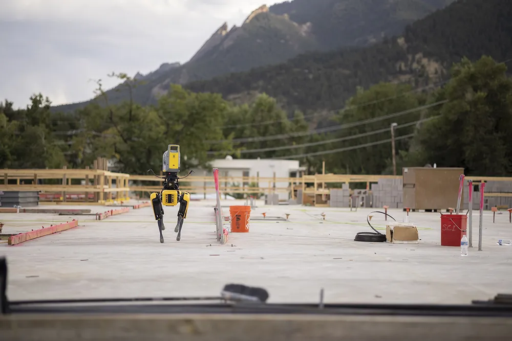
Remote surveying and scanning can be achieved using the autonomous robotic system available from Trimble. The package combines the Spot robot autonomous rover unit with the Trimble X7 3D laser scanner and Trimble FieldLink software.
January 18, 2022 Read time: 2 mins
Autonomous surveying and scanning is possible using the new package from Trimble

This solution has been jointly developed between Trimble and Boston Dynamics and allows autonomous operation on construction sites. The system takes advantage of the robot's ability to navigate challenging, dynamic and potentially unsafe environments. Trimble's 3D data capture technology can deliver a continuous flow of information between the field and the office for documentation of jobsite progress.

The innovative package allows users to make important decisions, rather than waiting for the information to be relayed to project staff. The integration is focused on the automated capture of field construction data through the use of Trimble 3D capture technology and the Spot robot. The autonomous workflow for the X7 laser scanner uses fully integrated Spot robot controls in FieldLink software to create a predefined path of waypoints for Spot to follow and collect laser scans.

Laser scans collected using the X7 scanner and the Spot robot can be tied to a jobsite project coordinate system, as well as individual scan stations. The data is collected, and then made into a composite point cloud in real-time on the Trimble tablet controller before leaving the site. While performing autonomous operations, Spot's docking station enables in-field charging of batteries on both the robot and the X7 3D laser scanner, and also provides the continuous transfer of data through a Gigabit Ethernet connection to the office.

For more information on companies in this article

Related Content

  • Latest GIS and software tools improve operations
    February 24, 2012
    Innovative GIS and software solutions are coming to market from the three key market players - Mike Woof reports Competition is strong in the field for GIS and surveying systems as well as the associated software. The three major players in the sector, Leica Geosystems, Topcon and Trimble, all invest heavily in research and development and continue to roll out new solutions for construction customers that will boost the efficiency of surveying as well as overall project implementation.
  • Laser scanning focuses on asset management
    January 9, 2015
    Laser scanners and improved data collection and analysis software are making light of asset management surveying. David Arminas reports The age of the laser scanner is upon us, taking over from traditional manual methods of surveying, data collection and processing. These new technical developments are making it much easier to process and use the data captured and are providing highways engineers with powerful tools to record, map and visualise their assets. This is good news for highways authorities
  • Bentley’s point cloud innovation for information modelling in road design
    August 22, 2013
    Latest software packages from Bentley Systems will help optimise project design and construction efficiency – Mike Woof reports Software systems have come a long way in helping optimise construction projects from design through construction to delivery. And the latest software from Bentley Systems offers additional capabilities for road design applications. Bentley Systems is offering the V8i (SELECTseries 3) versions of its InRoads, GEOPAK, and MXROAD products. All of the products now share the
  • Optimising operations with construction software gains
    May 20, 2015
    Innovations in construction software are helping boost project efficiency and optimising project operations – Clive Davidson writes Over the past decade, while construction engineers have been putting up buildings or infrastructure, software engineers have been developing a parallel universe where virtual buildings or infrastructure can be created in ever increasing detail. What started with 2D architectural drawings in computer-aided design (CAD) systems, has become a multi-dimensional world, with 3D ge