Precision GNSS surveying

Trimble is widening its radio line-up with the addition of the TDL450H for surveyors. This unit offers long-range capabilities for productive surveys and is designed to support high-precision GNSS surveying applications. The Trimble TDL450H is a 2-35W radio transceiver and enables work in difficult terrain and urban areas. The multi-function user interface streamlines field configuration and troubleshooting so surveyors can maintain productivity.
February 16, 2012 Read time: 1 min
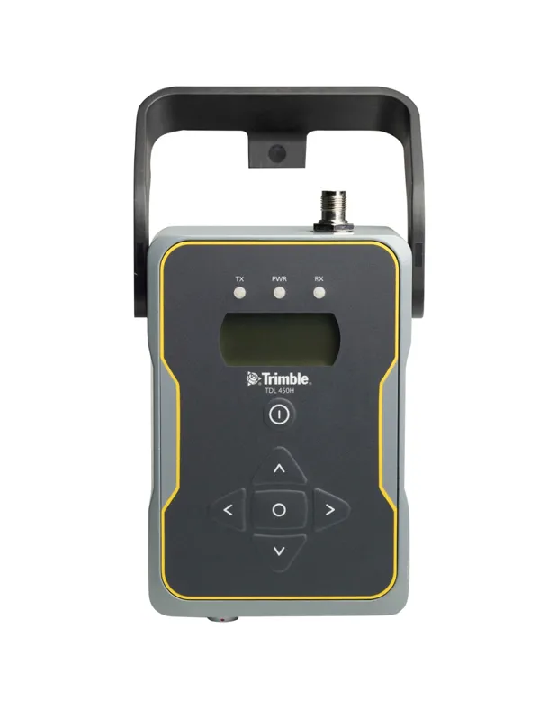
High performance communications can be achieved with the new Trimble radio system
2122 Trimble is widening its radio line-up with the addition of the TDL450H for surveyors. This unit offers long-range capabilities for productive surveys and is designed to support high-precision GNSS surveying applications. The Trimble TDL450H is a 2-35W radio transceiver and enables work in difficult terrain and urban areas. The multi-function user interface streamlines field configuration and troubleshooting so surveyors can maintain productivity. The radio modem allows users to adapt as conditions require: for longer baselines surveyors can dial up the power, and when the work area is smaller, a lower power output can extend battery life. The Trimble TDL450 series is available in two frequency bands to cover the entire commercial UHF band without sacrificing radio performance. It also allows the user to select from either 12.5 or 25kHz channel bandwidth. This high-power radio comes with a new protocol offering 9600bps in a 12.5kHz channel without loss of range.

For more information on companies in this article

Related Content

  • Smarter software from Trimble
    May 8, 2019
    Trimble has introduced version 5.0 of Trimble Business Center. This merges two products, Trimble Business Center and Business Center - HCE, to provide surveying and civil construction customers with a complete office software solution. The combined software enables data interoperability between survey and construction workflows for more efficiency, time savings and data quality. The firm says that the package simplifies workflows and licensing for its customers, saving them time and money by providing a
  • Software innovations aid road design
    February 24, 2012
    As an aid to design, construction software continues to be a foundation stone in new project development. Autodesk is working with the Incheon Free Economic Zone (IFEZ) and the Incheon Urban Development Corporation (IUDC) to cooperate in the creation of Asia's first Digital City for Incheon.
  • Advancing asphalt paving technology
    April 5, 2016
    Asphalt paver manufacturers are meeting demands for high performance machines that can deliver a quality mat - Mike Woof reports Major manufacturers are rolling out ranges of new asphalt pavers designed to meet the latest emissions regulations for Europe, as well as developing models to suit customers in developing nations. The firms have designed many of the latest machines to meet tough new emissions legislation, although versions will also be available for less regulated markets also. Ammann has up
  • Leica Geosystems' smart GNSS antenna
    August 25, 2016
    Leica Geosystems is now offering a smart, versatile antenna for use in GNSS monitoring applications. The firm says that this high-quality device is customisable to fit a wide array of project requirements. The unit is sophisticated, while offering reliability and ease-of-use and combines both GNSS antenna and receiver. The new smart antenna can be used for monitoring installations in static, long-term projects. The unit can also enable dynamic monitoring with up to 10Hz data streaming and multi-freque