Precision GNSS surveying

Trimble is widening its radio line-up with the addition of the TDL450H for surveyors. This unit offers long-range capabilities for productive surveys and is designed to support high-precision GNSS surveying applications. The Trimble TDL450H is a 2-35W radio transceiver and enables work in difficult terrain and urban areas. The multi-function user interface streamlines field configuration and troubleshooting so surveyors can maintain productivity.
February 16, 2012 Read time: 1 min
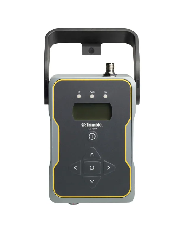
High performance communications can be achieved with the new Trimble radio system
2122 Trimble is widening its radio line-up with the addition of the TDL450H for surveyors. This unit offers long-range capabilities for productive surveys and is designed to support high-precision GNSS surveying applications. The Trimble TDL450H is a 2-35W radio transceiver and enables work in difficult terrain and urban areas. The multi-function user interface streamlines field configuration and troubleshooting so surveyors can maintain productivity. The radio modem allows users to adapt as conditions require: for longer baselines surveyors can dial up the power, and when the work area is smaller, a lower power output can extend battery life. The Trimble TDL450 series is available in two frequency bands to cover the entire commercial UHF band without sacrificing radio performance. It also allows the user to select from either 12.5 or 25kHz channel bandwidth. This high-power radio comes with a new protocol offering 9600bps in a 12.5kHz channel without loss of range.

For more information on companies in this article

Related Content

  • Wider range of survey software functionality
    February 9, 2012
    Leica Geosystems is offering a broad spread of new packages and hardware that will deliver improved performance to users. The firmware 2.0 product is said to add powerful new capabilities to the Leica ScanStation C10, the industry's most popular 3D laser scanner for as-built and topographic surveys. This further increases the productivity and versatility of the fully integrated, cable-less ScanStation C10. A new Setup facility lets users take advantage of known survey points and backsighting, while remote,
  • Innovations in concrete paving technology
    March 16, 2012
    Paving with concrete offers a strong and long life base for a roadway, with manufacturers continuing to develop technologies – Mike Woof reports. Innovation comes fast in the concrete paving market with a number of specialist suppliers offering an array of solutions to meet the needs of slipforming contractors. These machines can be used for a range of applications from large-scale airport runway or highway construction duties, tunnel jobs, bridge decks, barriers, traffic islands and kerbs. Because the app
  • Spectra Precision introduces new GNSS RTK rover
    January 6, 2017
    Spectra Precision is introducing its sophisticated ProMark 700 system, a GNSS network RTK rover aimed at duties in land survey applications. The unit weighs in at only 650grammes and is said to be the lightest GNSS RTK smart antenna available on the market. Its light weight, together with its compact and slim design, makes the unit the receiver portable and comfortable for field use. It features a long battery life, a rugged, waterproof design and a wide operating temperature range, allowing the ProMark 700
  • Spectra Precision introduces new GNSS RTK rover
    March 8, 2013
    Spectra Precision is introducing its sophisticated ProMark 700 system, a GNSS network RTK rover aimed at duties in land survey applications. The unit weighs in at only 650grammes and is said to be the lightest GNSS RTK smart antenna available on the market. Its light weight, together with its compact and slim design, makes the unit the receiver portable and comfortable for field use. It features a long battery life, a rugged, waterproof design and a wide operating temperature range, allowing the ProMark 700