Precision GNSS surveying

Trimble is widening its radio line-up with the addition of the TDL450H for surveyors. This unit offers long-range capabilities for productive surveys and is designed to support high-precision GNSS surveying applications. The Trimble TDL450H is a 2-35W radio transceiver and enables work in difficult terrain and urban areas. The multi-function user interface streamlines field configuration and troubleshooting so surveyors can maintain productivity.
February 16, 2012 Read time: 1 min
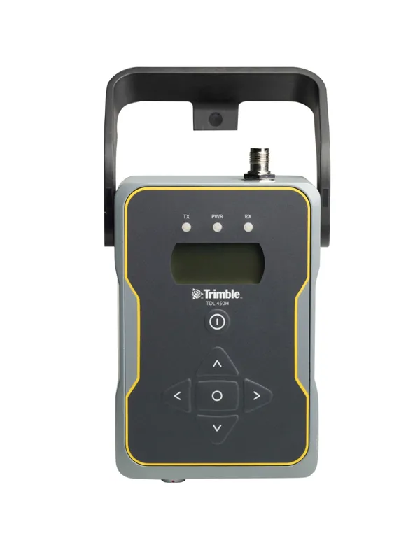
High performance communications can be achieved with the new Trimble radio system
2122 Trimble is widening its radio line-up with the addition of the TDL450H for surveyors. This unit offers long-range capabilities for productive surveys and is designed to support high-precision GNSS surveying applications. The Trimble TDL450H is a 2-35W radio transceiver and enables work in difficult terrain and urban areas. The multi-function user interface streamlines field configuration and troubleshooting so surveyors can maintain productivity. The radio modem allows users to adapt as conditions require: for longer baselines surveyors can dial up the power, and when the work area is smaller, a lower power output can extend battery life. The Trimble TDL450 series is available in two frequency bands to cover the entire commercial UHF band without sacrificing radio performance. It also allows the user to select from either 12.5 or 25kHz channel bandwidth. This high-power radio comes with a new protocol offering 9600bps in a 12.5kHz channel without loss of range.

For more information on companies in this article

Related Content

  • Clearer road markings influence driver behaviour
    July 12, 2012
    Research into driver behaviour has identified that driver safety and decision-making can be positively influenced by clearer and higher performing road markings. Patrick Smith reports. Bare roads will lead to total vehicular confusion. Markings are painted on the road to direct, guide and regulate the road user, and include all lines patterns, words and colours applied on or attached to the road surface or kerb for these purposes.
  • Navtech Radar to showcase ClearWay radar-based safety and monitoring systems
    March 19, 2012
    Navtech Radar will be showcasing the safety and economic benefits of using longer-range radar systems for Automated Incident Detection (AID) and enforcement at Intertraffic 2012. The company’s ClearWay sensor technology is currently deployed in live tunnel and above-ground environments in Northern Europe and has been further developed to provide count and classification capabilities as well as an effective counter to illegal tailgating and unsafe lane-change manoeuvres.
  • Eradicating work zone danger
    June 26, 2013
    New safety systems for highway work zones are helping to reduce deaths and injuries in the United States, while much work is being done in Europe to improve work zone safety. Guy Woodford reports. With more road building underway than at any one time in Texas history, the US Lone Star state’s Department of Transportation (TxDOT) is introducing its first highway safety system with queue-warning technology and temporary rumble strips to cut work zone collisions. Debuting along a central Texas stretch of the
  • G&Z pave the way as East meets West
    March 28, 2014
    The Silk Route is one of the oldest trading links between Europe and Asia and is being upgraded with some of the newest equipment. The nation of Georgia is located on what is known as the ‘crossroads’ between Western Asia and Eastern Europe. It lies to the east of the Black Sea and is on one of the shortest routes between western China and Europe. Since the Middle Ages this strategically important country has played host to one of the network of roads collectively known as the Silk Route. For much of the 20