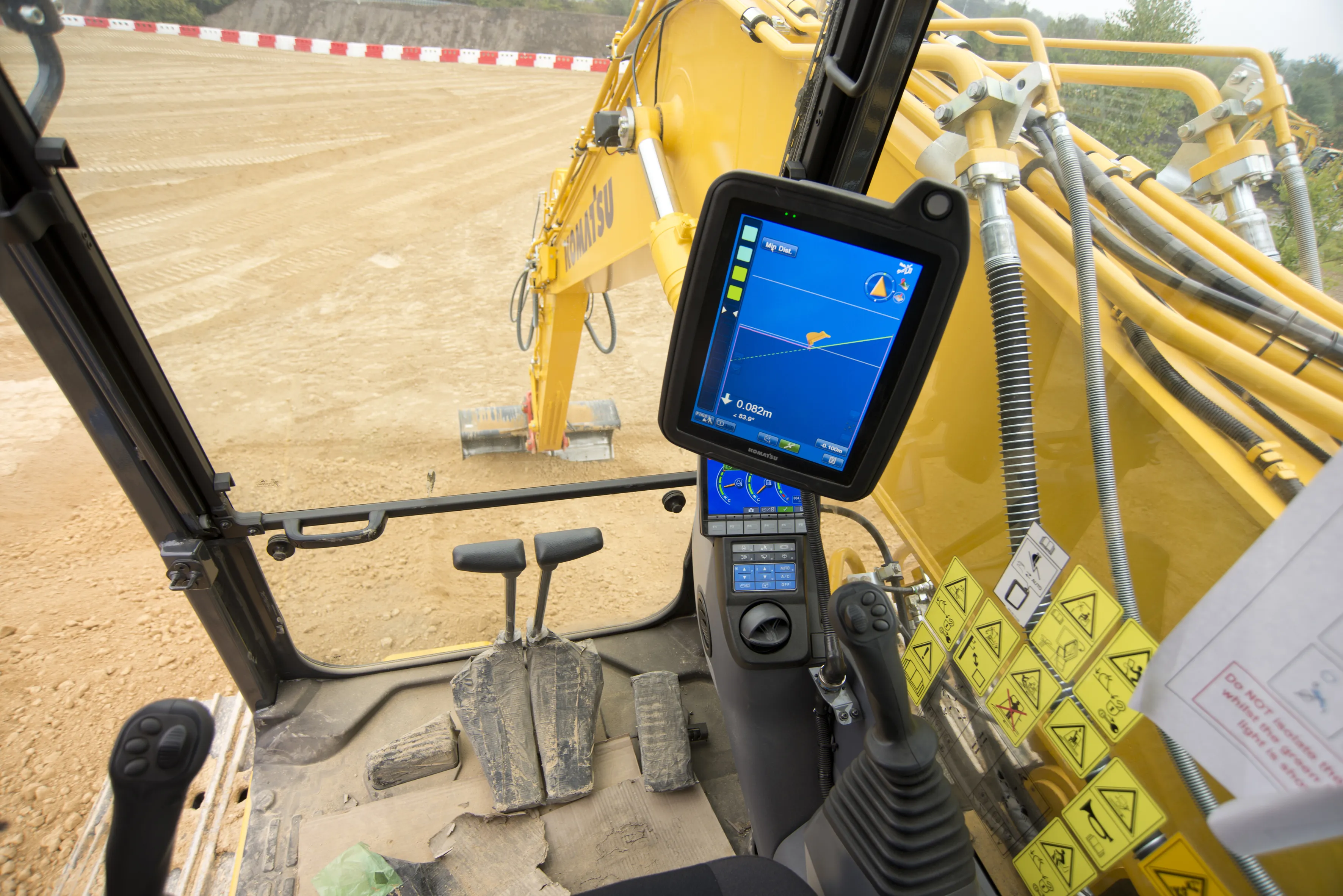
THE TRIMBLE TSC3 handheld controller for construction is said to offer powerful and rugged control capabilities. This hand-held unit is aimed at duties with heavy and highway contractors and features builtin GPS, 3G, Wi-Fi and a 5 megapixel digital camera. The unit is said to allow site workers to stay connected and also provides accurate positioning and digital design information. Using this unit allows engineers to locate, measure and record information anywhere on the construction site with a single devi
THE 2122 Trimble TSC3 handheld controller for construction is said to offer powerful and rugged control capabilities.
This hand-held unit is aimed at duties with heavy and highway contractors and features builtin GPS, 3G, Wi-Fi and a 5 megapixel digital camera.
The unit is said to allow site workers to stay connected and also provides accurate positioning and digital design information. Using this unit allows engineers to locate, measure and record information anywhere on the construction site with a single device. The TSC3 features a large sunlight-readable touch screen display, ruggedised bumpers and long battery life.
The controller is shock, dust and water resistant for durability. The built-in GPS allows the TSC3 controller to be used for standalone navigation and measurement purposes.2362 Bluetooth and optional radio capabilities allow the controller to be used with Trimble Site Positioning Systems, GNSS or total stations, where the highest accuracy is required. Integrated communications, including Bluetooth, Wi-Fi and a cellular modem, keep data flowing between field instruments and job crews and other stakeholders. The integrated 3G modem also can provide instant access to the Internet for receiving base station corrections as well as emailing files. The 5 megapixel digital camera makes it easy to collect site information and visually record site conditions for documentation and quality control. No extra devices or batteries are required, and images are automatically geo-tagged and associated with measured points for easy identification. Avanced capabilities and communications are incorporated into one handheld device. Engineers can send design changes or work orders to contractors and crews in the field. The contractor can transfer progress reports, on-site problems, and as-built data back to the office on completion of on-site operations. Site issues and completed work can be photographed and sent back to the office overlaid on the site map.
This hand-held unit is aimed at duties with heavy and highway contractors and features builtin GPS, 3G, Wi-Fi and a 5 megapixel digital camera.
The unit is said to allow site workers to stay connected and also provides accurate positioning and digital design information. Using this unit allows engineers to locate, measure and record information anywhere on the construction site with a single device. The TSC3 features a large sunlight-readable touch screen display, ruggedised bumpers and long battery life.
The controller is shock, dust and water resistant for durability. The built-in GPS allows the TSC3 controller to be used for standalone navigation and measurement purposes.