Pinpoint accuracy offered by Leica’s iCON MCH100 and Telematics

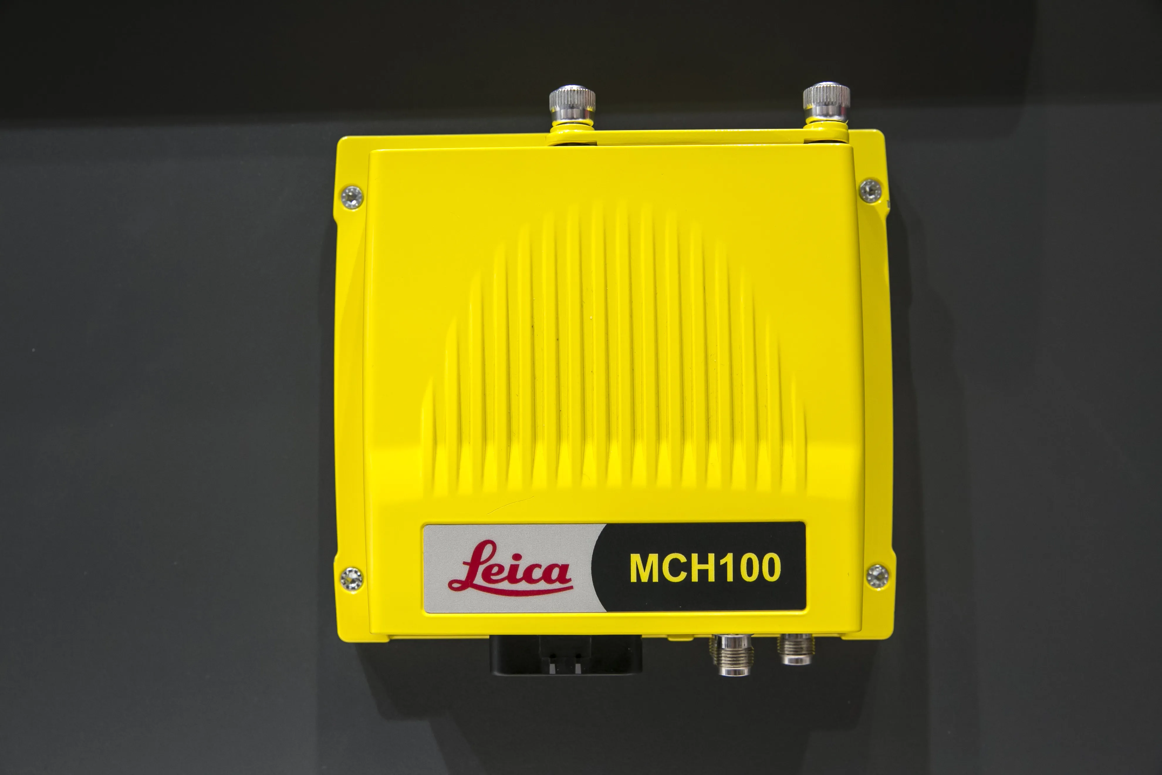
Leica’s iCON MCH100 and Telematics machine monitoring systems make it possible to know what any type of earthmoving machine is doing anytime and anywhere in the quarry or construction site. The iCON MCH100 unit, which offers the real-time location of machinery, can be attached in a non-invasive fashion with no calibration needed. Importantly, it has wireless connectivity for any type of earthmoving equipment – and from any manufacturer - and can stand up to long hours of operation in rugged conditions.
April 14, 2016 Read time: 2 mins
Accuracy and more: Leica’s iCON MCH100 and Telematics systems

265 Leica’s iCON MCH100 and Telematics machine monitoring systems make it possible to know what any type of earthmoving machine is doing anytime and anywhere in the quarry or construction site.

The iCON MCH100 unit, which offers the real-time location of machinery, can be attached in a non-invasive fashion with no calibration needed. Importantly, it has wireless connectivity for any type of earthmoving equipment – and from any manufacturer - and can stand up to long hours of operation in rugged conditions.

Leica’s ICON Telematics takes the information for analysis which is then presented in a user-friendly visual way for any employee. It can monitor overtime and off-schedule activity, as well as use projected schedules to easily identify costly overtime.

For multiple site managers and owners, the iCON Telematics system can compare performance across projects, regions and other groupings. It is also easily accessible from any internet-connected device, making it practically universal.

All videos

For more information on companies in this article

Related Content

  • Trimble is developing smart construction site solutions
    March 7, 2016
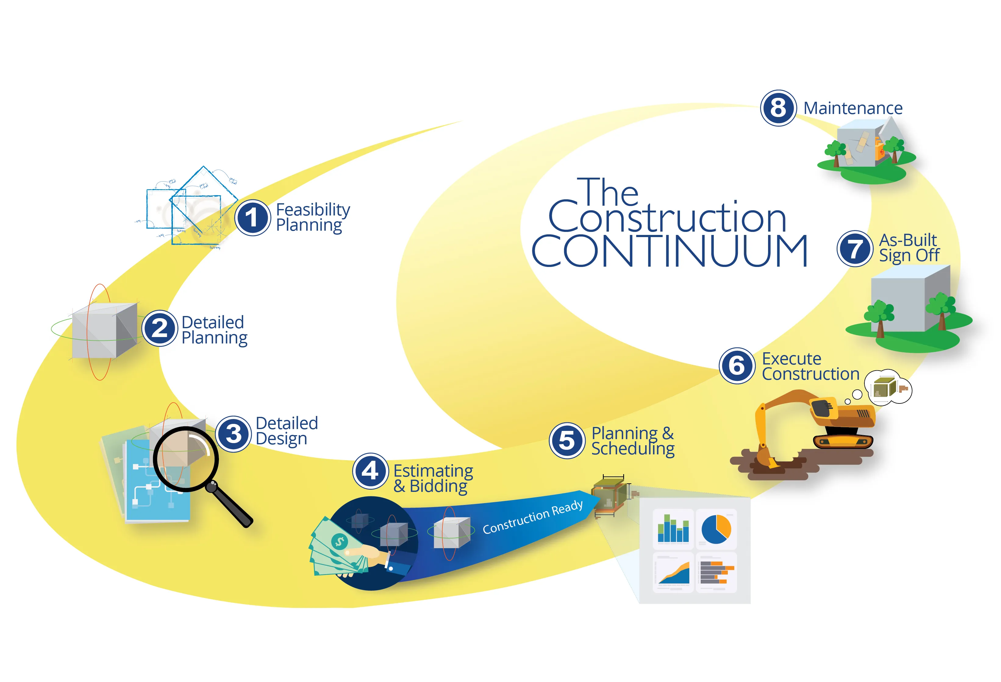
    Trimble is taking the concept of the building information model (BIM) one stage further with its development of its construction continuum concept. This is intended to show the process and benefits to building a construction-ready model embedded with intelligent data. Such a model can serve as the basis for how contractors plan and execute construction projects. With intelligent modeling, users can add and remove information in real time while simultaneously looking at multiple ways to perform construction
  • Trimble is developing smart construction site solutions
    January 6, 2017
    Trimble is taking the concept of the building information model (BIM) one stage further with its development of its construction continuum concept. This is intended to show the process and benefits to building a construction-ready model embedded with intelligent data. Such a model can serve as the basis for how contractors plan and execute construction projects. With intelligent modeling, users can add and remove information in real time while simultaneously looking at multiple ways to perform construction
  • Digital transformation is delivering digital adoption
    August 15, 2023
    Digital transformation is key for transportation agencies and their partners to do their jobs better and faster. One way to do this is through digital delivery using digital models, data, and supporting field tools for roadway design, structures design, and construction, say the tech experts at Bentley Systems.
  • Accurate positioning with Leica Geosystems
    June 19, 2017
    The new Zeno GG04 smart antenna from Leica Geosystems is said to increase access to GIS and boost tracking performance. This is said to deliver a versatile solution that can improve the accuracy of GNSS mobile devices with real-time Kinematic (RTK) and precise point positioning (PPP). Paired with the Zeno GG04, any Zeno or third party mobile device with Android or Windows OS can now collect precise positioning data with Leica Geosystems’ GNSS technology and 555-channel tracking performance. With PPP, users