Novel survey solution from Hexagon

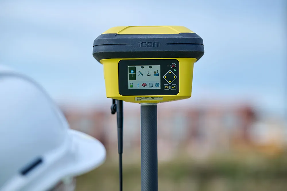
Leica Geosystems, part of Hexagon, says that its Leica iCON gps 160 package is a next-generation construction Smart Antenna with features that increase productivity for stakeout and measurement applications on the jobsite.
January 6, 2023 Read time: 2 mins
Leica iCON gps

The Leica iCON construction portfolio offers a broad range of Smart Antennas to suit all applications according to the firm. The Smart Antennas are said to be able to withstand challenging site conditions. The units integrate with all Leica iCON construction instruments and controllers as well as the iCON field software for precise, real-time verification.

The iCon gps 160 is a versatile solution for various applications. It can be used as a base station, a rover or for machine guidance. The Leica iCON gps 160 is an improved version of the successful Leica iCON gps 60. The result is a smaller, more compact GNSS antenna with additional features and a larger display for ease of use.

Leica Geosystems introduced its safety awareness solution portfolio, including Leica iCON PA10, iCON PA80 and iCON CAS, which addresses the need to immediately warn on- and off-machine field personnel of potential machine-to-people, machine-to-machine and machine-to-object and collisions. As the next step, the company integrates the field-generated safety data into the cloud-based collaboration platform Leica ConX, allowing decision-makers to review incidents and assess the entire operation over time and space. These insights support important safety initiatives by providing visualisation, analysis, monitoring, reporting and data management functions, and address communication and integration needs.

To expand its portfolio of Smart Antennas, Leica Geosystems has launched the iCON gps 160, a versatile solution for various applications. It can be utilised as a base station, a rover or for machine guidance. The Leica iCON gps 160 is a modernisation and enhancement of the successful Leica iCON gps 60, which has been well accepted in the market. The result is a smaller, more compact GNSS antenna with additional features and a larger display for ease of use.

For more information on companies in this article

Related Content

  • In control - with machine control technology
    June 21, 2016
    Advances with machine control technologies are providing major benefits right across the construction sector - Mike Woof writes With the massive bauma 2016 exhibition now having run its course, the construction sector look set to benefit from a range of new machine control technologies. These systems are being offered across a range of different segments in the equipment sector. Bulldozing was one of the first portions of the earthmoving segment to benefit from machine control systems, but a vast array o
  • Sophisticated slipformer control from Wirtgen
    August 10, 2018
    Wirtgen is now offering a new version of its concrete slipformer control package. This new tool offers additional capabilities and improved performance over the earlier version. The company claims that its upgraded Wirtgen AutoPilot 2.0 package can deliver a higher paving accuracy along with lower costs. Newly-developed, this package is said to produce a wide array of offset and inset profiles, while also delivering these more economically and precisely than with the previous version. The 3D system can eit
  • Paving Control Platform from Trimble
    May 27, 2022
    Users of Trimble’s Roadworks Paving Control Platform can transfer 3D designs wirelessly from the office to the machine.
  • Optimising operations with construction software gains
    May 20, 2015
    Innovations in construction software are helping boost project efficiency and optimising project operations – Clive Davidson writes Over the past decade, while construction engineers have been putting up buildings or infrastructure, software engineers have been developing a parallel universe where virtual buildings or infrastructure can be created in ever increasing detail. What started with 2D architectural drawings in computer-aided design (CAD) systems, has become a multi-dimensional world, with 3D ge