New surveying tool from Sokkia

Sokkia is introducing a new field controller for use with construction and surveying applications, the SHC5000. The unit runs the firm’s MAGNET Field, Site and Layout software and is designed as a versatile and fast handheld computer for GNSS receivers and total stations. It is also said to offer the largest screen size in the Sokkia line. The display’s capacitive touch interface comes with finger, glove, small tip stylus and water capable options. Operators can also change the screen from portrait to l
July 6, 2016 Read time: 2 mins
1090 Sokkia is introducing a new field controller for use with construction and surveying applications, the SHC5000.

The unit runs the firm’s MAGNET Field, Site and Layout software and is designed as a versatile and fast handheld computer for GNSS receivers and total stations. It is also said to offer the largest screen size in the Sokkia line. The display’s capacitive touch interface comes with finger, glove, small tip stylus and water capable options. Operators can also change the screen from portrait to landscape when viewing maps or drawings. The SHC5000 comes with two built-in cameras. One uses an 8MP camera with autofocus and LED flash that is designed for uses such as field photography. The second has a 2MP camera on the front side of the unit for purposes such as video meetings.

Additional features include 64GB of flash storage, an optional 4G LTE cellular modem, internal GPS navigation, Bluetooth and Wi-Fi, and a battery life of 10-plus hours.

For more information on companies in this article

Related Content

  • JAI’s VISCAM 1000 at Intertraffic 2014
    May 13, 2014
    JAI, a leading manufacturer of vehicle imaging systems and components, exhibited its VISCAM 1000 system at Intertraffic in Amsterdam. The new high resolution all-in-one imaging system for video tolling, tolling enforcement, congestion charging, red light and speed enforcement, is said to incorporate the latest high performance video triggering technology, light sensing, dynamic range control, and other technologies designed to maximise the quality of the images produced for automated number plate reading (A
  • Using machine control in earthmoving boosts efficiency
    December 19, 2017
    The use of new machine control tools has made a significant boost in earthmoving efficiency. Automated grade control using GNSS signals has transformed how earthmoving contractors get work done. Through the engineering efforts of its innovators and developers, machine control technology has been improved and refined over the years. A development in the ongoing evolution of machine control technology is Topcon Positioning Systems’ introduction of its 3D-MCMAX integrated 3D dozer system. Most notably, the
  • Highway design software developments
    February 21, 2012
    New advanced software is being released for use by those involved in highway design as Adrian Greeman reports. The growing importance of BIM, building or project information modelling, as a design and construction process, and not just 3D modelling, is the driving force for the latest 2012 versions of Autodesk's comprehensive range of software for civil engineers. This is reflected in a new packaging of its various software tools into suites (along the lines of Microsoft's office suites) tailored to variou
  • Picture perfect from Leica
    July 18, 2012
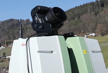
    Advanced imaging capability has been added to the Leica ScanStation C10 laser scanner. The new option consists of a direct digital camera mount on the ScanStation C10 scanner and tight, automated integration of external camera images into the scanner’s on-board controller and data storage system. Cyclone v7.4 supports the new option.