Leica’s growing support network

Leica Geosystems has launched Leica Zeno Office v3.1 and Leica MobileMatriX v5.1 software updates for the Zeno GIS series. Leica Zeno Office v3.1 and MobileMatriX v5.1 now support the new Leica CS25 GNSS, an innovative tablet computer and high accuracy data collector; Esri ArcGIS 10.0/10.1; and post-processing accuracy improvements. Johannes Hotz, senior product manager, says: “Both Zeno Office, in combination with Leica Zeno Field, and MobileMatriX further support the measurement of positions and associate
April 23, 2013 Read time: 2 mins

Leica Geosystems has launched Leica Zeno Office v3.1 and Leica MobileMatriX v5.1 software updates for the Zeno GIS series.

265 Leica Zeno Office v3.1 and MobileMatriX v5.1 now support the new Leica CS25 GNSS, an innovative tablet computer and high accuracy data collector; Esri ArcGIS 10.0/10.1; and post-processing accuracy improvements.

Johannes Hotz, senior product manager, says: “Both Zeno Office, in combination with Leica Zeno Field, and MobileMatriX further support the measurement of positions and associated information of items of economic value that are owned by an individual, the public or an organisation. This associated information includes support for feature and attribute rich data collection in addition to the capture, management and storage of survey grade geometry. This means that for every stage in the asset management life cycle our valued clients can collect rich and accurate data, while maintaining the integrity of their data model.”

The combination of the Leica CS25 GNSS and MobileMatriX is said to ensure that asset collection and post-processing of GNSS raw data can now been done in one application and on one device, bringing field and office application together into a highly portable solution. Support for file based geodatabases ensures that the user can take data into the field, while, at the same time, benefiting from claimed unmatched performance in terms of file size and speed.

Leica MobileMatriX v5.1 also supports the latest sensors from Leica Geosystems to ensure compatibility of MobileMatriX with other Leica Geosystems technology (Zeno GG03 SmartAntenna, Zeno CS25 GNSS tablet computer, Leica GS14 and the new Leica FlexLine plus series).

For more information on companies in this article

Related Content

  • Apps for all in Louisiana
    May 20, 2020
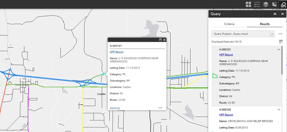
    Jason Barnes* looks at how a system of engagement (SoE) from software specialist Esri helped the US state of Louisiana’s transportation department create user-friendly apps
  • Spectra Precision introduces new GNSS RTK rover
    January 6, 2017
    Spectra Precision is introducing its sophisticated ProMark 700 system, a GNSS network RTK rover aimed at duties in land survey applications. The unit weighs in at only 650grammes and is said to be the lightest GNSS RTK smart antenna available on the market. Its light weight, together with its compact and slim design, makes the unit the receiver portable and comfortable for field use. It features a long battery life, a rugged, waterproof design and a wide operating temperature range, allowing the ProMark 700
  • Spectra Precision introduces new GNSS RTK rover
    March 8, 2013
    Spectra Precision is introducing its sophisticated ProMark 700 system, a GNSS network RTK rover aimed at duties in land survey applications. The unit weighs in at only 650grammes and is said to be the lightest GNSS RTK smart antenna available on the market. Its light weight, together with its compact and slim design, makes the unit the receiver portable and comfortable for field use. It features a long battery life, a rugged, waterproof design and a wide operating temperature range, allowing the ProMark 700
  • Intermat innovation for machine control systems
    June 23, 2015
    Improving technologies for machine control systems continue to deliver increases in efficiency for contractors - Mike Woof writes Machine control technologies have continued to develop as the specialist suppliers in this fiercely fought sector seek to find a competitive advantage over their rivals. The key players, Leica Geosystems, MOBA, Topcon and Trimble, have all been pushing the boundaries with their latest technologies. Although the systems these firms are introducing are aimed at a number of differen