Intelligent drone solution

By MJ Woof September 19, 2024 Read time: 2 mins
A Smart Construction drone package offers the chance for efficient recovery of site data

Earthmoving digital solutions specialist Smart Construction has provided the UK’s first ever demonstration of the sophisticated drone system to professionals from the construction and civil engineering sectors.

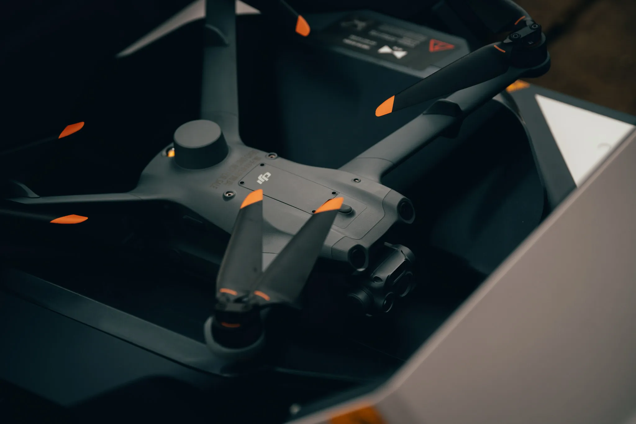
The Dock 2 is DJI's first dedicated drone in a box solution for surveying, allowing automated and remote deployment for round-the-clock and on-demand data collection.

This product can be supported by software such as Smart Construction’s Dashboard which uses as-built data to create a digital twin, enabling site managers, surveyors and other team members to measure progress, calculate volumes and control finished work within a collaborative platform.

The demonstration was held at the Smart Construction’s UK base in County Durham. Attendees were shown the DJI FlightHub 2 system as well as Smart Construction’s Edge 2 and Dashboard.

The launch was aimed at industry professionals to show how drone models can host smart technology and hardware to increase site safety, avoid obstacles and conduct efficient surveys.

Smart Construction also demonstrated its mixed solutions including its Edge system which is compatible with DJI drones. Edge has accompanying hardware that is fitted to drone technology and used to process site data.

Richard Clement, deputy general manager of Smart Construction, said: This launch is a UK first and will help to modernise the earthmoving industry. We’re excited to roll this out into the industry during a pivotal time of change as digital solutions become common practice.

“Drone technology will revitalise the earthmoving industry by increasing productivity, avoiding data black holes, and allowing virtual data to be presented live in real-time.”

Ruairi Hardman, business development manager, at heliguy added: ‘It was the perfect backdrop to showcase the Dock 2's capabilities for the construction sector.”

heliguy is a DJI Dock partner and helps organisations integrate drone technology into their workflows. Lifetime support includes consultancy, site surveys and software partnerships. 
 

Related Content

  • Surveying utilities across the UK
    December 11, 2024
    Ordnance Survey is surveying utilities across the UK.
  • US road asset map
    December 13, 2024
    A comprehensive map of the US interstate network is now available through Blyncsy, part of Bentley Systems.
  • Efficient Load Out: the digital solution revolutionising mass excavation projects
    November 15, 2021
    Staying connected to customers and colleagues has never been more important and over the last two years, adoption of innovative technologies that enable this has accelerated in businesses in every sector around the world. And for Volvo Construction Equipment, the construction site is no different. Efficient Load Out is a digital solution which connects machine operators, truck drivers and site managers in real-time to maximise the profitability and sustainability of mass excavation projects
  • Accurate deformation monitoring from Leica Geosystems
    March 7, 2017
    Leica Geosystems is now offering a sophisticated tool that allows engineers to measure deformation accurately. The Leica GeoMoS Now! Survey Edition is a service for monitoring and managing 3D deformation of points of potentially unstable areas for surveying projects. It has a streamlined workflow and can deliver monitoring reports of man-made structures or natural dangers to smart devices. Surveyors can use this to upload coordinates, process and visualise deformations, allowing other users to access result