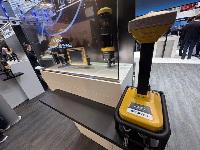
Get highly detailed 3D point road surface data from Topcon’s new RD-M2 scanner

April 11, 2025 Read time: 1 min
The vehicle-mounted downward-facing RD-M2 from Topcon Positioning Systems delivers precise surface conditions over long and complex roads

Topcon Positioning System’s new RD-M2 laser scanner has been purpose-built for road resurfacing applications.

The vehicle-mounted downward-facing RD-M2 delivers precise surface conditions over long and complex roads, which means no road closures are needed.  

Millions of points are collected by the vehicle operator from safety of his or her cab.

The 3D point data from the RD-M2 scanner serves as the basis for detailed road surface designs using the Topcon Office Suite.  

These ground-truth surfaces are a part of the company’s SmoothRide system workflow.

Users can take advantage of Topcon’s intuitive workflow to create their own custom design from the scan or they can integrate a predefined template.  

Users can also align the scan to the local coordinate system with millimetre-level precision, providing complete flexibility for road resurfacing projects.  

For more information on companies in this article

Related Content

  • ESRI's highway data solution
    March 20, 2012
    ESRI is developing a comprehensive highway data maintenance and linear referencing solution scheduled for release in the fourth quarter of 2010. Aimed at highway departments, state departments of transportation, and national roadway administrations, the company says it will provide an integrated set of tools and functionality that allows agencies to easily maintain highway geometry, their associated multiple linear referencing systems, and complex roadway features
  • ESRI's highway data solution
    February 6, 2012
    ESRI is developing a comprehensive highway data maintenance and linear referencing solution scheduled for release in the fourth quarter of 2010. Aimed at highway departments, state departments of transportation, and national roadway administrations, the company says it will provide an integrated set of tools and functionality that allows agencies to easily maintain highway geometry, their associated multiple linear referencing systems, and complex roadway features.
  • Accurate laser scanning with Leica Geosystems
    February 6, 2020
    A new handheld imaging laser scanner from Leica Geosystems is said to offer high efficiency for surveyors.
  • Silver Star marries a Topcon GPS system to a Power Curber 5700-C
    January 19, 2016
    In the US state of Oklahoma, Silver Star Construction has adopted 3D technology for site modelling and stringless machine control The company, based in the town of Moore, recently used a Topcon Millimeter GPS system mounted on one of their Power Curber 5700-Cs to put down nearly 5,500m of curb and gutter in a residential housing addition in south-west Oklahoma City. Once the dirt work and grading was completed, the concrete crew got to work by mounting the Topcon receivers on their 5700-C. The Topcon