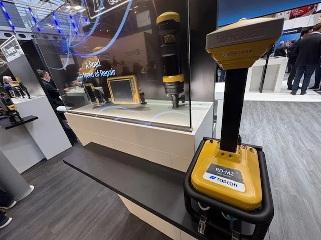
Get highly detailed 3D point road surface data from Topcon’s new RD-M2 scanner

April 11, 2025 Read time: 1 min
The vehicle-mounted downward-facing RD-M2 from Topcon Positioning Systems delivers precise surface conditions over long and complex roads

Topcon Positioning System’s new RD-M2 laser scanner has been purpose-built for road resurfacing applications.

The vehicle-mounted downward-facing RD-M2 delivers precise surface conditions over long and complex roads, which means no road closures are needed.  

Millions of points are collected by the vehicle operator from safety of his or her cab.

The 3D point data from the RD-M2 scanner serves as the basis for detailed road surface designs using the Topcon Office Suite.  

These ground-truth surfaces are a part of the company’s SmoothRide system workflow.

Users can take advantage of Topcon’s intuitive workflow to create their own custom design from the scan or they can integrate a predefined template.  

Users can also align the scan to the local coordinate system with millimetre-level precision, providing complete flexibility for road resurfacing projects.  

For more information on companies in this article

Related Content

  • Don't buy, subscribe instead... and stay ahead of the pack
    September 19, 2024
    The traditional way of doing things is to own the construction equipment you need on site. You can buy, or you can rent. You mix and match your technology needs with what is happening on site and your costs go up and down accordingly. However, a new model is emerging: Subscriptions. Take out a flat-fee plan and let someone else make sure you can get access to the latest thinking and the cleverest technology. Pete Kennedy reports.
  • Free modeling: Improving efficiency in construction- site management
    July 24, 2025
    Liebherr’s innovative Free Modeling technology enables road-construction operators to create and modify simple 3D site models directly from their machinery, enhancing real-time decision-making.
  • Software tools aid construction, reduce costs
    February 28, 2012
    Integrated construction software offers an effective planning solution - *Mark Nichols writes. In a world where resources are limited, 20 year designing and building in a sustainable way is more critical than ever. By employing today's software tools it is possible to reduce the total cost of construction of a new highway, while reducing operating costs and environmental impacts. The path to achieving the greatest gains is to take a holistic approach to the plan, design, construct and operate process from t
  • Laser monitoring of road surfaces
    February 28, 2012
    Klaruw says that its advanced laser scanner system can accurately evaluate the macro-texture of road pavement surfaces. This sophisticated system allows highway agencies to monitor road surface condition more accurately and assess whether the skid resistance meets safety requirements. The innovative Laser Texture Tester (LTT) device uses uses a rotating, high resolution laser to scan circular sections of road pavement.