Get highly detailed 3D point road surface data from Topcon’s new RD-M2 scanner

April 11, 2025 Read time: 1 min
The vehicle-mounted downward-facing RD-M2 from Topcon Positioning Systems delivers precise surface conditions over long and complex roads

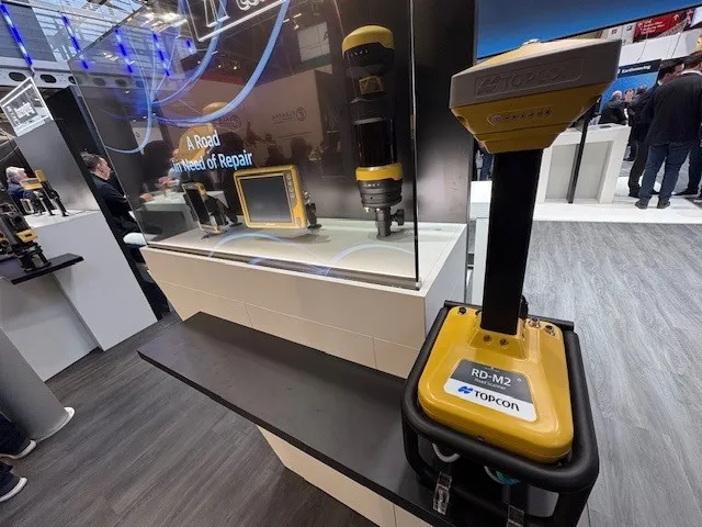
Topcon Positioning System’s new RD-M2 laser scanner has been purpose-built for road resurfacing applications.

The vehicle-mounted downward-facing RD-M2 delivers precise surface conditions over long and complex roads, which means no road closures are needed.  

Millions of points are collected by the vehicle operator from safety of his or her cab.

The 3D point data from the RD-M2 scanner serves as the basis for detailed road surface designs using the Topcon Office Suite.  

These ground-truth surfaces are a part of the company’s SmoothRide system workflow.

Users can take advantage of Topcon’s intuitive workflow to create their own custom design from the scan or they can integrate a predefined template.  

Users can also align the scan to the local coordinate system with millimetre-level precision, providing complete flexibility for road resurfacing projects.  

For more information on companies in this article

Related Content

  • Weigh in motion technology reduces road damage
    February 8, 2012
    Overweight vehicles cause enormous damage to road structures but they can be caught, even at high speed. Weigh-in-motion or WIM devices are designed to capture and record axle weights and gross vehicle weights as vehicles drive over a measurement site.
  • Innovative new drainage solutions will help keep roads free from water
    October 2, 2014
    An array of new technologies will help optimise road drainage and minimise flooding risks - Mike Woof reports In the UK the specialist contractor Lanes Group has carried out extensive inspection work of the drainage systems for the M6 toll route around the city of Birmingham. A powerful zoom camera has been used to carry out the inspection work for Midland Expressway, which operates and maintains the 43km-long motorway, running from Coleshill to Cannock.
  • IRF data warehouse launched in Stockholm in joint move
    March 24, 2020
    IRF (Geneva) launched in Stockholm on 20th February an IRF Data Warehouse in the framework of a side event organised jointly with the Global Alliance of NGOs for Road Safety and the Total Foundation at the 3rd Global Ministerial Conference on Road Safety.
  • Barrier innovations making roads safer
    February 21, 2013
    Developments in barrier technology continue to make roads safer for drivers - Mike Woof writes. Innovative new barrier technology is helping make roads safer for drivers. Key developments have been made in barrier design, helping ensure road and highway infrastructure is more passively safe. New barrier designs ensure that errant vehicles are redirected into the roadway, with reduced risks for occupants and also other road users. Continuously slipformed concrete barriers reinforced with steel are now widely