Get highly detailed 3D point road surface data from Topcon’s new RD-M2 scanner

April 11, 2025 Read time: 1 min
The vehicle-mounted downward-facing RD-M2 from Topcon Positioning Systems delivers precise surface conditions over long and complex roads

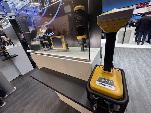
Topcon Positioning System’s new RD-M2 laser scanner has been purpose-built for road resurfacing applications.

The vehicle-mounted downward-facing RD-M2 delivers precise surface conditions over long and complex roads, which means no road closures are needed.  

Millions of points are collected by the vehicle operator from safety of his or her cab.

The 3D point data from the RD-M2 scanner serves as the basis for detailed road surface designs using the Topcon Office Suite.  

These ground-truth surfaces are a part of the company’s SmoothRide system workflow.

Users can take advantage of Topcon’s intuitive workflow to create their own custom design from the scan or they can integrate a predefined template.  

Users can also align the scan to the local coordinate system with millimetre-level precision, providing complete flexibility for road resurfacing projects.  

For more information on companies in this article

Related Content

  • HxGN Live 2014 attracts record event numbers
    August 28, 2014
    Attracting an HxGN Live event record-breaking 3,500 attendees, HxGN Live 2014 held at the MGM Grand in Las Vegas, US, June 2-5 showcased exciting new and in-demand design, measurement and visualisation technologies for industries including road construction and mining. Themed Great Stories Start Here, this year’s event also included a variety of exclusive presentations by industry experts, hands-on training, inspiring keynotes and international networking opportunities. Guy Woodford reports In
  • New project software developed by Bentley
    February 8, 2018
    Bentley Systems claims that its OpenRoads ConceptStation modelling package allows highway engineering professionals to quickly build conceptual road and bridge models. The software allows rapid conceptual and preliminary design, using information obtained through point clouds, reality meshes, GIS, and other sources. OpenRoads ConceptStation combines engineering drawing tools and project costs to improve decision-making in the design phase. Benefits include increasing design productivity, identifying
  • Surface quality a key trend in asphalt paving
    March 7, 2012
    Improved surface quality and improved machine design are key trends in the asphalt paving sector, Mike Woof reports There is a big difference in asphalt paving techniques in North America and Europe. In North America, the need to construct long stretches of highway quickly resulted in wide pavers offering high throughput capacity, with compaction equipment then being used to achieve the required density of the various courses. In Europe's highway construction projects, distances tend to be shorter and contr
  • Scanning accurately
    July 19, 2012
    Riegl says that its innovative laser scanners allow accurate 3D mapping from the air or on-road. The system uses high-speed laser pulses to capture millimetre accurate measurements at ranges of up to 500m. The scanners offer online full-waveform analysis, digital processing and high data capture rates, according to the firm. With scanning rates up to 100 scans/second and pulse repetition rates up to 200 Hz the range is said to offer multiple, unlimited target capability. A range of additional options includ