
Geotechnical tool from Trimble and GroundProbe

By MJ Woof May 13, 2025 Read time: 1 min
Trimble’s new tool developed with GroundProbe suits duties in geotechnical applications

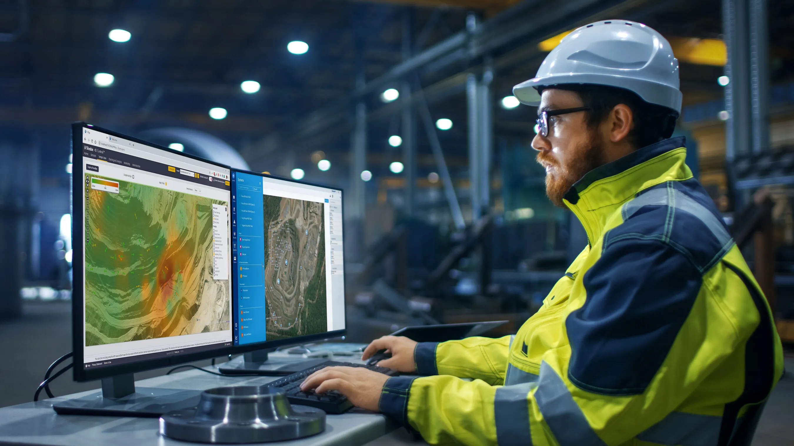
Trimble and GroundProbe are introducing a new tool that will enable geotechnical customers to purchase a comprehensive slope stability monitoring portfolio from a single point of contact. GroundProbe customers can also purchase Trimble monitoring solutions to complement GroundProbe's range of sensors and software.

The system can assess slope stability, with integration between Trimble and GroundProbe sensors and software for smooth data flow. Incorporating the necessary mine monitoring sensors into one environment helps professionals visualise a picture of site conditions to improve decision making on slope stability risks and site safety.

Efficiency, reliability and safety can be improved in extreme site conditions due to effective slope stability monitoring.

For more information on companies in this article

Related Content

  • ARRB Systems' network-level continuous friction testing
    November 20, 2024
    Pavement safety assessments have traditionally focused on discrete low-density friction assessments using proven technology. But more detailed investigations and analysis are now feasible through improved technologies, explains Simon Tetley of ARRB Systems*.
  • Trimble launches Site Positioning System Essentials Kit
    February 20, 2014
    Trimble has introduced a Site Positioning System designed for owner operators, small site contractors or construction companies new to GPS. The Trimble Site Positioning System Essentials Kit gives contractors proven Trimble quality and accuracy in an affordable and easy-to-use solution. The Essentials Kit is comprised of the new Trimble Site Mobile controller, Trimble SCS900 Site Controller Software and Trimble SPS985L GNSS Smart Antenna for a complete GPS positioning solution. Using GPS, a grade checker
  • Efficient construction using advanced technology
    August 19, 2020
    Advances in asphalt paving control systems are helping contractors deliver higher efficiency
  • More satellites, more signals
    July 20, 2012
    Greater GPS accuracy suggests closer tolerances for surveying and machine control functions What happens in the future for GPS surveying and machine control could depend on satellite choice and signals. Right now there are around 30 satellites in orbit, largely built by the US, but by 2012 that could rise to 120 as Europe, China, India and Russia fully enter the market. A chequered history has faced the European's Galileo system. At long last, the finance appears to be in place and the European Commission a