Faster surveying with Leica Geosystems

Leica Geosystems says that the new LS15 tool can be used to complete all the key stages for levelling. The system has a high accuracy of 0.2mm, which can be achieved by aiming at the target via the colour touch display and pressing the measuring button. Key working features include an electronic bubble and tilt checks prior to each measurement and autofocus. These are said to help to reduce fatigue over a shift and help minimise the risk of working errors, ensuring consistently high accuracy of measureme
June 16, 2016 Read time: 2 mins
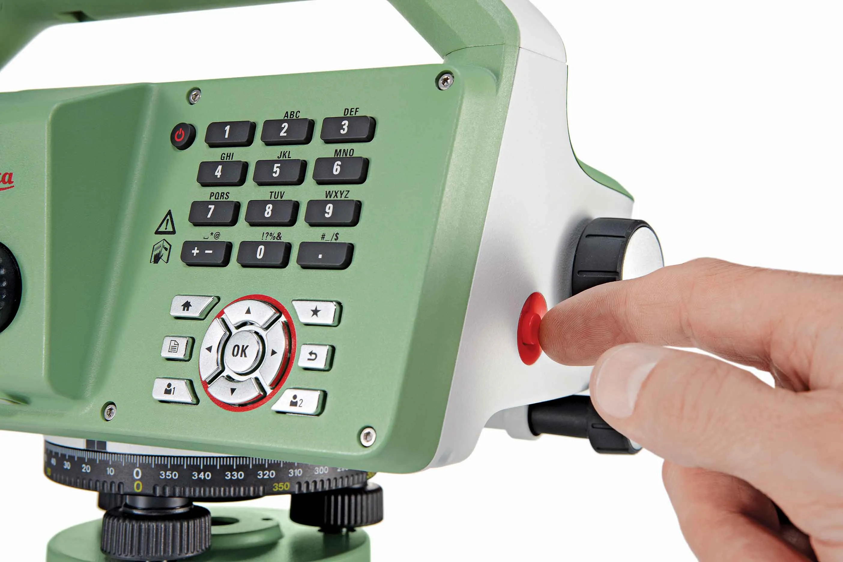
The new tool from Leica Geosystems helps boost surveying efficiency
265 Leica Geosystems says that the new LS15 tool can be used to complete all the key stages for levelling. The system has a high accuracy of 0.2mm, which can be achieved by aiming at the target via the colour touch display and pressing the measuring button.

Key working features include an electronic bubble and tilt checks prior to each measurement and autofocus. These are said to help to reduce fatigue over a shift and help minimise the risk of working errors, ensuring consistently high accuracy of measurement.

The firm says that the LS15 is the only level on the market equipped with a camera and this allows target staffs to be sighted faster. Users locate the staff on the camera touch display and then press the measuring button to record the staff reading and measurement values.

The unit’s USB and Bluetooth interface allow enable fast data transfer, while the Leica Infinity software package can process complex levelling data in the office. Users can combine tables with graphics or cross check key project information in one program window, providing access to all data, results and deliverables.

For more information on companies in this article

Related Content

  • Soil compaction innovations abound
    October 26, 2012
    Manufacturers continue to innovate with sophisticated new soil compaction machines - Mike Woof reports This year has seen the introduction of a series of new soil compaction machines, as manufacturers develop their product ranges. Meeting emission legislation requirements in Europe and North America has helped drive firms to install the latest engine designs. Meanwhile machines have also evolved as companies further refine operating features. The global market for compaction machines has been dominated by
  • Smart constructioon with GIS, GPS design technology
    May 2, 2012
    A UK highway project has benefited from the latest software, GIS and GPS technology, Mike Woof reports. Sophisticated software, GIS and GPS technology has played an important role in a large highway upgrade project in the UK and helping to increase efficiency and drive down construction costs.
  • RoadVista launches StripeMaster 3
    March 1, 2023
    StripeMaster 3 quantifies roadway and airfield pavement marking characteristics including retroreflectivity, daytime visibility and night-time retroreflected colour.
  • Smarter compaction equipment from key manufacturers
    June 23, 2015
    Intelligent compaction technologies continue to advance in sophistication - Mike Woof writes Ever more sophisticated intelligent compaction technologies are being offered to customers, which can boost working efficiency and help improve construction quality. This is particularly the case for the compaction of asphalt running surfaces. Asphalt cooling leaves only a short time window during which a paved mat can be properly compacted, so intelligent compaction systems offer major gains for contractors and cli