Faster surveying with Leica Geosystems

Leica Geosystems says that the new LS15 tool can be used to complete all the key stages for levelling. The system has a high accuracy of 0.2mm, which can be achieved by aiming at the target via the colour touch display and pressing the measuring button. Key working features include an electronic bubble and tilt checks prior to each measurement and autofocus. These are said to help to reduce fatigue over a shift and help minimise the risk of working errors, ensuring consistently high accuracy of measureme
June 16, 2016 Read time: 2 mins
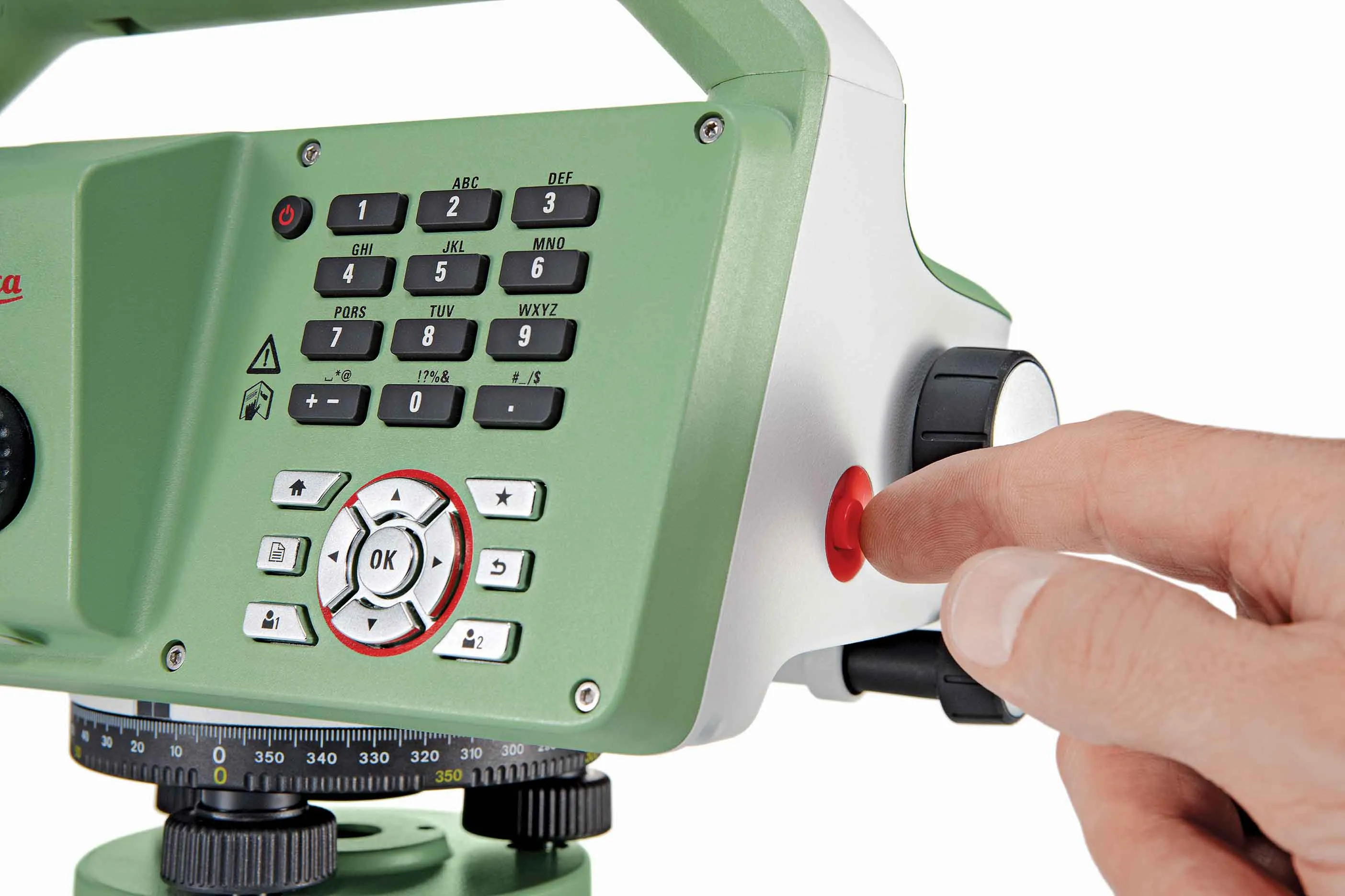
The new tool from Leica Geosystems helps boost surveying efficiency
265 Leica Geosystems says that the new LS15 tool can be used to complete all the key stages for levelling. The system has a high accuracy of 0.2mm, which can be achieved by aiming at the target via the colour touch display and pressing the measuring button.

Key working features include an electronic bubble and tilt checks prior to each measurement and autofocus. These are said to help to reduce fatigue over a shift and help minimise the risk of working errors, ensuring consistently high accuracy of measurement.

The firm says that the LS15 is the only level on the market equipped with a camera and this allows target staffs to be sighted faster. Users locate the staff on the camera touch display and then press the measuring button to record the staff reading and measurement values.

The unit’s USB and Bluetooth interface allow enable fast data transfer, while the Leica Infinity software package can process complex levelling data in the office. Users can combine tables with graphics or cross check key project information in one program window, providing access to all data, results and deliverables.

For more information on companies in this article

Related Content

  • Efficient asset management delivers
    April 25, 2013
    Maximising the economic benefit of infrastructure assets can be achieved through delivering better quality maintenance. Increasing utilisation of infrastructure follows on from those assets being in better condition. Clearly by tracking infrastructure condition closely, huge gains can be made in addressing technical issues before they become more serious and more costly, as well as minimising disruption. In UK city Birmingham, high resolution aerial photography from Bluesky is helping the city council under
  • Software innovations aid road design
    February 24, 2012
    As an aid to design, construction software continues to be a foundation stone in new project development. Autodesk is working with the Incheon Free Economic Zone (IFEZ) and the Incheon Urban Development Corporation (IUDC) to cooperate in the creation of Asia's first Digital City for Incheon.
  • New software makes road marking applications easier
    February 17, 2012
    Equipment, materials and testing combine to offer motorists better road markings as Patrick Smith reports Drivers realise that clear road markings, particularly in darkness and during the wet, are life-savers, offering guidance and direction. Manufacturers of marking materials, in-road studs, and testing and laying equipment have spent years perfecting solutions to make such markings easier to place; easier to see through the use of a variety of materials, and longer lasting. Sophisticated testing equip
  • Sophisticated new loaders
    March 10, 2021
    Sophisticated new wheeled loaders are now coming to market from key suppliers