Faster surveying with Leica Geosystems

Leica Geosystems says that the new LS15 tool can be used to complete all the key stages for levelling. The system has a high accuracy of 0.2mm, which can be achieved by aiming at the target via the colour touch display and pressing the measuring button. Key working features include an electronic bubble and tilt checks prior to each measurement and autofocus. These are said to help to reduce fatigue over a shift and help minimise the risk of working errors, ensuring consistently high accuracy of measureme
June 16, 2016 Read time: 2 mins
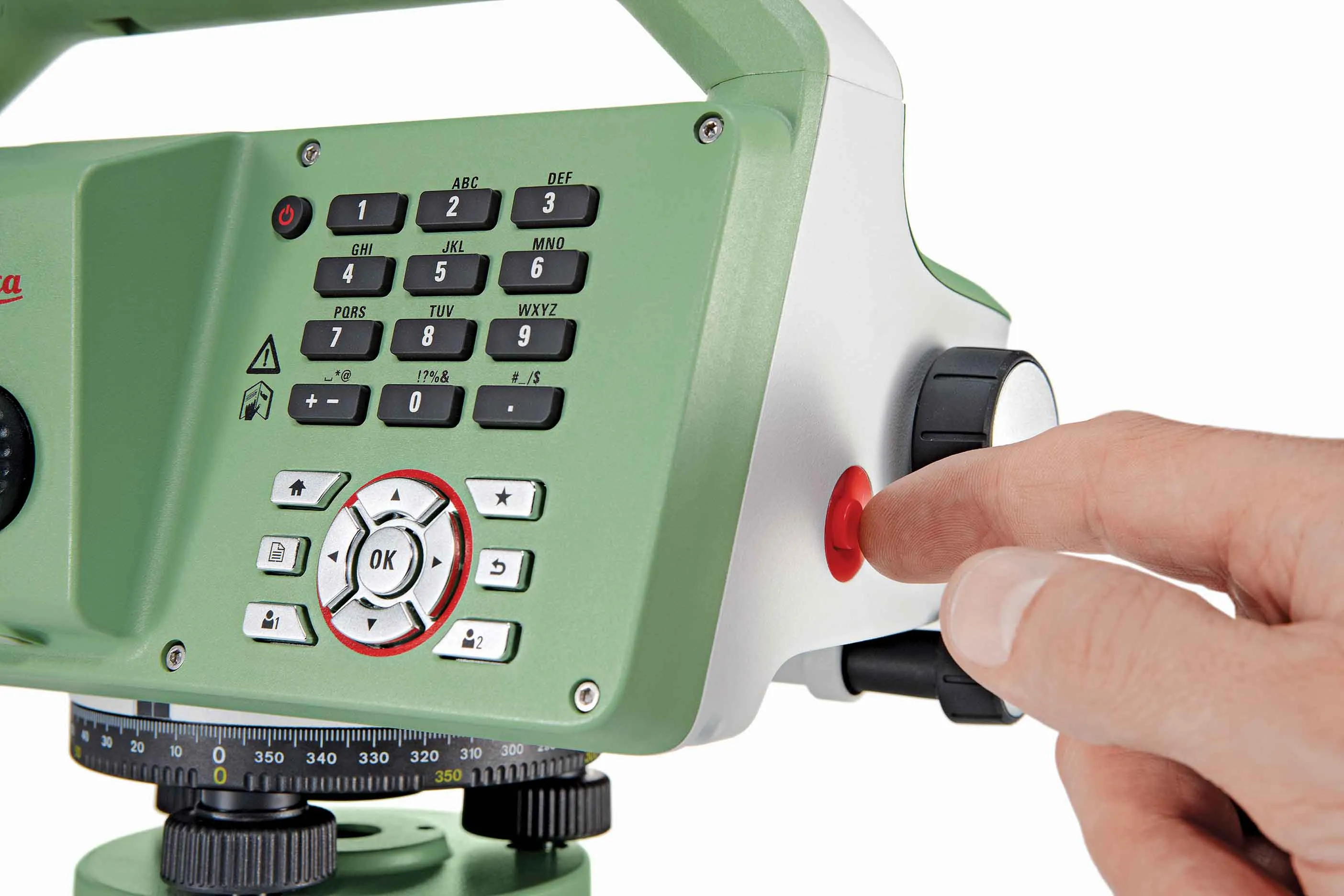
The new tool from Leica Geosystems helps boost surveying efficiency
265 Leica Geosystems says that the new LS15 tool can be used to complete all the key stages for levelling. The system has a high accuracy of 0.2mm, which can be achieved by aiming at the target via the colour touch display and pressing the measuring button.

Key working features include an electronic bubble and tilt checks prior to each measurement and autofocus. These are said to help to reduce fatigue over a shift and help minimise the risk of working errors, ensuring consistently high accuracy of measurement.

The firm says that the LS15 is the only level on the market equipped with a camera and this allows target staffs to be sighted faster. Users locate the staff on the camera touch display and then press the measuring button to record the staff reading and measurement values.

The unit’s USB and Bluetooth interface allow enable fast data transfer, while the Leica Infinity software package can process complex levelling data in the office. Users can combine tables with graphics or cross check key project information in one program window, providing access to all data, results and deliverables.

For more information on companies in this article

Related Content

  • New positioning tools streamline survey operations
    March 14, 2012
    Trimble has launched a range of new tools which it says will deliver faster and more accurate data to surveyors. The Trimble S6 Robotic Total Station with Trimble Vision Technology enables surveyors to remotely see and measure through a live video feed from the instrument on their data controller.
  • Efficient, accurate asphalt compaction technology
    February 14, 2012
    The efficiency of asphalt compaction performance has improved immeasurably in recent years with the development of more effective equipment. Manufacturers have honed the designs of the machines, making them easier and more comfortable to operate, improving visibility and also tackling issues such as maintenance downtime by making the equipment more reliable and quicker to service. However one of the biggest advances in compaction performance has come not from the machines, but from the control and measur
  • Positioning tools continue to improve
    July 16, 2012
    Topcon says that its new IP-S2 package combines GNNS positioning capabilities with inertial sensors, while the firm also has a solution for customers wanting to mix and match receiver components. The IP-S2 is a vehicle-mounted, mobile 3D tool that offers precision mapping and surveying capabilities. The package collects data using 3D laser scanners, LIDAR, and/or cameras, and this is then integrated, time-stamped and geo-referenced. The customer can use this assembled data to combine LIDAR point cloud and d
  • Leica believes that digitisation is the key to improving efficiency and lowering costs
    April 20, 2016
    The digitisation of the construction process will give greater transparency on costs at the site and ultimately lead to improved productivity and efficiency in the industry, said Johan Arnberg, president of Leica Geosystems Machine Control Division, speaking at a Leica roundtable on digitisation of the construction industry held at bauma. The data gathered by the new generation of digitised construction machines and tools will enable contractors and owners for the first time to put key performance indicator