Faster surveying with Leica Geosystems

Leica Geosystems says that the new LS15 tool can be used to complete all the key stages for levelling. The system has a high accuracy of 0.2mm, which can be achieved by aiming at the target via the colour touch display and pressing the measuring button. Key working features include an electronic bubble and tilt checks prior to each measurement and autofocus. These are said to help to reduce fatigue over a shift and help minimise the risk of working errors, ensuring consistently high accuracy of measureme
June 16, 2016 Read time: 2 mins
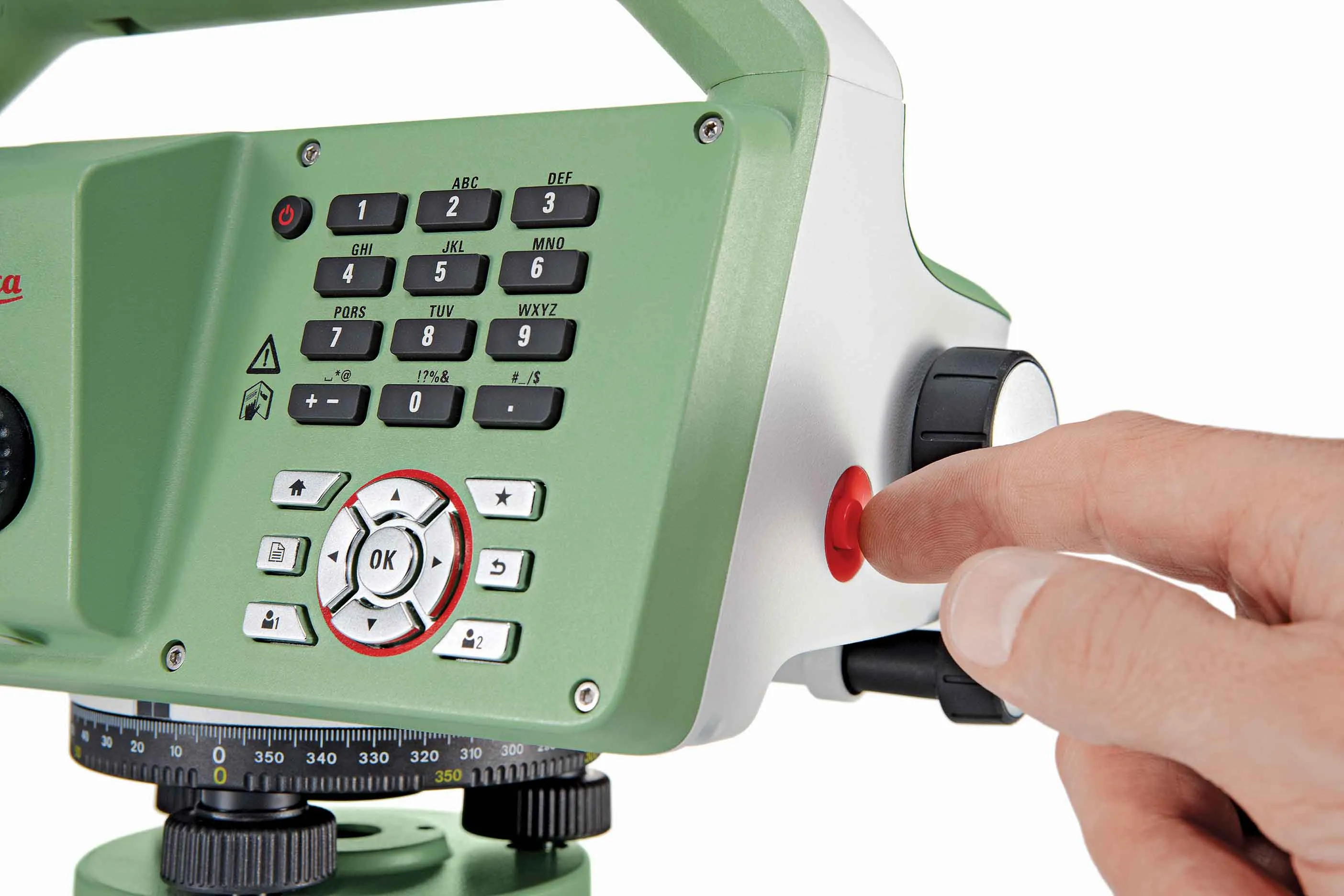
The new tool from Leica Geosystems helps boost surveying efficiency
265 Leica Geosystems says that the new LS15 tool can be used to complete all the key stages for levelling. The system has a high accuracy of 0.2mm, which can be achieved by aiming at the target via the colour touch display and pressing the measuring button.

Key working features include an electronic bubble and tilt checks prior to each measurement and autofocus. These are said to help to reduce fatigue over a shift and help minimise the risk of working errors, ensuring consistently high accuracy of measurement.

The firm says that the LS15 is the only level on the market equipped with a camera and this allows target staffs to be sighted faster. Users locate the staff on the camera touch display and then press the measuring button to record the staff reading and measurement values.

The unit’s USB and Bluetooth interface allow enable fast data transfer, while the Leica Infinity software package can process complex levelling data in the office. Users can combine tables with graphics or cross check key project information in one program window, providing access to all data, results and deliverables.

For more information on companies in this article

Related Content

  • Sophisticated plotting
    February 7, 2012
    Leica Geosystems is offering its improved SpiderWeb v4.0 package as part of the new reference station software update. This improved suite of solutions also includes the GNSS Spider v4.0 and SpiderQC v4.0 packages.
  • Topcon to smoothen roads with SmoothRide system
    February 28, 2018
    Topcon Positioning has developed a sophisticated package that can help deliver better road surface quality. The firm’s latest SmoothRide data collection package is said to make the mapping of road conditions easier and more efficient. The new RD-M1 Collect 2.0 package has an improved interface and a new graphical interface status bar that indicates the optimum speed for collecting road information based on the project requirements.
  • Asset management and BIM solutions offer cost efficiency
    May 22, 2018
    New technology will help deliver projects more efficiently – Mike Woof writes. An array of new software and hardware tools are coming to market that can boost working efficiency for construction projects. Technology company thinkWhere is helping to improve collaboration and communication on Scotland’s largest road infrastructure project. Providing online access to multiple layers of live project maps and geographical data, the firm’s groundMapper software offers a web-based viewer that is allowing the co
  • Concrete testing - defining standards
    February 13, 2012
    Concrete is a versatile construction product, but it must be tested to make sure that it is fit for purpose