Faster surveying with Leica Geosystems

Leica Geosystems says that the new LS15 tool can be used to complete all the key stages for levelling. The system has a high accuracy of 0.2mm, which can be achieved by aiming at the target via the colour touch display and pressing the measuring button. Key working features include an electronic bubble and tilt checks prior to each measurement and autofocus. These are said to help to reduce fatigue over a shift and help minimise the risk of working errors, ensuring consistently high accuracy of measureme
June 16, 2016 Read time: 2 mins
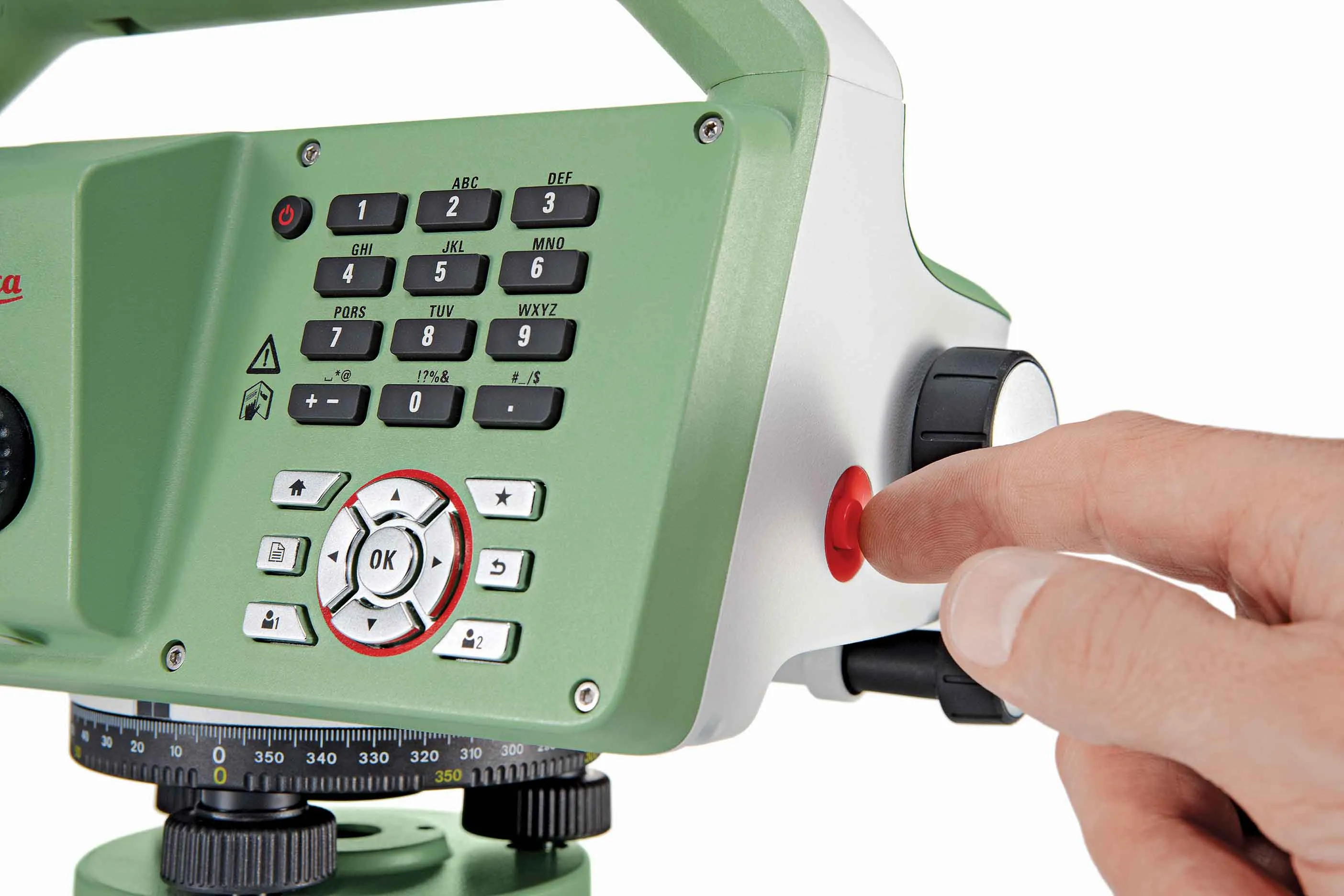
The new tool from Leica Geosystems helps boost surveying efficiency
265 Leica Geosystems says that the new LS15 tool can be used to complete all the key stages for levelling. The system has a high accuracy of 0.2mm, which can be achieved by aiming at the target via the colour touch display and pressing the measuring button.

Key working features include an electronic bubble and tilt checks prior to each measurement and autofocus. These are said to help to reduce fatigue over a shift and help minimise the risk of working errors, ensuring consistently high accuracy of measurement.

The firm says that the LS15 is the only level on the market equipped with a camera and this allows target staffs to be sighted faster. Users locate the staff on the camera touch display and then press the measuring button to record the staff reading and measurement values.

The unit’s USB and Bluetooth interface allow enable fast data transfer, while the Leica Infinity software package can process complex levelling data in the office. Users can combine tables with graphics or cross check key project information in one program window, providing access to all data, results and deliverables.

For more information on companies in this article

Related Content

  • Laser scanning focuses on asset management
    January 9, 2015
    Laser scanners and improved data collection and analysis software are making light of asset management surveying. David Arminas reports The age of the laser scanner is upon us, taking over from traditional manual methods of surveying, data collection and processing. These new technical developments are making it much easier to process and use the data captured and are providing highways engineers with powerful tools to record, map and visualise their assets. This is good news for highways authorities
  • New Leica Geosystems grade control works in more applications
    January 6, 2017
    Leica Geosystems has introduced a dual-control system for graders that works in more applications, including crab walking and slope work.The Leica iCON grade iGG4 means designs and applications previously thought to be beyond control technology now can be handled
  • New Leica Geosystems grade control works in more applications
    April 23, 2015
    Leica Geosystems has introduced a dual-control system for graders that works in more applications, including crab walking and slope work.The Leica iCON grade iGG4 means designs and applications previously thought to be beyond control technology now can be handled
  • Advances in tunneling machines coming to market
    November 19, 2015
    A diverse array of new tunnelling technologies will help boost productivity and cut project costs, while boosting quality - Mike Woof writes The worldwide market for tunnelling projects continues to be strong, with a series of major projects underway or planned for the future. These good market conditions have helped fuel research and development in new tunnelling equipment, designed to be more productive, more efficient and more reliable and able to deliver a higher quality of work. Drilling and blas