Fast modelling

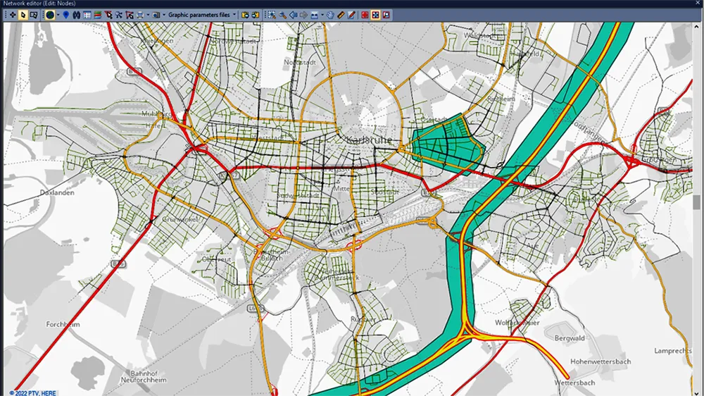
The latest version of the PTV Visum transportation planning software offers easier and faster dynamic modelling according to the firm.
May 17, 2023 Read time: 2 mins


The new version means that users can blend mesoscopic and macroscopic assignments in the same model run, which allows them to evaluate more projects in less time. This is said to leverage the dynamic perspective and high level of detail provided by simulation-based assignments (SBA) for critical parts of the model. Furthermore, the mesoscopic SBA now allows lane level modelling, which unlocks new use cases that were previously only possible in microscopic simulation.

Meanwhile, PTV Visum 2023 brings tight integration with Activity-Sim, the popular open-source package for Activity Based demand Modeling (ABM) and provides a renewed network-wide signal optimisation algorithm. For easier modelling of bicycle traffic, users can now import bicycle networks from OpenStreetMap (OSM). Besides many other improvements, Public Transit analysis gets a boost by extended and drastically accelerated import of e-Ticketing data.

In addition, the visualisation tool PTV Visum Publisher was upgraded for the new release. It provides personalised cloud-based dashboards with illustrative visualisations, by which transportation modellers can share their project stories with anyone. The 2023 edition of the traffic engineering software PTV Vistro improves trip generation by adding ITE TripGen data to the model via ITE’s web-app. Moreover, the improved Universal Traffic Data Format (UTDF) import allows users to quickly integrate layout, lanes, phasing, timing plans and volumes. Thus, users can import data from various traffic models and signal controller systems for future analysis in Vistro, Vissim, or Visum.

The new features of PTV Optima empower traffic operators to better deal with demand changes. Also simulating the impact of traffic deviations and rerouting information in case of temporary road closure has been simplified.

For more information on companies in this article

Related Content

  • Bentley Systems launches OpenRoads Designer CONNECT Edition
    April 13, 2017
    The beginning of this year saw Bentley Systems launch a major advanced comprehensive global tool for today’s increasingly widespread BIM environment. Christmas 2016 came early for Bentley's global clients. In fact, they had a hint of what was going to be under their tree come the celebrations in December. On November 1, at Bentley’s annual global client gathering and awards event Year in Infrastructure Conference in London, the solutions provider announced that OpenRoads Designer CONNECT Edition would be a
  • Kapsch upgrades Dallas-Fort Worth 511 traveller information system
    January 7, 2019
    Kapsch reports that it has upgraded the traveller information system and mobile app for the North Central Texas Council of Governments in Dallas-Fort Worth The new platform is powered by the Kapsch EcoTrafiX software for which Kapsch served as the lead systems integrator. Kapsch will maintain the new system for NCTCOG for two years and enhance it based on new data and customer feedback. The fully integrated system allows agencies to share information, optimise operations and balance traffic flow while pr
  • Innovative GIS software offerings
    July 18, 2012
    The latest construction software developments can speed the construction process overall, Adrian Greeman reports Construction software is by its very nature a very fast moving technology, with new systems coming to the market almost continuously. There are some key developments however, such as major new product launches and market trends. One of the most important developments in the road design sector is the launch of the Bentley Systems V8i versions of its software, including its road design applications
  • Data handling for efficient machine control
    October 16, 2012
    The rapid increase in information availability is transforming the construction sector. Conventional methods used for sourcing geographic data based on maps and localised sampling meant that there was often a lack of accurate information relating to ground conditions at specific areas where work was planned, often resulting in unwelcome surprises for construction companies along with additional costs for projects.