Fast modelling

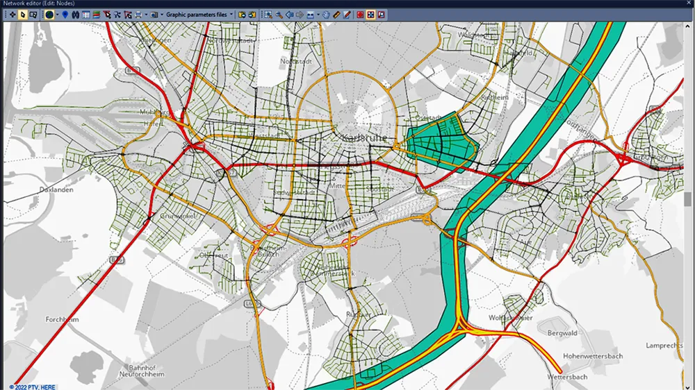
The latest version of the PTV Visum transportation planning software offers easier and faster dynamic modelling according to the firm.
May 17, 2023 Read time: 2 mins


The new version means that users can blend mesoscopic and macroscopic assignments in the same model run, which allows them to evaluate more projects in less time. This is said to leverage the dynamic perspective and high level of detail provided by simulation-based assignments (SBA) for critical parts of the model. Furthermore, the mesoscopic SBA now allows lane level modelling, which unlocks new use cases that were previously only possible in microscopic simulation.

Meanwhile, PTV Visum 2023 brings tight integration with Activity-Sim, the popular open-source package for Activity Based demand Modeling (ABM) and provides a renewed network-wide signal optimisation algorithm. For easier modelling of bicycle traffic, users can now import bicycle networks from OpenStreetMap (OSM). Besides many other improvements, Public Transit analysis gets a boost by extended and drastically accelerated import of e-Ticketing data.

In addition, the visualisation tool PTV Visum Publisher was upgraded for the new release. It provides personalised cloud-based dashboards with illustrative visualisations, by which transportation modellers can share their project stories with anyone. The 2023 edition of the traffic engineering software PTV Vistro improves trip generation by adding ITE TripGen data to the model via ITE’s web-app. Moreover, the improved Universal Traffic Data Format (UTDF) import allows users to quickly integrate layout, lanes, phasing, timing plans and volumes. Thus, users can import data from various traffic models and signal controller systems for future analysis in Vistro, Vissim, or Visum.

The new features of PTV Optima empower traffic operators to better deal with demand changes. Also simulating the impact of traffic deviations and rerouting information in case of temporary road closure has been simplified.

For more information on companies in this article

Related Content

  • Bentley advances construction software technology
    December 19, 2016
    Design and construction software specialist Bentley Systems is strengthening its position in the market with the introduction of new software advances as well as a series of strategic business moves. This allows the company to offer new solutions and technologies to its client base, as well as reaching out to new business segments The firm is introducing an array of powerful tools to the market. A key launch is for the OpenRoads Designer CONNECT Edition, which is the successor to Bentley’s well-proven an
  • Leica Geosystems introduces smart monitoring of structures
    October 1, 2014
    Highly sophisticated, the Leica GeoMoS Now! From Leica Geosystems is a new web-based application enables on-the-go visualisation and analysis of structural and ground movement monitoring data. With this package, large quantities of geodetic and geotechnical data are said to be easier to handle with simplified workflows using automatic configuration and distribution tools. The package can quickly notify users of any changes in data for faster, more informed responses. Leica GeoMoS Now! allows users t
  • Software advances from around the globe
    April 24, 2013
    A quick look at various software development in highways – Adrian Greeman. Software for BIM processes, internet cloud based computing to link site and office, and the use of laser scan point-cloud data continue to be the central themes for major software suppliers in the road design area. Developments go hand in hand with the recent strategic agreements that firms like Autodesk and Bentley Systems have made with major survey companies, Topcon and Trimble respectively. The tie-ups, along with acquisitions, m
  • New project software developed by Bentley
    February 8, 2018
    Bentley Systems claims that its OpenRoads ConceptStation modelling package allows highway engineering professionals to quickly build conceptual road and bridge models. The software allows rapid conceptual and preliminary design, using information obtained through point clouds, reality meshes, GIS, and other sources. OpenRoads ConceptStation combines engineering drawing tools and project costs to improve decision-making in the design phase. Benefits include increasing design productivity, identifying