
EarthCam and Procore provide live site streaming

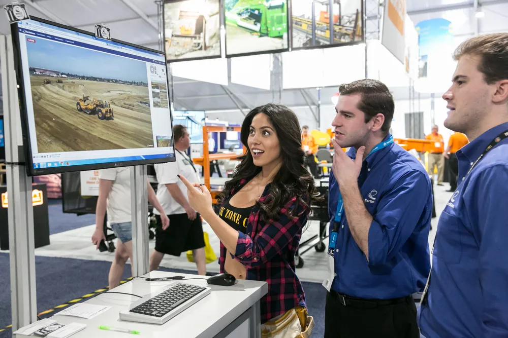
Webcam content provider EarthCam has entered into a strategic relationship with cloud-based construction management software company Procore to deliver high quality live streaming video and imagery directly from construction projects around the world. The deal was announced at the CONEXPO-CON/AGG show, where EarthCam live-streamed images from the exhibition.
March 13, 2017 Read time: 1 min
EarthCam provides live streaming from the project, straight to Procore’s project management software

Webcam content provider 7653 EarthCam has entered into a strategic relationship with cloud-based construction management software company Procore to deliver high quality live streaming video and imagery directly from construction projects around the world. The deal was announced at the CONEXPO-CON/AGG show, where EarthCam live-streamed images from the exhibition.

Under the agreement, EarthCam’s images and video streams can be relayed and integrated directly into Procore project management software, allowing project managers to document in real-time progress on site. The video stream can also be used by clients to promote the project to customers and supporters.

For more information on companies in this article

Related Content

  • Free modeling: Improving efficiency in construction- site management
    July 24, 2025
    Liebherr’s innovative Free Modeling technology enables road-construction operators to create and modify simple 3D site models directly from their machinery, enhancing real-time decision-making.
  • Picture perfect from Leica
    July 18, 2012
    Advanced imaging capability has been added to the Leica ScanStation C10 laser scanner. The new option consists of a direct digital camera mount on the ScanStation C10 scanner and tight, automated integration of external camera images into the scanner’s on-board controller and data storage system. Cyclone v7.4 supports the new option.
  • Positioning tools continue to improve
    July 16, 2012
    Topcon says that its new IP-S2 package combines GNNS positioning capabilities with inertial sensors, while the firm also has a solution for customers wanting to mix and match receiver components. The IP-S2 is a vehicle-mounted, mobile 3D tool that offers precision mapping and surveying capabilities. The package collects data using 3D laser scanners, LIDAR, and/or cameras, and this is then integrated, time-stamped and geo-referenced. The customer can use this assembled data to combine LIDAR point cloud and d
  • InEight puts project software suite in the cloud
    March 13, 2017
    InEight announced that its Project Suite software will now operate in a cloud environment at CONEXPO-CON/AGG. InEight Project Suite will accept models from any design package and includes modules for estimation, contract management, planning, budget control and inspection. It enables all elements of a project – and the people involved – to be connected in an integrated environment.