
Augmented reality helps explain the benefits of Carmix mixers

Carmix is looking to harness the power of augmented reality (AR) to helps sales people explain the benefits of its off-road self-loading concrete mixer. Having downloaded a free app onto a smart phone or tablet, users can then scan a digital tag to discover details about different aspects of the machine.
April 24, 2015 Read time: 1 min
Carmix’s new sales tools gets the message across with the help of augmented reaility

8074 Carmix is looking to harness the power of augmented reality (AR) to helps sales people explain the benefits of its off-road self-loading concrete mixer. Having downloaded a free app onto a smart phone or tablet, users can then scan a digital tag to discover details about different aspects of the machine.

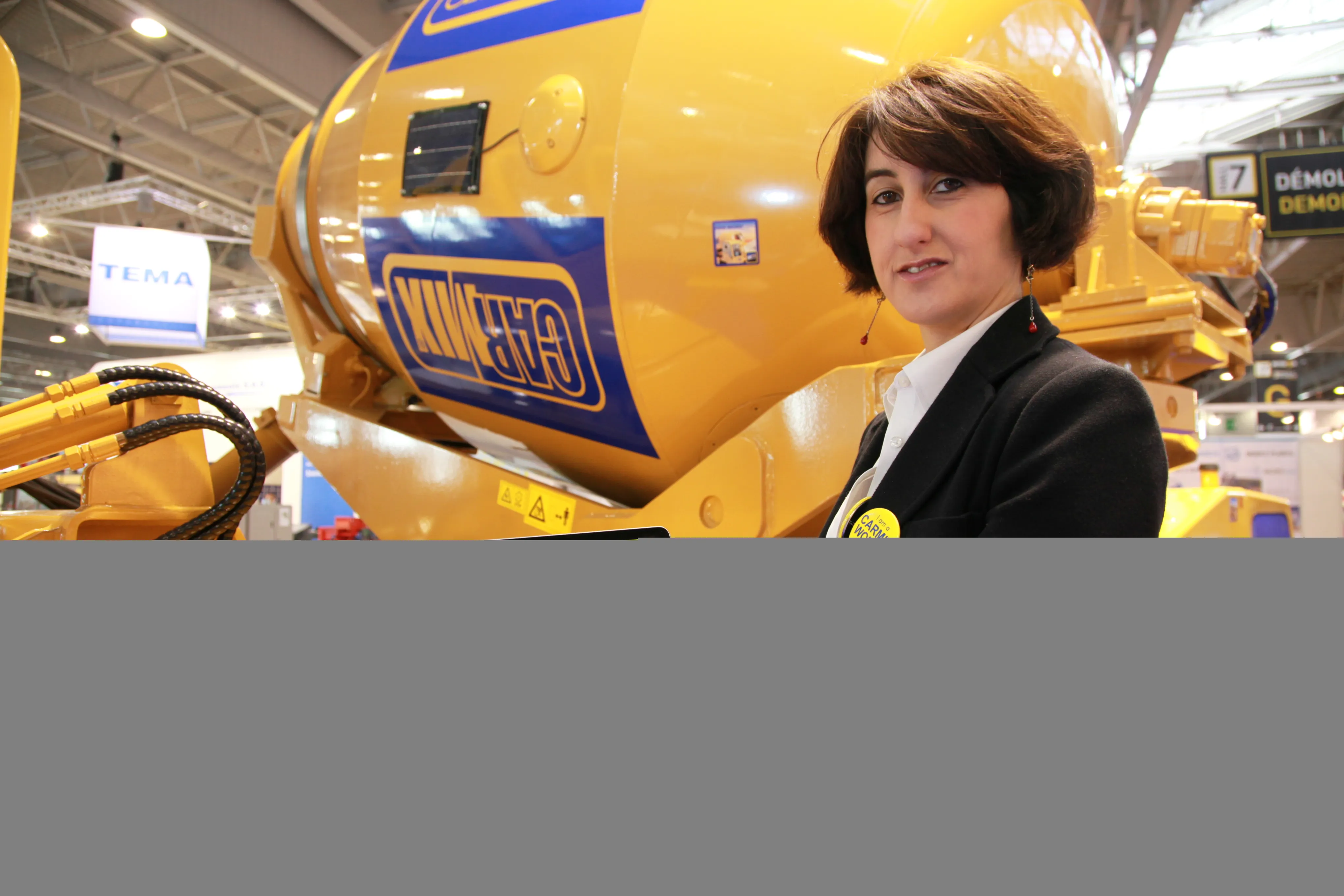
With digital tags located on the drum, main body, loader shovel and cab of a mixer on the Carmix stand, visitors could learn more about the machine by scanning the tag and watching videos and 3D animations. So for example an animated 3D cutaway explains how the mixer fits together while another explains the loading system.

“It’s a sales tool for sales managers around the world,” said marketing director Manuela Galante. “They can use it to explain all the extras and pluses you get with our machine.”

Carmix, which sells around 500 units a year to 152 countries around the world, plans to add more information to its app. Manuals, for example, could be explained using this method.

For more information on companies in this article

Related Content

  • Positioning tools continue to improve
    July 16, 2012
    Topcon says that its new IP-S2 package combines GNNS positioning capabilities with inertial sensors, while the firm also has a solution for customers wanting to mix and match receiver components. The IP-S2 is a vehicle-mounted, mobile 3D tool that offers precision mapping and surveying capabilities. The package collects data using 3D laser scanners, LIDAR, and/or cameras, and this is then integrated, time-stamped and geo-referenced. The customer can use this assembled data to combine LIDAR point cloud and d
  • Next-generation materials testing with new technology
    August 17, 2022
    The US’s Balanced Mix Design sets the stage for next-generation performance testing, according to CONTROLS’ Andrea Carlessi
  • Precision narrows the gap between design software and GIS
    March 20, 2012
    Greater precision is helping blur the boundaries between GIS technology and design software While GIS map based technology has extended its range across an ever more universal spectrum of uses in the highways sector, it is increasingly showing weaknesses for engineering purposes. It is very often not accurate enough. This has not mattered previously because the GIS tool has been seen essentially as an automated version of paper based systems from the design department's point of view. Where engineers
  • Brisbane’s Airport: Innovative Management of One of the World’s Busiest Runways
    June 26, 2014
    When it comes to runways, there are few busier then Brisbane’s main runway. Servicing both domestic and international travel, with over 200,000 movements per year, operating without a curfew Brisbane’s main runway is the busiest in Australia. For maintenance, crews only have a limited period of time to determine the pavement condition, normally during the night, making the detection of pavement faults difficult. To resolve this issue, a new high speed pavement scanner was used to rapidly survey the pavem