Advanced GNSS capabilities with Topcon

April 9, 2025 Read time: 1 min
Topcon’s new GNSS tools offers more capabilities for users

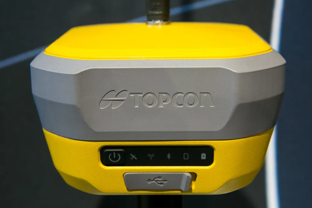
Topcon Positioning says that its new HiPer XR offers more capabilities for GNSS duties. The HiPer receivers suit duties in survey applications, including engineering design, and cadastral projects. These versatile tools can also be used for construction site layout/stakeout, grade checking, and material volume calculations. HiPer receivers can also be paired with robotic total stations for Hybrid Positioning

The tools allow users to measure building edges without using an offset, or stretch to otherwise out-of-reach points using Topcon Integrated Levelling Technology (TILT). This novel technology allows the HiPer XR, HR and VR receivers to compensate for rods that are not exactly vertical. The latest version allows for a told of 60°. New features include the unit being calibration-free and the inclusion of a magnetic interference immune IMU system.

For more information on companies in this article

Related Content

  • New soil compactor launches from key manufacturers
    May 30, 2013
    Major manufacturers continue to develop new soil compactor models - Mike Woof reports. Innovations in machine design are being seen in the soil compaction sector from a number of major firms. As in other equipment sectors, new engine emissions legislation has played a huge role in driving the latest design changes. Europe, the US and Japan are rolling in the new Tier 4 Final/Stage IV legislation on noise and exhaust emissions which will be phased in across power output classes from the start of January 2014
  • Advanced asphalt plants being developed
    April 7, 2017
    The Fayat Group is developing its asphalt plant range with its Marini-Ermont product offerings - Mike Woof writes The Fayat Group is a major player in the global asphalt plant sector with its Marini and Ermont brands and is further developing both product ranges. The latest machines have been designed to cater to a wide array of customer needs, from large, fixed high-production plants to its compact super portable units, as well as from high sophistication down to more basic technology for developing mar
  • Made to Measure laser mapping
    June 15, 2012
    Dutch surveying company Geomaat says it is taking millimetre accurate measurements in record time to aid a range of highway design, construction and maintenance projects. Using the mobile laser mapping system StreetMapper, and specially developed point cloud software, Geomaat says it can calculate highly accurate cutting, milling and asphalt figures, create as built models and undertake change detection.
  • Made to Measure laser mapping
    June 26, 2012
    Dutch surveying company Geomaat says it is taking millimetre accurate measurements in record time to aid a range of highway design, construction and maintenance projects. Using the mobile laser mapping system StreetMapper, and specially developed point cloud software, Geomaat says it can calculate highly accurate cutting, milling and asphalt figures, create as built models and undertake change detection.