Advanced GNSS capabilities with Topcon

April 9, 2025 Read time: 1 min
Topcon’s new GNSS tools offers more capabilities for users

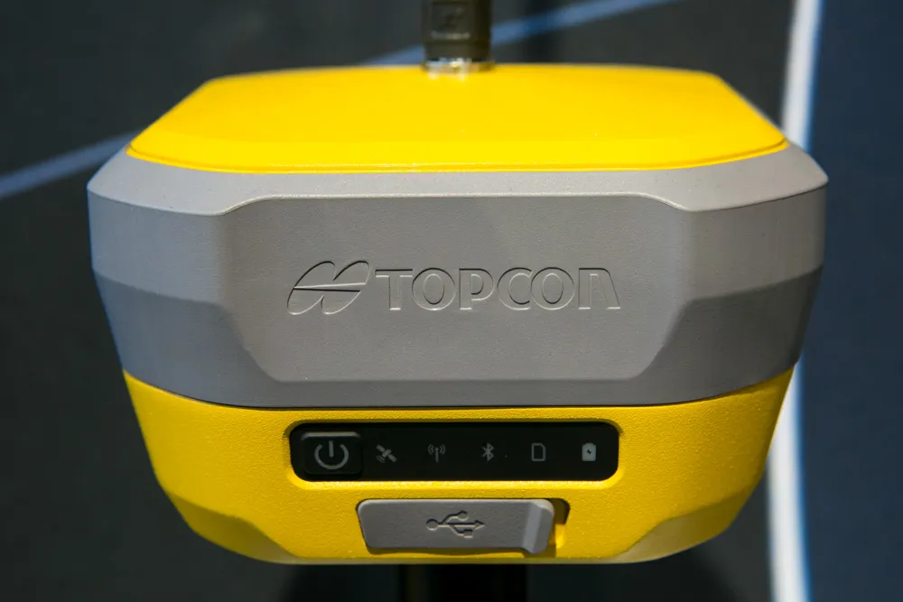
Topcon Positioning says that its new HiPer XR offers more capabilities for GNSS duties. The HiPer receivers suit duties in survey applications, including engineering design, and cadastral projects. These versatile tools can also be used for construction site layout/stakeout, grade checking, and material volume calculations. HiPer receivers can also be paired with robotic total stations for Hybrid Positioning

The tools allow users to measure building edges without using an offset, or stretch to otherwise out-of-reach points using Topcon Integrated Levelling Technology (TILT). This novel technology allows the HiPer XR, HR and VR receivers to compensate for rods that are not exactly vertical. The latest version allows for a told of 60°. New features include the unit being calibration-free and the inclusion of a magnetic interference immune IMU system.

For more information on companies in this article

Related Content

  • Movement monitoring
    February 6, 2012
    New software and hardware from Trimble provide movement monitoring capabilities for major structures New Trimble 4D control software offers users the chance to monitor movement of structures such as bridges and flyovers, using a combination of GNSS and optical technologies.
  • Sophisticated georeferencing technology from Applanix
    November 24, 2020
    Applanix is now offering the Trimble AP+ Air OEM solution for Direct Georeferencing of airborne sensor data.
  • Using machine control in earthmoving boosts efficiency
    December 19, 2017
    The use of new machine control tools has made a significant boost in earthmoving efficiency. Automated grade control using GNSS signals has transformed how earthmoving contractors get work done. Through the engineering efforts of its innovators and developers, machine control technology has been improved and refined over the years. A development in the ongoing evolution of machine control technology is Topcon Positioning Systems’ introduction of its 3D-MCMAX integrated 3D dozer system. Most notably, the
  • Surveying software
    February 6, 2012
    A new CAD-based package is available for surveying and job site information editing and plotting from Topcon Europe Positioning. Called SurveyMaster Lite, this software is a cost-efficient surveying office package suited to cadastral surveying and construction stakeout duties. The product has been developed from Topcon's SurveyMaster software program, SurveyMaster Lite and features survey specific