Accurate scanning

TOPCON CLAIMS that its GLS- 1500 laser scanner speeds point cloud collection. This unit is 10 times faster than previous units and collects up to 30,000 points/second, reducing the amount of equipment needed in the field. The GLS-1500 offers a range of up to 330m and is designed for quick setup to save time and improve productivity.
February 6, 2012 Read time: 2 mins
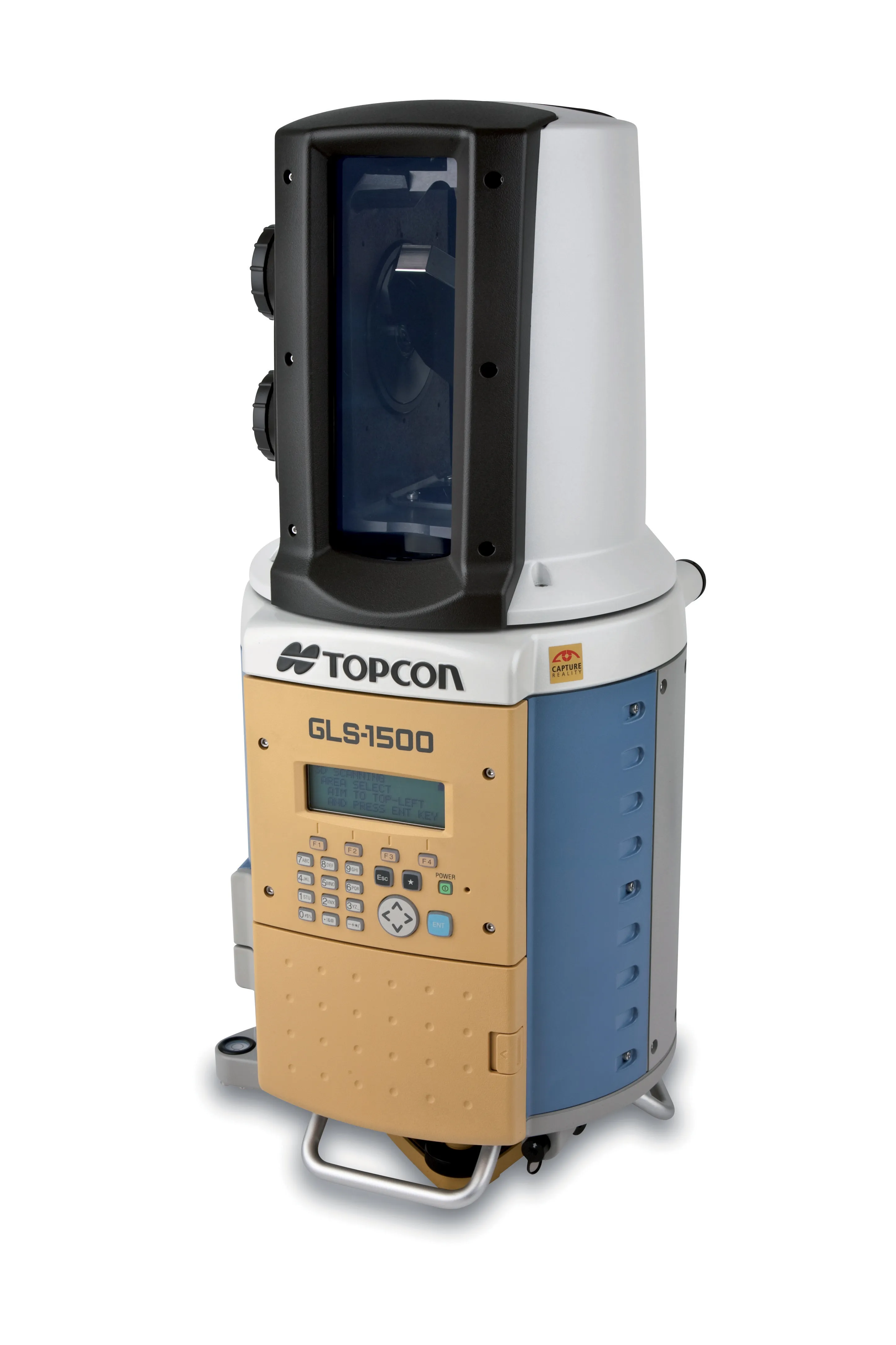
Low power consumption allows Topcon's GLS-1500 to operate for longer times with fewer battery changes and saves time in the field
342 Topcon CLAIMS that its GLS- 1500 laser scanner speeds point cloud collection. This unit is 10 times faster than previous units and collects up to 30,000 points/second, reducing the amount of equipment needed in the field. The GLS-1500 offers a range of up to 330m and is designed for quick setup to save time and improve productivity. It is also said to be portable, highly accurate reliable and durable. Easy to use, the unit features PC control, high-quality co-axially aligned images and scan data.

Robust and field-ready the instrument will run in the harshest of conditions. Data quality is second to none and this combines with advanced scanning technology. Topcon's precise scanning technology allows consistent high accuracy measurements over a wide range of distances. The SAW filtering allow the GLS- 1500 scanner a maximum measurement range of 330m, while the lens array optics technology maintain distance accuracy from 1-150m. On Board scan control software stores scan data and images to a standard SD card for easy download while the units features an eye-safe and invisible Class 1 Laser with lower power consumption.

Topcon is also offering a high performance field controller with its new FC-250. The FC-250 is designed to give users increased power and performance in a rugged and compact unit. The FC-250 has the operating system power of the latest Windows Mobile Version 6.5. It has PC performance with an 806MHz processor and 256MB SDRAM to speed up data collection in the field. The FC-250 also has a built-in Bluetooth modem and wireless LAN capability as standard features. This unit offers improved graphics and userinterface as well as higher performance for handling video images.

When used with Topcon's IS Imaging Station, the FC-250 displays real-time images transferred from the IS via wireless LAN, allowing users to work with live images. Additional features include a touch-screen display, optional spread spectrum radio, an optional long-range Bluetooth modem, quick access to swap the battery, SD and CF card slots and USB, and DE-9 com ports.

For more information on companies in this article

Related Content

  • The use of concrete cutting tools and tips for users
    October 8, 2015
    Despite the proven importance of identifying metal targets and electrical lines before cutting into concrete, every day there are stories about mishaps that happen when the necessary reconnaissance is not done. In this article, a few firms that provide concrete scanning services weigh in on the critical importance of locating embedded and or buried obstructions by scanning for these features using ground penetrating radar (GPR). Also offered are tips for selecting the best GPR equipment and best practices f
  • New milling machine advances
    June 15, 2020
    Two of the leaders in the milling machine market are now offering upgraded planers
  • Concrete slipforming and compaction advances
    August 17, 2020
    An array of new systems are being made available for concrete slipforming and compaction duties
  • Mobile mapping innovation
    June 1, 2022
    There are millions of kilometres of roads and features that need to be mapped in today’s world. We see a strong vision and application for the future, therefore Leica Geosystems, part of Hexagon, recently announced the introduction of the reality capture mobile mapping system Leica Pegasus TRK, introducing artificial intelligence, autonomous workflows and intuitive interfaces. This technology goes beyond the capabilities of what’s already been done, making it the perfect companion for today’s mobile mapping requirements.