Accurate scanning

TOPCON CLAIMS that its GLS- 1500 laser scanner speeds point cloud collection. This unit is 10 times faster than previous units and collects up to 30,000 points/second, reducing the amount of equipment needed in the field. The GLS-1500 offers a range of up to 330m and is designed for quick setup to save time and improve productivity.
February 6, 2012 Read time: 2 mins
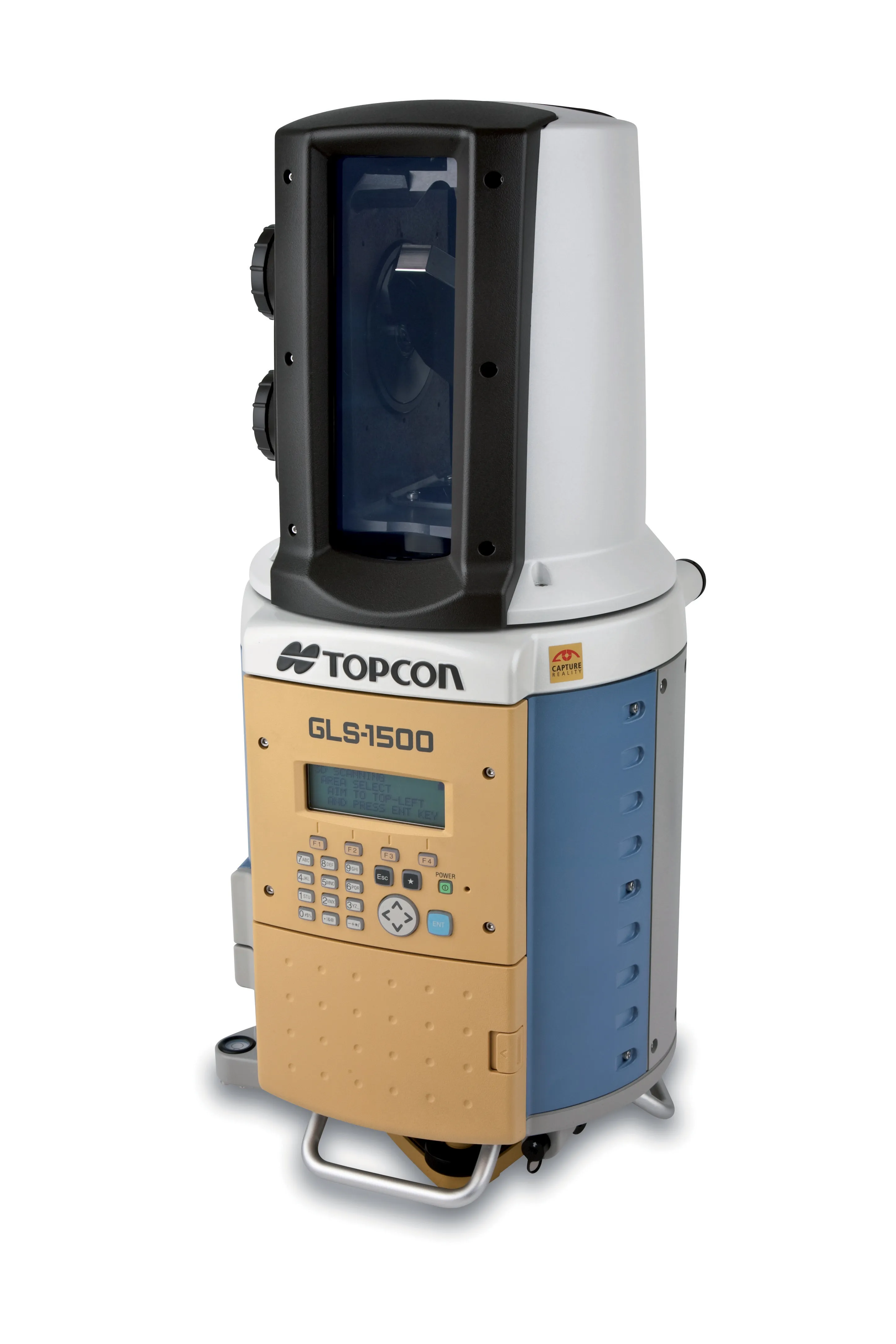
Low power consumption allows Topcon's GLS-1500 to operate for longer times with fewer battery changes and saves time in the field
342 Topcon CLAIMS that its GLS- 1500 laser scanner speeds point cloud collection. This unit is 10 times faster than previous units and collects up to 30,000 points/second, reducing the amount of equipment needed in the field. The GLS-1500 offers a range of up to 330m and is designed for quick setup to save time and improve productivity. It is also said to be portable, highly accurate reliable and durable. Easy to use, the unit features PC control, high-quality co-axially aligned images and scan data.

Robust and field-ready the instrument will run in the harshest of conditions. Data quality is second to none and this combines with advanced scanning technology. Topcon's precise scanning technology allows consistent high accuracy measurements over a wide range of distances. The SAW filtering allow the GLS- 1500 scanner a maximum measurement range of 330m, while the lens array optics technology maintain distance accuracy from 1-150m. On Board scan control software stores scan data and images to a standard SD card for easy download while the units features an eye-safe and invisible Class 1 Laser with lower power consumption.

Topcon is also offering a high performance field controller with its new FC-250. The FC-250 is designed to give users increased power and performance in a rugged and compact unit. The FC-250 has the operating system power of the latest Windows Mobile Version 6.5. It has PC performance with an 806MHz processor and 256MB SDRAM to speed up data collection in the field. The FC-250 also has a built-in Bluetooth modem and wireless LAN capability as standard features. This unit offers improved graphics and userinterface as well as higher performance for handling video images.

When used with Topcon's IS Imaging Station, the FC-250 displays real-time images transferred from the IS via wireless LAN, allowing users to work with live images. Additional features include a touch-screen display, optional spread spectrum radio, an optional long-range Bluetooth modem, quick access to swap the battery, SD and CF card slots and USB, and DE-9 com ports.

For more information on companies in this article

Related Content

  • New generator power systems
    August 10, 2022
    New power generation systems are now coming to market that offer lower emissions and cleaner options for customers. Engine technology has improved enormously in recent years, with exhaust emissions from industrial diesels having been reduced significantly. Meanwhile, manufacturers have also introduced new systems that can further reduce emissions while retaining output and performance.
  • Using machine control in earthmoving boosts efficiency
    December 19, 2017
    The use of new machine control tools has made a significant boost in earthmoving efficiency. Automated grade control using GNSS signals has transformed how earthmoving contractors get work done. Through the engineering efforts of its innovators and developers, machine control technology has been improved and refined over the years. A development in the ongoing evolution of machine control technology is Topcon Positioning Systems’ introduction of its 3D-MCMAX integrated 3D dozer system. Most notably, the
  • Improved excavator models available
    September 7, 2021
    Improved excavator models are now being made available for customers wanting higher performance
  • New tablet solution for Leica Geosystems
    December 12, 2018
    Leica Geosystems is now using the rugged ZX70 Android tablet from Getac as the hardware for its new Leica Zeno GG04 plus Tablet Solution. The new partnership allows Leica Geosystems to bring geospatial data collection capabilities to customers in all terrains and weather conditions such as utilities, public services, transportation and construction. Leica Geosystems has developed a range of new software and hardware including its Zeno Mobile data collection app and Zeno GG04 plus smart antenna to capture a