
Accurate scanning

TOPCON CLAIMS that its GLS- 1500 laser scanner speeds point cloud collection. This unit is 10 times faster than previous units and collects up to 30,000 points/second, reducing the amount of equipment needed in the field. The GLS-1500 offers a range of up to 330m and is designed for quick setup to save time and improve productivity.
February 6, 2012 Read time: 2 mins
Low power consumption allows Topcon's GLS-1500 to operate for longer times with fewer battery changes and saves time in the field
342 Topcon CLAIMS that its GLS- 1500 laser scanner speeds point cloud collection. This unit is 10 times faster than previous units and collects up to 30,000 points/second, reducing the amount of equipment needed in the field. The GLS-1500 offers a range of up to 330m and is designed for quick setup to save time and improve productivity. It is also said to be portable, highly accurate reliable and durable. Easy to use, the unit features PC control, high-quality co-axially aligned images and scan data.

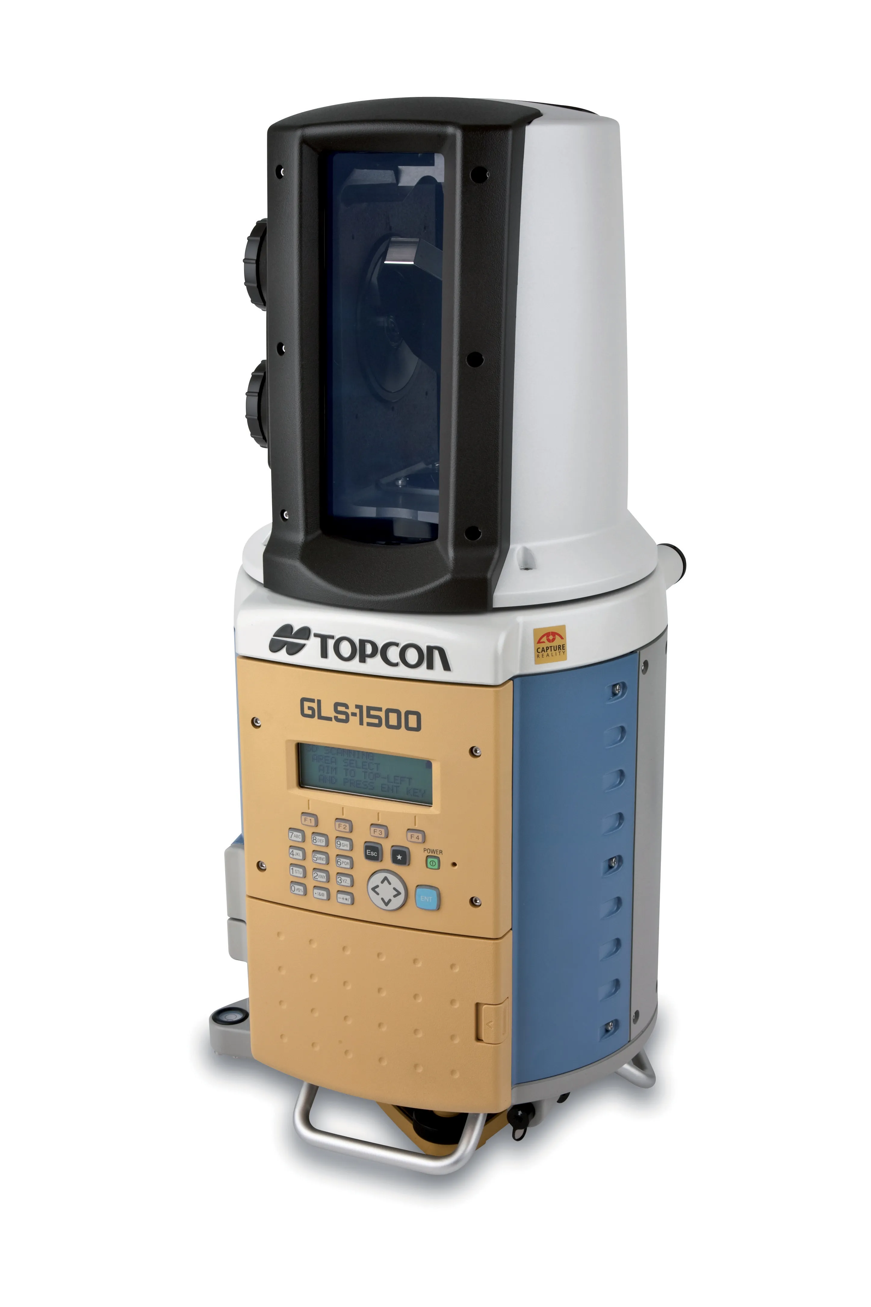
Robust and field-ready the instrument will run in the harshest of conditions. Data quality is second to none and this combines with advanced scanning technology. Topcon's precise scanning technology allows consistent high accuracy measurements over a wide range of distances. The SAW filtering allow the GLS- 1500 scanner a maximum measurement range of 330m, while the lens array optics technology maintain distance accuracy from 1-150m. On Board scan control software stores scan data and images to a standard SD card for easy download while the units features an eye-safe and invisible Class 1 Laser with lower power consumption.

Topcon is also offering a high performance field controller with its new FC-250. The FC-250 is designed to give users increased power and performance in a rugged and compact unit. The FC-250 has the operating system power of the latest Windows Mobile Version 6.5. It has PC performance with an 806MHz processor and 256MB SDRAM to speed up data collection in the field. The FC-250 also has a built-in Bluetooth modem and wireless LAN capability as standard features. This unit offers improved graphics and userinterface as well as higher performance for handling video images.

When used with Topcon's IS Imaging Station, the FC-250 displays real-time images transferred from the IS via wireless LAN, allowing users to work with live images. Additional features include a touch-screen display, optional spread spectrum radio, an optional long-range Bluetooth modem, quick access to swap the battery, SD and CF card slots and USB, and DE-9 com ports.

For more information on companies in this article

Related Content

  • Machine Control sector is the place for acquisitions
    January 22, 2014
    The machine control sector has been lively in recent months with a major acquisition, the unveiling of new software innovation and landmark testing of new technology to monitor paving temperature. Guy Woodford reports The state road construction authority in the German state of Saxony-Anhalt (LSBB Saxony-Anhalt) has become the first nationally to test MOBA’s new PAVE-IR Scan temperature measurement system at a works site.
  • Latest GIS and software tools improve operations
    February 24, 2012
    Innovative GIS and software solutions are coming to market from the three key market players - Mike Woof reports Competition is strong in the field for GIS and surveying systems as well as the associated software. The three major players in the sector, Leica Geosystems, Topcon and Trimble, all invest heavily in research and development and continue to roll out new solutions for construction customers that will boost the efficiency of surveying as well as overall project implementation.
  • Laser scanning versatility
    February 13, 2012
    The upgraded ScanStation C10 laser scanning system from Leica Geosystems now offers high performance as well as increased versatility and productivity.
  • Wider range of survey software functionality
    February 9, 2012
    Leica Geosystems is offering a broad spread of new packages and hardware that will deliver improved performance to users. The firmware 2.0 product is said to add powerful new capabilities to the Leica ScanStation C10, the industry's most popular 3D laser scanner for as-built and topographic surveys. This further increases the productivity and versatility of the fully integrated, cable-less ScanStation C10. A new Setup facility lets users take advantage of known survey points and backsighting, while remote,