Accurate data capture with Hexagon

Hexagon is introducing the Leica BLK ARC and the Leica BLK2FLY tools, which offer speed, portability and mobility for autonomous mobile reality capture.
January 2, 2022 Read time: 2 mins
Accurate site evaluation is feasible with Hexagon’s latest technology

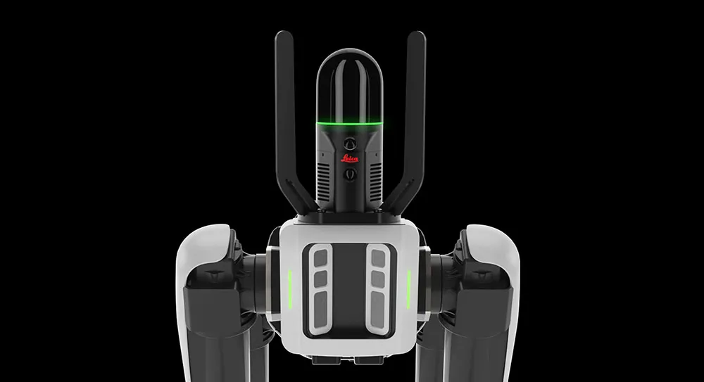
The Leica BLK ARC is a laser scanning sensor designed to improve autonomous navigation of robots and other carrier platforms. Combining speed, accuracy, and versatility with robotics, the BLK ARC offers an autonomous solution that can capture accurate 3D point clouds and panoramic images of changing environments with minimal user intervention.

The Leica BLK2FLY is a fully integrated, autonomous flying laser scanning sensor. Users can use a tablet to scan structures and environments accurately from the air.

The BLK ARC and BLK2FLY tools connect directly to Hexagon’s cloud-based visualisation platform, HxDR, where data uploaded from the field, AI-enabled cloud processing and storage of the captured data allows the delivery of smart digital reality to users.  The BLK ARC can be fitted to the Spot unit from Boston Dynamics Spot but can be integrated with other autonomous robotic carriers. The BLK ARC delivers fully autonomous mobile laser scanning specifically designed for robots. The BLK ARC improves Spot's navigation while capturing 3D data.

The BLK2FLY offers advanced autonomous obstacle avoidance. The system combines LiDAR, radar, cameras, and GNSS for optimal and safe flight paths. Users can combine data from the BLK2FLY with interior scans of buildings and structures captured with the Leica BLK2GO, Hexagon’s handheld 3D scanner. The resulting colourised 3D point clouds are instrumental to building information modelling (BIM) processes, including documenting site conditions.

For more information on companies in this article

Related Content

  • Efficient construction using advanced technology
    August 19, 2020
    Advances in asphalt paving control systems are helping contractors deliver higher efficiency
  • Hexagon buys SCCS, a supplier of Leica Geosystems in the UK
    January 13, 2016
    Hexagon has acquired Paul MacArthur Limited, SCCS – a UK supplier of surveying equipment to the engineering and infrastructure market and a Leica Geosystems distributor for over 20 years. SCCS, based in Cambridge, England, provides surveying solutions across the country, offering customers rent, purchase and service options in the road, rail and construction projects. “As the UK continues to fund major infrastructure projects with more stringent processes related to Building Information Modelling (BIM
  • Get paid faster for your work by being efficient, optimised, and careful with resources… get connected now
    September 1, 2023
    In this, the third roundtable meeting in World Highways’ series of Connected Construction discussions, Guy Woodford discusses the implications of developments in artificial intelligence (AI) and machine control with world-class experts in their field. Find out what Elwyn McLachlan, vice president of Civil Solutions at Trimble, Murray Lodge, senior vice president and general manager of Construction at Topcon Positioning Group, and Magnus Thibblin, vice president Heavy Construction at Hexagon Geosystems have to say about how you should be positioning your company for a successful future.
  • Software tools aid construction, reduce costs
    February 28, 2012
    Integrated construction software offers an effective planning solution - *Mark Nichols writes. In a world where resources are limited, 20 year designing and building in a sustainable way is more critical than ever. By employing today's software tools it is possible to reduce the total cost of construction of a new highway, while reducing operating costs and environmental impacts. The path to achieving the greatest gains is to take a holistic approach to the plan, design, construct and operate process from t