Accurate data capture with Hexagon

Hexagon is introducing the Leica BLK ARC and the Leica BLK2FLY tools, which offer speed, portability and mobility for autonomous mobile reality capture.
January 2, 2022 Read time: 2 mins
Accurate site evaluation is feasible with Hexagon’s latest technology

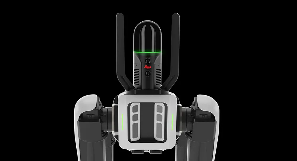
The Leica BLK ARC is a laser scanning sensor designed to improve autonomous navigation of robots and other carrier platforms. Combining speed, accuracy, and versatility with robotics, the BLK ARC offers an autonomous solution that can capture accurate 3D point clouds and panoramic images of changing environments with minimal user intervention.

The Leica BLK2FLY is a fully integrated, autonomous flying laser scanning sensor. Users can use a tablet to scan structures and environments accurately from the air.

The BLK ARC and BLK2FLY tools connect directly to Hexagon’s cloud-based visualisation platform, HxDR, where data uploaded from the field, AI-enabled cloud processing and storage of the captured data allows the delivery of smart digital reality to users.  The BLK ARC can be fitted to the Spot unit from Boston Dynamics Spot but can be integrated with other autonomous robotic carriers. The BLK ARC delivers fully autonomous mobile laser scanning specifically designed for robots. The BLK ARC improves Spot's navigation while capturing 3D data.

The BLK2FLY offers advanced autonomous obstacle avoidance. The system combines LiDAR, radar, cameras, and GNSS for optimal and safe flight paths. Users can combine data from the BLK2FLY with interior scans of buildings and structures captured with the Leica BLK2GO, Hexagon’s handheld 3D scanner. The resulting colourised 3D point clouds are instrumental to building information modelling (BIM) processes, including documenting site conditions.

For more information on companies in this article

Related Content

  • Thinking ahead in construction: digital PERI solutions for every project phase
    November 1, 2021
    One step ahead in the digital construction world with PERI
  • Powerful machine control technology
    February 14, 2012
    THE TRIMBLE TSC3 handheld controller for construction is said to offer powerful and rugged control capabilities. This hand-held unit is aimed at duties with heavy and highway contractors and features builtin GPS, 3G, Wi-Fi and a 5 megapixel digital camera. The unit is said to allow site workers to stay connected and also provides accurate positioning and digital design information. Using this unit allows engineers to locate, measure and record information anywhere on the construction site with a single devi
  • Bentley boosts its OpenRoads CONNECT construction software
    November 1, 2016
    Construction software solutions provider Bentley Systems announced that its OpenRoads Designer CONNECT Edition will be available from December. OpenRoads CONNECT Edition is the successor to Bentley’s civil engineering brands InRoads, GEOPAK, MX, and PowerCivil. OpenRoads Designer is a multi-discipline 3D modeling application for roadway projects from conceptual design through construction stages. Bentley Systems said that it “blends traditional engineering workflows for plan, profile and cross-section
  • New tablet solution for Leica Geosystems
    December 12, 2018
    Leica Geosystems is now using the rugged ZX70 Android tablet from Getac as the hardware for its new Leica Zeno GG04 plus Tablet Solution. The new partnership allows Leica Geosystems to bring geospatial data collection capabilities to customers in all terrains and weather conditions such as utilities, public services, transportation and construction. Leica Geosystems has developed a range of new software and hardware including its Zeno Mobile data collection app and Zeno GG04 plus smart antenna to capture a