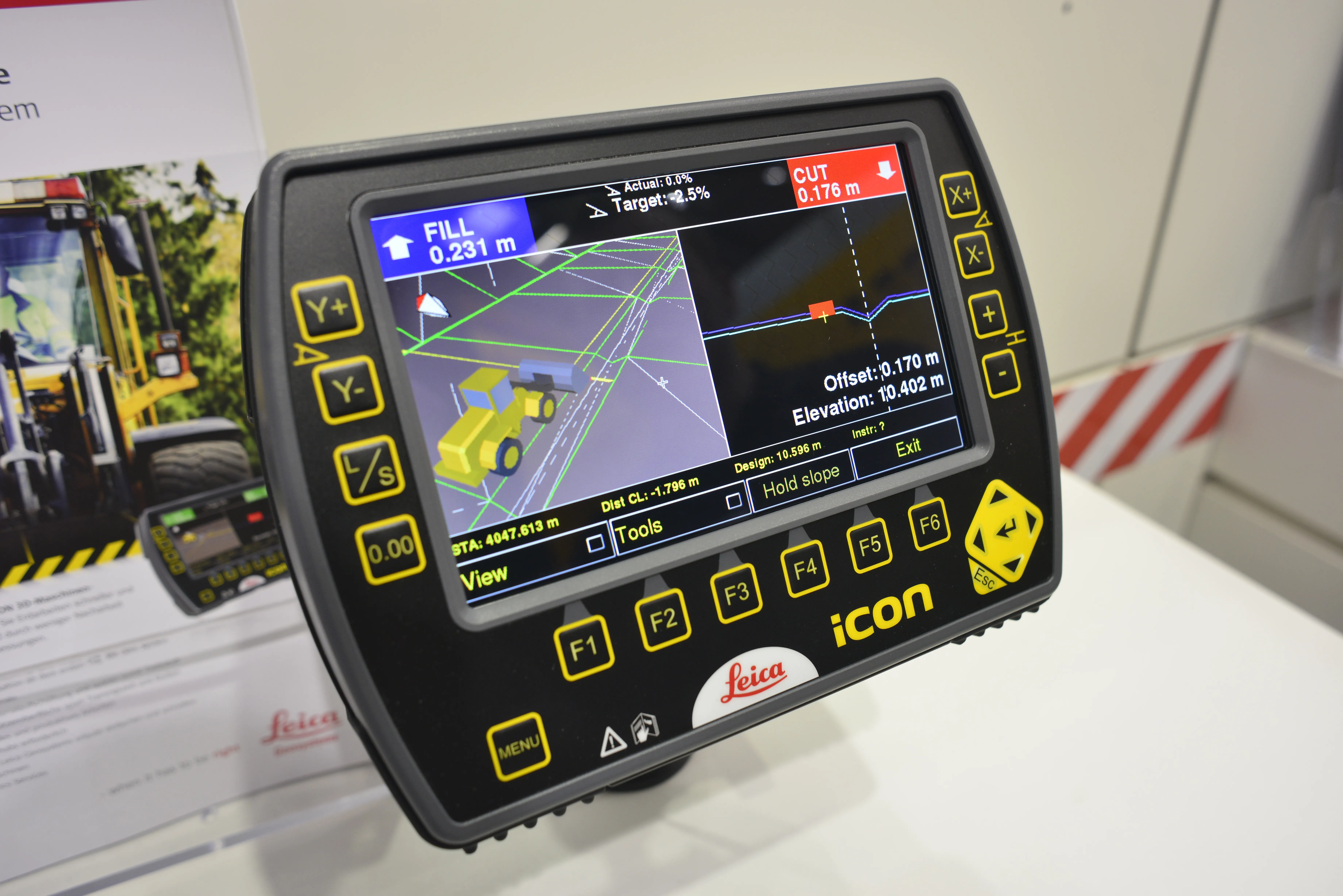
Wirtgen is introducing its latest AutoPilot Field Rover system which allows fully automatic, stringline-free concrete paving and allows jobs to be carried out more easily, quickly and economically. The system is more efficient than using conventional stringlines and is faster also and its 3D control system comprises a computer integrated into the machine and a control panel. Two GPS receivers mounted on the machine communicate with a GPS reference station on the job site. A digital terrain model is not requ
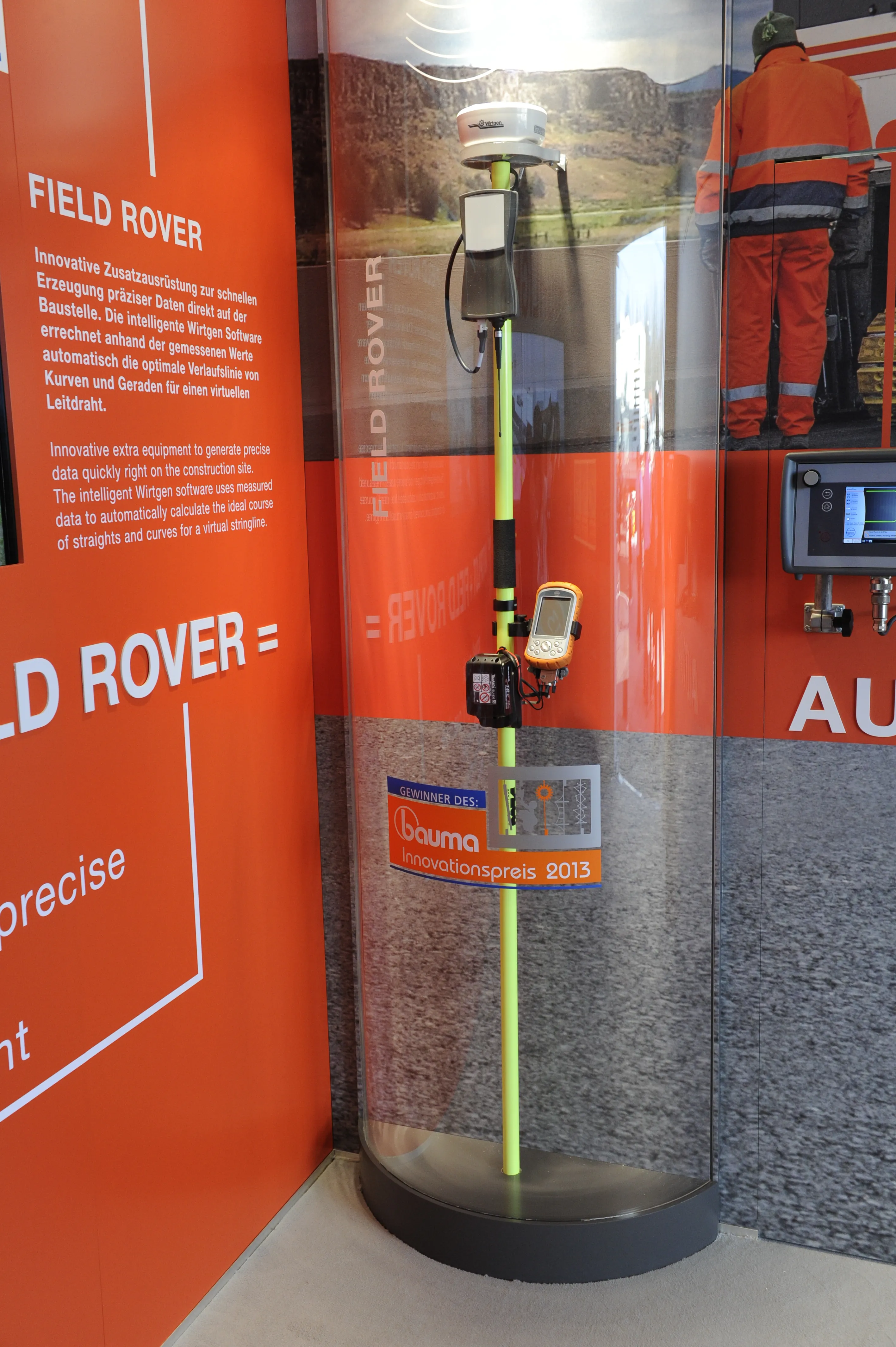
A digital terrain model is not required, as surveying and programming is carried out on the spot. The system is said to be simpler to use than conventional stringline-free 3D systems and can easily cope with minor changes on-site. The Field Rover comprises a GNSS receiver and a data collector on which the software developed by Wirtgen is installed.
The software calculates the optimum course on the basis of the measured points, creating a virtual stringline and data is saved on a USB stick that is then connected to the machine. It is not necessary for the operator to enter any additional data by hand. The slipform paver then automatically moves to the starting point calculated during the survey, and moves along the defined course. If the concrete profile is to be paved up to existing roadway edges, the user can calculate the optimum virtual stringline within minutes. The firm says this system lowers paving costs and as it bases its calculations on the actual job site measurements and does not rely on construction drawings, it achieves higher paving accuracy and quality, while it is less costly than conventional 3D technology.
%$Linker: