VIDEO: The ‘Hey! Watch out!’ traffic lights system

Time for a taxi ride around New York City, but back in 1928. Sit back and take a cruise, albeit tongue-in-cheek, around some of central New York’s better streets. But look closely. Rail lines were a prominent feature of those wider city streets as cars and trams mixed it along the boulevards, with people happily running between vehicles any which way. The roads surface looked as if there were no wear course, but simply a base course.
September 5, 2016 Read time: 2 mins

Time for a taxi ride around New York City, but back in 1928. Sit back and take a cruise, albeit tongue-in-cheek, around some of central New York’s better streets.

But look closely. Rail lines were a prominent feature of those wider city streets as cars and trams mixed it along the boulevards, with people happily running between vehicles any which way. The roads surface looked as if there were no wear course, but simply a base course.

Notice, also, few traffic signs and the absence of white dividing lines - or any other lines for that matter. In fact, there doesn’t appear to be any traffic lights – traffic semaphores, as they were originally called, after the system of railway semaphores.

In the early 20 century, policemen were the arbiters of right of way and they were found on most major intersections in central New York. But it wasn’t necessarily a safe occupation. Starting in the early 1920s a series of “traffic towers” were set up where the policeman stood in an enclosed kiosk raised high above the junction, possibly 7m or more.

Once such %$Linker: 2 External <?xml version="1.0" encoding="utf-16"?><dictionary /> 0 0 0 oLinkExternal iconic bronze traffic signal tower Click here vintage photos 1920s traffic towers US false http://untappedcities.com/2013/10/21/vintage-photos-1920s-traffic-towers-along-fifth-avenue/ false false%> designed by Joseph H. Freedlander stood at 42nd Street and Fifth Avenue in 1922. It was one of seven Freedlander towers along the length of Fifth Avenue at the time.


Traffic towers were the result of a failure of the first attempt at traffic lights in 1917, according to historical records. In Freedlander’s tower, a policeman changed signals, allowing one to two minutes for each direction. But since 1920, green had meant Fifth Avenue traffic was to stop so crosstown traffic could proceed. A white light had meant go.

But, as more traffic flowed through the arteries of N.Y.C., the more the traffic towers became a nuisance because most were situated in the centre of the road. Towers increasingly became an obstacle in themselves and 1929 signalled the end of the tower, to be replaced with what we are now familiar.

Related Content

  • World Highways contributor Max Lay wins Peter Nicol Russell award
    December 9, 2014
    The Institution of Engineers Australia has awarded World Highways contributor Dr Maxwell Lay the prestigious Peter Nicol Russell medal for his contribution to science and engineering. According to the citation, the medal is the most prestigious award made by the institution. “The recipient represents the technical, professional and community service standards of engineering to the profession and the community.” May received degrees at Melbourne University and the US university Lehigh in Pennsylvania.
  • NDT sensor fusion in structural pavement condition surveys
    February 27, 2017
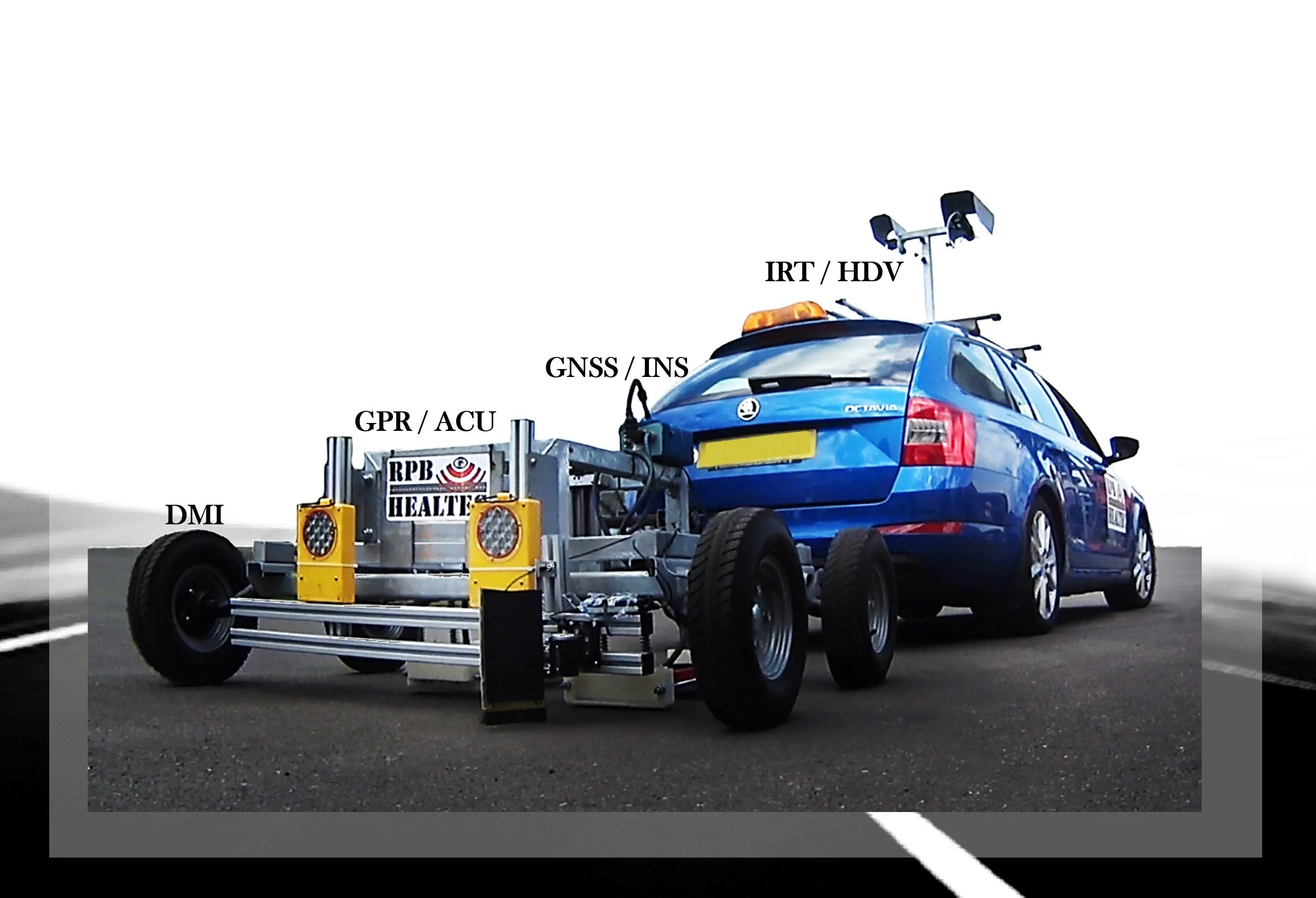
    Early detection of pavement defects and the causes of deterioration is essential for effective maintenance planning, writes Dr Alena Uus* There is a need for optimisation and development of UK highway survey methods that would provide comprehensive information on the surface and subsurface pavement condition and operate at traffic speed, which eliminates the requirement for lane closures. Performance of non-destructive testing (NDT) methods commonly employed in pavement condition surveys can be potent
  • From Topcon comes a sophisticated mapping system
    January 6, 2017
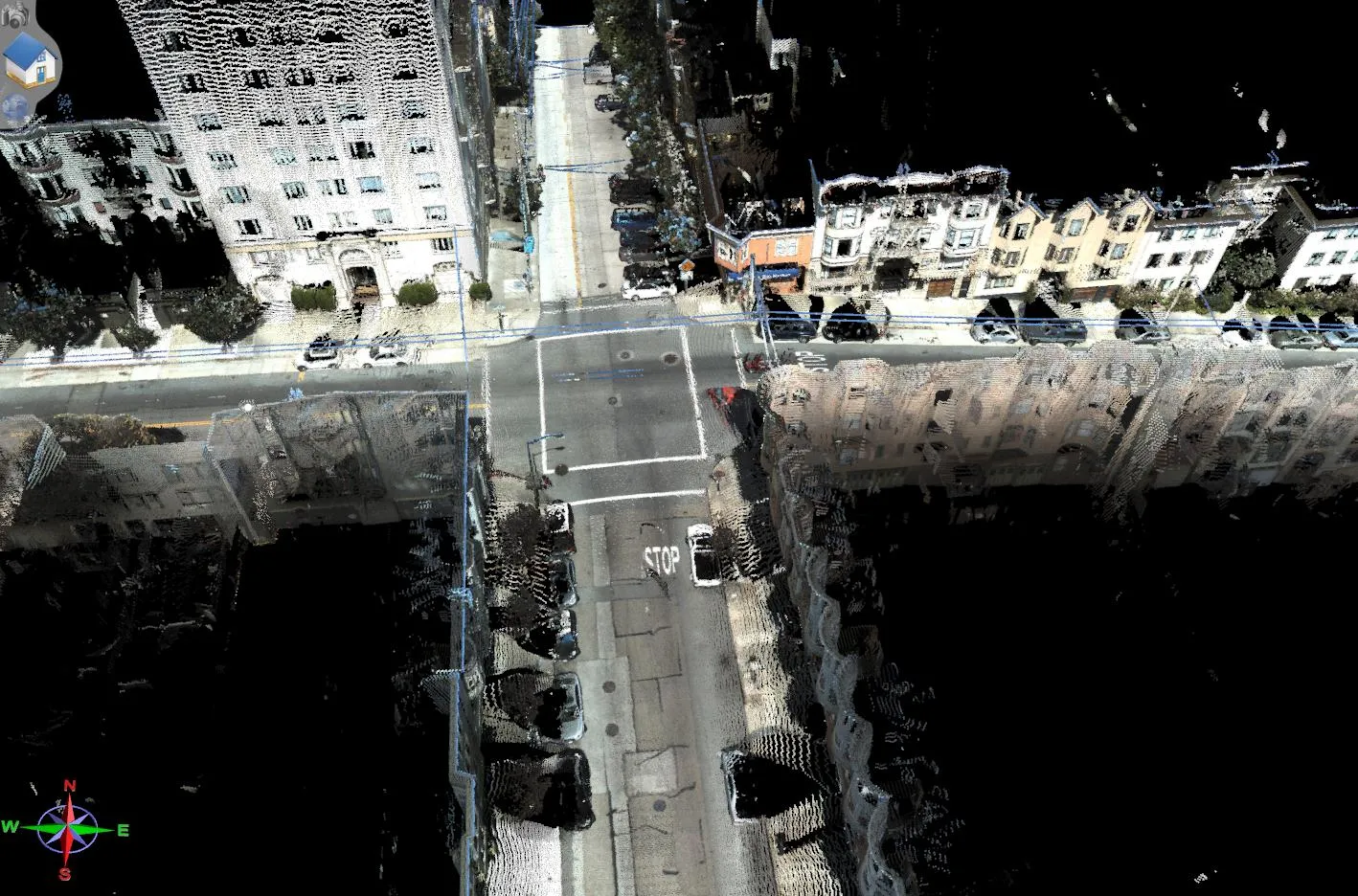
    Topcon Europe Positioning says that its new IP-S2 Compact+ package is an innovative mobile mapping system that can accurately measure objects even in adverse weather conditions and enclosed job sites such as tunnels and mines. This replaces the earlier Topcon’s IP-S2 system, launched in 2009. The new vehicle-mounted system has improved scanner orientation to optimise visibility of roadside assets and is packaged in an affordable, compact system that fits on a car or truck. It offers full-colour, high-resolu
  • From Topcon comes a sophisticated mapping system
    February 8, 2013
    Topcon Europe Positioning says that its new IP-S2 Compact+ package is an innovative mobile mapping system that can accurately measure objects even in adverse weather conditions and enclosed job sites such as tunnels and mines. This replaces the earlier Topcon’s IP-S2 system, launched in 2009. The new vehicle-mounted system has improved scanner orientation to optimise visibility of roadside assets and is packaged in an affordable, compact system that fits on a car or truck. It offers full-colour, high-resolu